JALUR EXODUS MUSA

Authors
note: The exodus route we propose was conceived in 2005 AD, but it
is actually a restoration of the ancient view held by first century Christians.
1. Step #1: We
began with the Bible as our only guide and blueprint for locating places
connected with the exodus. We completely ignored everything EXCEPT the bible:
We ignored: maps, history, commentaries and the opinions of archeologists. From
this study, we concluded the scriptures taught that Israel crossed the Red Sea
somewhere on the Gulf of Aqaba, forcing Mt. Sinai in Saudi Arabia. (Paul
plainly tells us Mt. Sinai is in Arabia: Gal 4:25) We were also able to prove
from scripture that Kadesh Barnea must be transjordan, somewhere south of the
Dead Sea in modern Jordan.
2. Step #2: Only
after we had concluded our scriptural study, did we begin to consider two
important additional witnesses: history and archeology. Josephus and Eusebius
and others caused us to chose Mt. Lawz as the best candidate for Mt. Sinai.
Josephus and Eusebius caused us to choose the general Petra area for Kadesh
Barnea. When conflicts arose between the scriptures, history and archeology, we
always chose the infallible, all-sufficient, imperishable word of God.
While this may not make Bible
doubting archeologists happy, we have more trust in the Bible then the ever
shifting opinions of archeologists who are more often looking to disprove the
Bible, rather than support it as the book of true ancient history that it
really is. Having said this, archeology is an important tool in validating the
Bible. I have travelled extensively throughout Israel and the Levant. I have
been directly involved in many archeological digs under the authority of the
IAA (Israel Antiquities Authority). I did not discover this exodus route, I
merely restored it to what is revealed in scripture. I hope this book will
strengthen your faith in God's inspired word. You can print the maps and glue
them into the back of your bible. You can use this material in public
presentations and sermons, as long as you do not put any part of this book on
the internet or sell it.
Steve
Rudd: Contact the author for
comments, input or corrections.
|
The
Exodus Route
|
|
|
|
|
 Overview map |
 Satellite map |
|
|
|
|
50 stops of the Exodus: (4 legs of the
Journey) |
|
|
|
|
|
|
|
|
|
|
- The Exodus is an important and foundational fact.
- 2.5 million Jews left Egypt, not 5,000 or 35,000 as some modernists have wrongly suggested based upon interpreting the Hebrew word for thousand (elep) as clans, households or tribes.
- We propose that Israel crossed the Red sea at the Straits of Tiran, that Mt. Sinai is Mt. al-Lawz in Arabia and that Kadesh Barnea is at or just north of Petra at Beidha.
- Below, we will prove this exodus route from the Bible.
- Many of the New Testament images have their origin in the exodus.
- The Lord's Supper is a type of the Passover mean of Ex 12. Just as the Jews partook of the Passover mean one a year, Christians partake of the Lord's Supper every week: Learn more about the Lord's Supper.
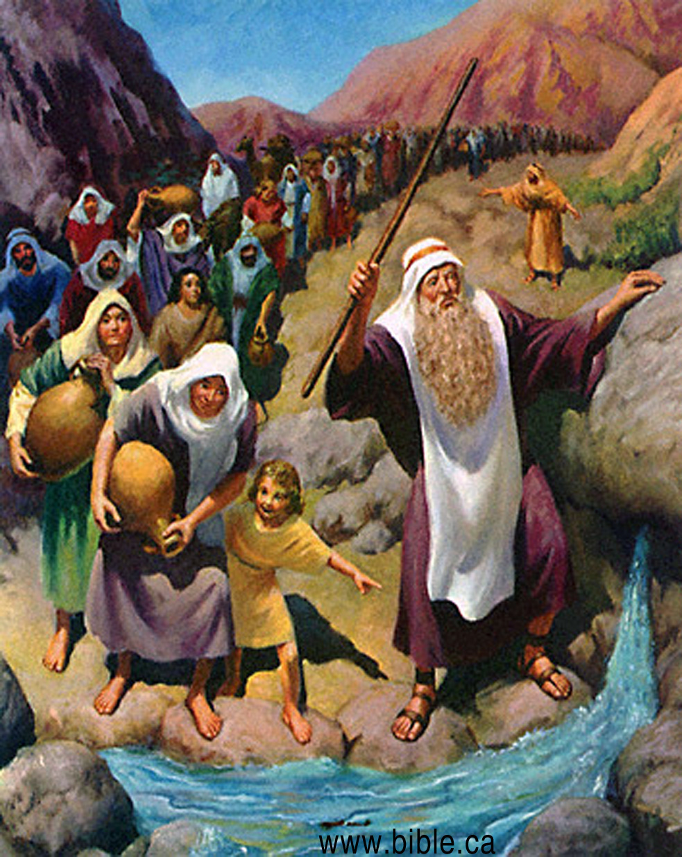
- God as "Our Rock" had is a type of the Rock Moses struck for water. 1 Cor 10:4.
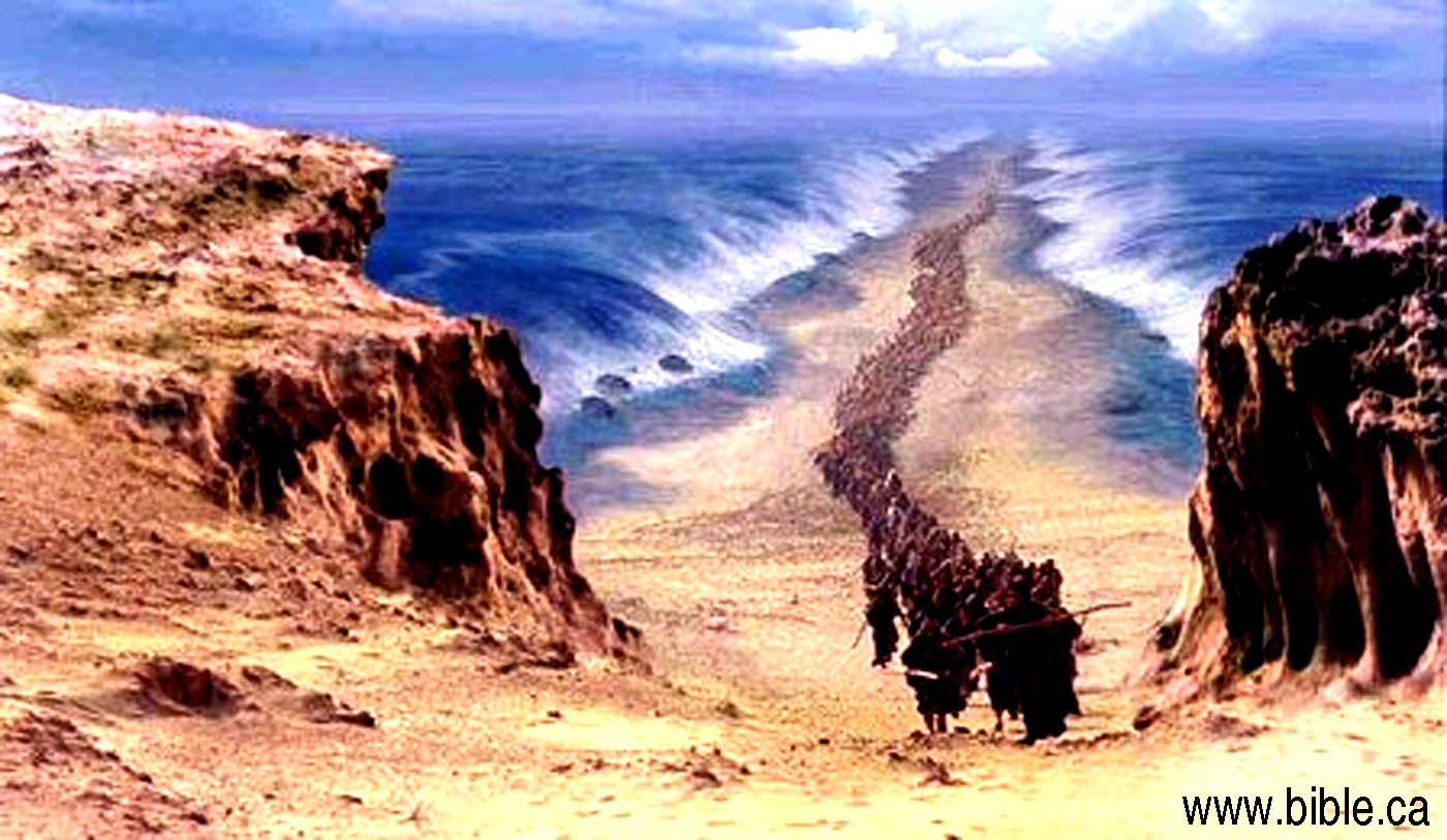
- Our salvation from the slavery of sin happens when we are baptized into Christ, and is a type of the Red Sea crossing when they were saved from the slavery of Egypt and baptized into Moses: 1 Cor 10:1-4. Have you been baptized in water by full immersion as a believer in order to be saved? Take this interactive online Bible study!
- Mt. Sinai is a type of the heavenly Jerusalem: Hebrews 12:18-24.
- The 38 years in the wilderness at Kadesh Barnea is a type of our earthly life.
- Crossing the Jordan is a type of our death and passing into a new spirit world.
- The promised land of Israel is a type of heaven.
|
|
|
 |
Bible proof Israel crossed the
Red Sea at the Straits of Tiran |
- There are so many texts in the Bible that clearly teach a crossing point of the Red Sea somewhere on the Gulf of Aqaba, we don't know where to start! But if you want to start... start here! Any one of these points is sufficient to rule out the Bitter Lakes or the Port of Suez crossing points. Ruling out the Bitter Lakes or the North Suez, forces a crossing point on the Gulf of Aqaba.
- Contrary to popular myth, the Bible tells us that it took 25 days before they crossed the Red Sea, not 3 days! The only reason people assume three days, is because there were three stops between Goshen and the Red Sea. But the Bible says that they traveled day and night with supernatural help from God.
- The Sinai Peninsula is called "The Wilderness of Egypt". The Bible says that there was a long journey through the wilderness BEFORE they reached the Red Sea. (Ezekiel 20:36; Judges 11:16; Exodus 13:18). In 50 AD, Philo of Alexandria understood this and wrote: "a long and desolate journey through the wilderness, destitute of any beaten road, at last arrived at the sea which is called the Red Sea". There is no wilderness west of the bitter lakes or north west of the Gulf of Suez, so they must both be rejected as crossing points.
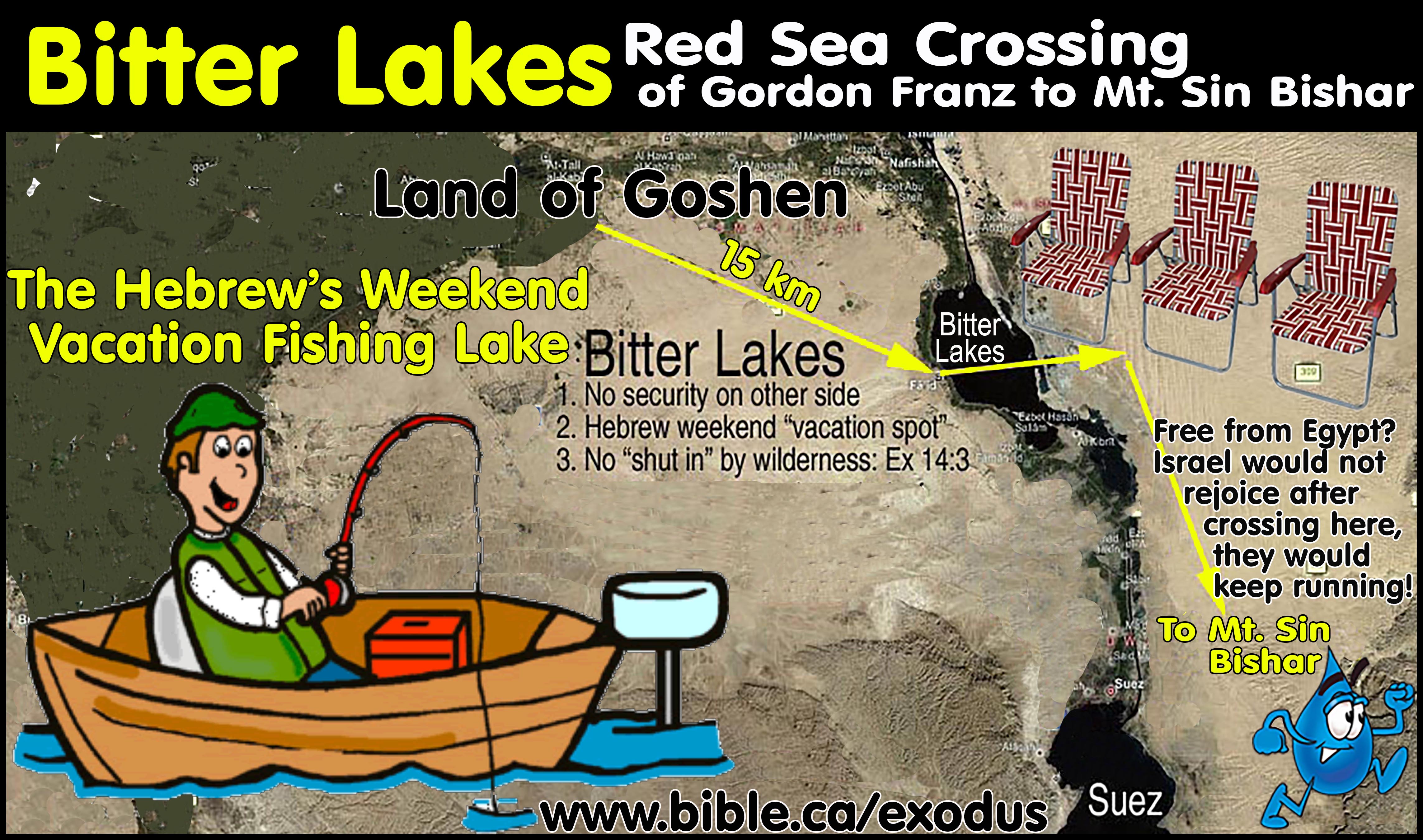
- The crossing point had to be far enough away from Goshen
to justify their bitter complaints about being in the wilderness (Exodus
14:11-12) and to guarantee security from Egypt. We can rule out the Bitter
lakes as utterly absurd since it was only 30 km from Goshen. The
Bitter lakes were so close to Goshen, that the Hebrews probably spent
their days off fishing and having romantic walks the beaches of the Bitter
lakes. "Hey honey, I got tomorrow off, lets pack the kids into the
chariot and have a nice day at the Bitter lakes!" If the Bitter lakes
was the crossing point, the Hebrews would not endure hardship, starve and
complain: they would sleep in their own cottages and already know the best
fishing holes for food. Need we remind you that the Bitter lakes was an
endless supply of fresh water?
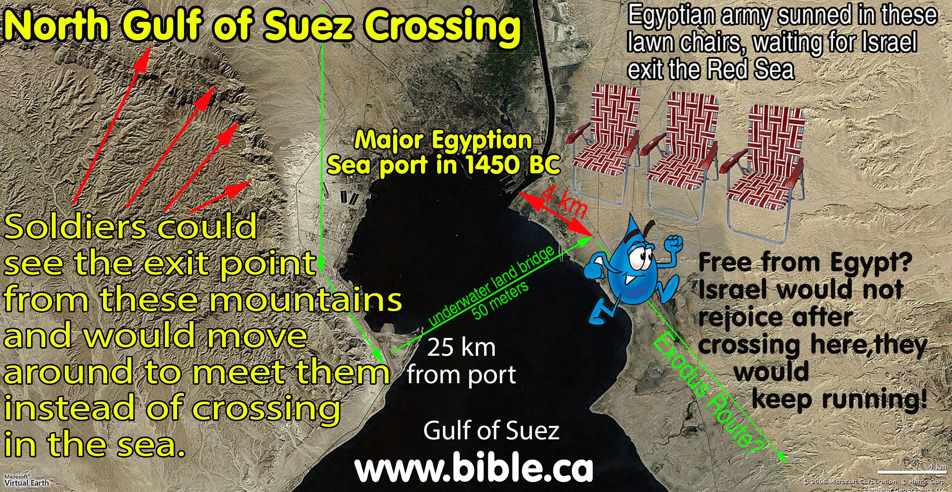
- The Port
of Suez is only 100 km from Goshen, making it far too close. But there
is another huge problem: The exit point of the Gulf of Suez crossing
brought the Hebrews only 4 km from a major Egyptian sea port. The Egyptian
soldiers could easily see the entire crossing route from the nearby
mountains. When the angel of the Lord prevented them from crossing the Red
Sea until Israel had finished, they would move around to wait for them on
the other shore. If I had just crossed the Red Sea and came out next to
the Port of Suez, I would not start singing the Song of Moses, I would keep running!
- To learn why the Bitter lakes and the Gulf of Suez must be rejected as the crossing point of the Red Sea. Click here.
- At the time of the exodus, the entire Sinai Peninsula was controlled by Egypt and considered part of their formal territory. Egypt began west of the Wadi el-Arish and west from Timna. Israel was not "out of Egypt" in the Sinai Peninsula. However a crossing of the Red Sea at the Straits of Tiran puts them out of Egypt into Arabia. That's where they started singing the Song of Moses and knew they were safe!
- Etham provides a critical scriptural detail overlooked by everyone. Correctly understanding what happened at Etham is why the Straits of Tiran are the only crossing point on the Gulf of Aqaba that fits scripture. After camping at Etham God commanded: "Tell the sons of Israel to turn back" [from Etham and retrace their steps and camp at the crossing point of the Red Sea]. This will bait Pharaoh into sending his army because he will think, 'They are wandering aimlessly in the land; the wilderness has shut them in.'" (Exodus 14:2-3). Amazingly, at the Straits of Tiran, there is a mountain range that traps Israel from going any further. No other crossing point has this critical feature. The crossing point at the north end of the Gulf of Suez has no such geographic feature that forced Israel to turn back and retrace their steps! These scriptures quite certainly force a Red Sea crossing at the Gulf of Aqaba into Modern Saudi Arabia. The Straits of Tiran is the only place that 100% harmonizes with scripture.
- You might wonder why a crossing point at the Gulf of Aqaba
had not been proposed until now? You might wonder why Bible students over
the last 2000 years had always considered a north Suez crossing or the
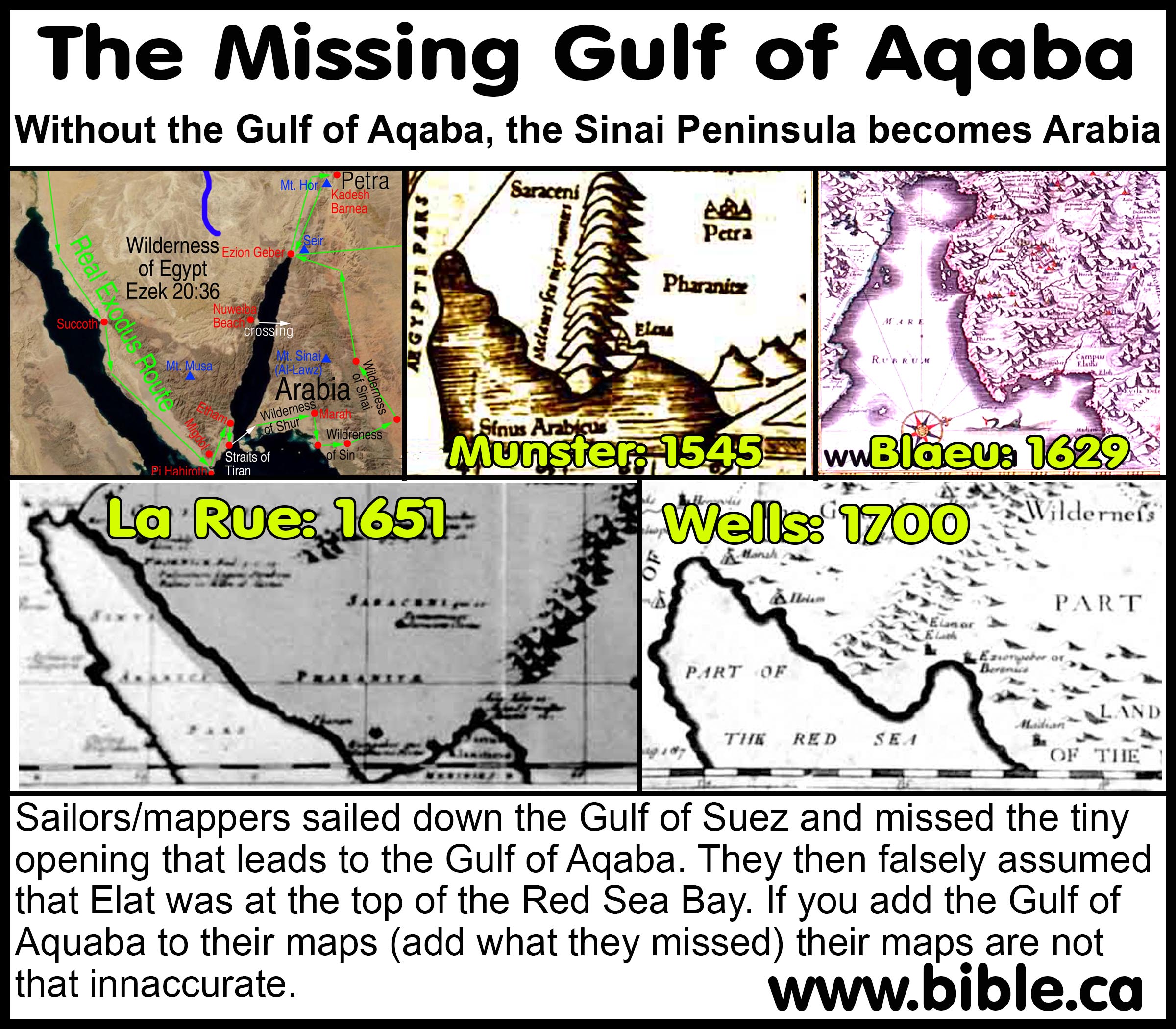
Bitter Lakes? The answer may shock you, but quite simply, they didn't know the Gulf of Aqaba even existed
until the 18th century. The very first map we could find that even showed
the Gulf of Aqaba was in 1750 AD by William Albert Bachiene. They could
not propose a crossing point at a place they never knew existed!
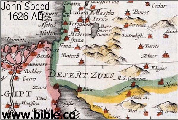
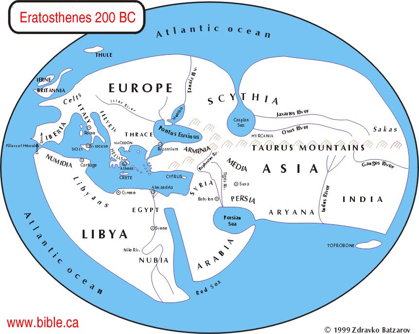
Geographers and mappers drew the Red
Sea as a single finger of water and had no concept of the existence of
the Gulf of Aqaba. They also had no concept of the Sinai Peninsula! Here
is just one example by John Speed in 1626 AD:
- How could they not know about
the Gulf of Aqaba until the 18th century?
Mystery solved!
There is a unique shape of the Red Sea that was mapped by Sebastian Munster's map in 1545 AD and others like Mercator (1584), Blaeu (1629), La Rue (1651), Visscher (1660), Moxon (1671), Wells (1700), Vaugondy (1743). When you compare this shape to a satellite map, you will notice they sailed right by the two narrow openings that led up the Gulf of Aqaba and missed it! They wrongly assumed that Ezion Geber/Elat were located at the bay to the east of where the Gulf of Aqaba opens onto the Red Sea. This explains the mystery of how they missed the long finger of water we know as the Gulf of Aqaba. It is not so much that the sailors who mapped these waters were careless or incompetent. Rather they mapped exactly what they saw. But they sailed right past the tiny Straits of Tiran, likely 5 or ten miles to the west simply missed the Gulf of Aqaba. If you take Munster's map and simply add the Gulf of Aqaba, it becomes quite accurate in shape! Remember, the sailors were not familiar with the local geography but were from Europe, France, Italy, England, Spain, and Netherlands. I have spent many weeks sailing and navigating on a ship and can attest first hand, to how difficult it is to map a shoreline from a boat.
- Since the Bible teaches that they crossed the Red Sea somewhere on the Gulf of Aqaba (we suggest the Straits of Tiran), this forces the location of Mt. Sinai to be in modern Saudi Arabia. We propose Mt. Sinai at Mt. Al-Lawz. But we do not need to reply upon this "domino effect" to prove Mt. Sinai is in Saudi Arabia, we have explicit statement of Paul in Gal 4:25: "Mount Sinai is in Arabia".
|
|
|
 |
Bible proof Mt. Sinai is in
modern Saudi Arabia Gal 4:25: "Mount Sinai is in Arabia" |
- Very few Christians know the history of how the traditional location for Mt. Sinai in the middle of the Sinai desert was chosen. In fact it was chosen by Constantine's mother, Queen Helena, in a dream! Helena claimed that God revealed to her in a dream that Mt. Sinai was located at Mt. Musa where St. Catharine's Monastery was later build in the middle of Sinai Peninsula. This has been the traditional location of Mt. Sinai on almost all Bible maps since 325 AD. Historically, Queen Helena deliberately chose many places in the Promised Land and Jerusalem that were politically expedient or to her taste. Today, through archeology, we know most of the places she chose were wrong. But a later Pope, who is considered infallible by Roman Catholics, sanctified Mt. Musa as the location of Mt. Sinai. That kind of makes it difficult for any good Catholic to even consider other options. As the saying goes, "You never find that, which you never search for."
- The first time in history that the Sinai Peninsula was called, "The Sinai Peninsula" was only after Helena decided it was where Mt. Sinai was located. No one before this ever referred to it as the Sinai Peninsula.
- Today, as a result of the infallible Pope's claim that Mt. Sinai is located at Mt. Musa in the middle of the Sinai peninsula, Catholic theologians have come up with a number of rather clever (false) arguments to harmonize Paul's Statement that "Mount Sinai is in Arabia". (Gal 4:25). The Sinai Peninsula is not Arabia! Many non-Catholic Bible students have become parrots in teaching these arguments.
- To prove to you just how effective this "brainwashing" has been on the mind of almost all Christians living today, we simply ask this question: "At the time of the Exodus, which country owned and controlled the Sinai Peninsula"? Their answer, if they can even think of one, is "I don't know" or "no one" or "it was a barren waste land nobody wanted" or "it was a caravan crossroads between nations" or "it is kind of like asking who owns the Atlantic Ocean: everyone and no one at the same time". These misinformed souls suggest that the Sinai Peninsula was a kind of "desert ocean" no one controlled. The true answer is that Egypt has always controlled the Sinai. They control it now, they controlled it in 1446 BC. Sure there was time when the Nabataeans edged in, and of course the Roman annexed the "Sinai" in 106 AD. Mt. Sinai cannot be in the Sinai Peninsula, because this was still in Egypt.
- You might ask the same question another way: "What country was on the west side of the eastern border of Israel?" Even the Bible teaches that the formal boundary line between Egypt and Israel is called the "River of Egypt" or wadi el-Arish. If you were standing in Judah and walked across the Wadi el-Arish, you would not be in some, "desert ocean, caravan crossroads, no man's land", you would be in Egypt. The Bible explicitly teaches this.
- A brand new approach has been developed by the advocates
of Mt. Musa to defend their sacred mountain in the Sinai. When someone
quotes Paul's "Mount Sinai in Arabia " (Gal 4:25), they with
brazen faces say, "The Sinai Peninsula is Arabia". As you stand
there thoughtfully twitching in disbelief, they add these facts:
"Look at these maps that have the words, 'Arabia' on top of the Sinai
Peninsula." Of course, the answer is quite simple. The Romans did
annex the Sinai Peninsula away from Egyptian control in 106 AD and the
Romans did name the land that was Egypt, "Arabia". But that was
in 106 AD and Paul wrote the book of Galatians some 50 years earlier. Even
good Bible students can be fooled with this slight of hand trick. When
Paul wrote Galatians 4:25, Arabia was east of the Gulf of Aqaba. In one
final futile attempt to make the Sinai Peninsula into "Arabia",
they will quote some "ancient geographers" before Paul's time,
who thought Goshen bordered next to Arabia. What they don't tell you is
that these same "ancient geographers", like the mappers from the
1500's mentioned above, also did not even know of the existence of the
Gulf of Aqaba and the Sinai Peninsula! Take a look for yourself!
- Paul not only said that Mt. Sinai is in Arabia, he also equated the location of Mt. Sinai as being in the traditional land of the children of Hagar: The Ishmaelites. The allegory of Galatians 4 draws a geographical parallel between specific nations of known territories. Everybody, Jew and Greek, that read what Paul wrote understood that the land of the Ishmaelites was Transjordan and in North Saudi Arabia AND NOT in the Sinai Peninsula. At the time Joseph was sold into slavery, the Ishmaelites lived in Midan with the Midianites. Everyone knows that the Midianites lived in North Saudi Arabia AND NOT in the Sinai Peninsula.
- In fact, the teaching of Paul is so clear, that we could
locate Mt. Sinai by saying: Mount Sinai is located in the land where
Ishmael lived: Midian
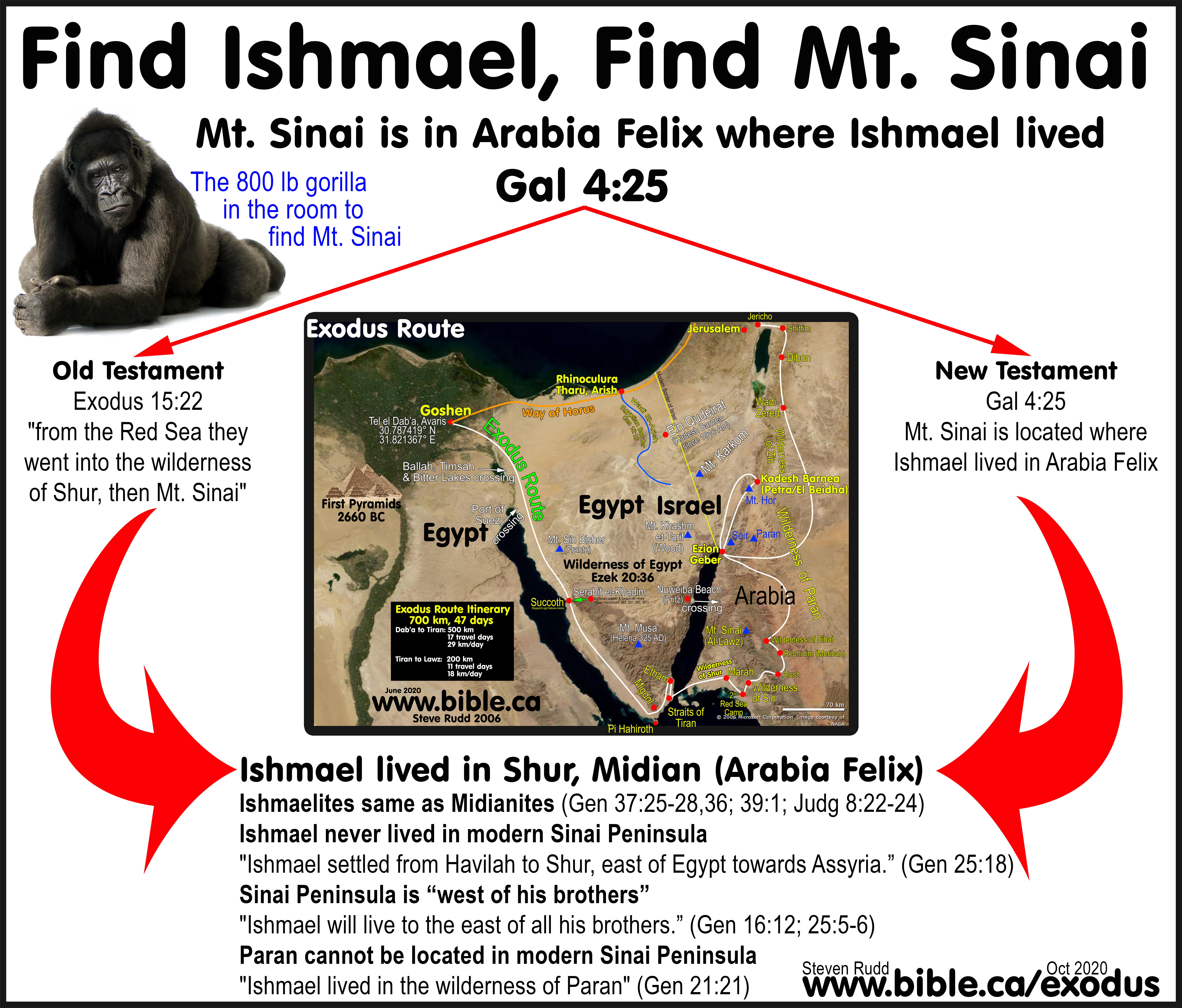
- Since the Wilderness of Shur and the Wilderness of Paran was the land in which Ishmael lived, this forces it to be located in Saudi Arabia, somewhere on the eastern shore of the Gulf of Aqaba. Take note that this is an independent line of reasoning from Paul's Statement in Gal 4:25. The Bible explicate says that Ishmael lived in Shur and Paran. This forces these two wildernesses to be Transjordan. Since Kadesh Barnea borders on the wilderness of Paran, this forces Kadesh Barnea to be Transjordan. (Gen 16:12; 21:21; 25:18)
- The Bible says that Moses was in Midian when he saw the burning bush: "Now Moses was pasturing the flock of Jethro his father-in-law, the priest of Midian; and he led the flock to the west side of the wilderness and came to Horeb, the mountain of God. The angel of the Lord appeared to him in a blazing fire from the midst of a bush; and he looked, and behold, the bush was burning with fire, yet the bush was not consumed." (Exodus 3:1-2) Now those intent on keeping Mt. Musa sacred and in the Sinai Peninsula have quite a dilemma here and are forced to read the passage this way: "It doesn't say that while he was pasturing his flock in the land of Midian he saw a burning bush." True, but it also doesn't say, "Moses traveled 250 km away from Jethro in Midian, around the Gulf of Aqaba and into the middle of a rugged mountain range to pasture his sheep that was owned by another man." The fact remains that the context of Exodus 3 begins with Moses living in the land of Midian, tending his flock, in a normal manner within a reasonable distance from home. A 500 km, 50 day round trip to pasture sheep that belonged to another man (Jethro) is a little extreme. The casual, natural reading of the text is, that Moses was pasturing Jethro's sheep near or in Midian. To suggest that Moses traveled 350 miles to Mt. Musa in the Sinai Peninsula is absurd. Some in desperation suggest that the Midianites lived in the Sinai Peninsula, but this is unfounded and false.
- Ron Wyatt has made many wild, fanciful and irresponsible archeological claims about Mt. Lawz. None of the evidence he uses to support Mt. Lawz as Mt Sinai are valid. All are to be rejected AND WE MEAN all. These false claims include: 1. the discovery of the rock Moses struck for water. 2. the altar of the golden calf. 3. the cave Elijah hid in. 4. The very place the 70 elders stood. 5. the altar Moses erected. 6. the twelve pillars erected by Moses. The truth is, all of this is highly speculative and although we can be certain that Mt. Sinai is in Arabia, not the Sinai Peninsula, we cannot be sure that Mt. Lawz is Mt. Sinai. However, is it the best choice we know of. The impossible Red Sea crossing As proposed by Ron Wyatt: The video "Exodus Revealed" and "The Exodus Case" by Lennart Mueller are all Wyatt's work. The Gold of Exodus is worthless to truth. "Ron Wyatt is neither an archaeologist nor has he ever carried out a legally licensed excavation in Israel or Jerusalem. In order to excavate one must have at least a BA in archaeology which he does not possess despite his claims to the contrary. ... [Ron Wyatt's work] fall into the category of trash which one finds in tabloids such as the National Enquirer, Sun etc." Archaeologist Joe Zias of Israel Antiquities Authority, IAA. Bob Cornuke's The Exodus Decoded, and video, "The exodus Conspiracy" are as worthless as the work of Ron Wyatt and must be discarded. Wyatt's archeological work on Mt. Sinai is also worthless, without any factual basis and must be rejected.
- One of the hidden blessings of wrongly locating Mt. Sinai at Mt. Musa in the Sinai Peninsula, is that almost no archeological research has been done at Mt. Lawz in north Saudi Arabia. Muslims are notorious for excavating with a pick axe (Madaba Map 700 AD), a bulldozer and a gravel making machine (Temple mount 2001 AD). Now since Mt. Sinai has been in Saudi Arabia all this time, the place where Mecca and some of the most radical Muslims on the face of the planet are located, Mt. Lawz has never really been seriously excavated or vandalized! It is just sitting there, waiting for the modern world to investigate for signs of the Exodus. Of course the Muslims do believe Moses was a prophet who stood on Mt. Sinai, but with the President of Iran (Mahmoud Ahmadinejad) on formal record that he wants Israel wiped off the face of the earth, we do not believe that they would allow any excavations whose purpose is to verify the Jewish Exodus and claim to the promised land since 1406 BC. Any such evidence would end up as gravel on Saudi Roads.
- We propose Mt. al-Lawz as the best candidate for Mt. Sinai in Arabia. It is the "highest mountain in the area", just as Josephus reported.
|
|
|
 |
Bible proof Kadesh Barnea is
Transjordan, south of the Dead Sea In 325 AD, Eusebius taught Kadesh was at Petra. Everyone believed Kadesh was at or near Petra until 1831 AD. |
- The Bible teaches that the Kadesh Barnea is Transjordan, south of the Dead Sea. This is done through a simple study of how to draw the southern border of Judah, in relation to Kadesh.
- Since 1916 AD, Kadesh has been wrongly located at Ein-Qudeirat. Nothing has been found earlier than the 10th century and the exodus happened in 1446 BC. Qudeirat is also 27 km inside the formal boundary of Judah (Wadi el-Arish). Israel did not spend 38 years in the wilderness at Kadesh INSIDE the promised land. Qudeirat is one of the network of border fortresses built by Solomon. If you believe the Bible doesn't contradict itself, then Kadesh cannot be located at Qudeirat. Yet this is where every Bible map has located Kadesh since 1916 AD. Take a look for yourself in your own Bible!
- There are two key passages that describe in great detail, how to draw the southern border of Judah: Numbers 34:3-5 and Joshua 15:1-4. Its all there in black and white in your Bible! Here is our detailed exegesis of these passages: click here. There is only one way to draw the southern border, so that Kadesh remains outside the boundary of the promised land and that is to put Kadesh Transjordan, at or near Petra.
- Ezion Geber is a critical location everybody overlooks in their exodus route maps. Ezion Geber is one of the few places on the Exodus route, that we can be certain of its location at the north tip of the Gulf of Aqaba. It is located on the eastern shore of the Gulf of Aqaba, under modern Aqaba in Jordan. It is also to note that it is located in the land of Edom. (1 Kings 9:26) Since Jezirat Faraun was an Egyptian sea port to facility mining at Timna, Ezion Geber must be located on the Arabian (eastern) side of the northern tip of the Red Sea. This was historically the land of Edom, so we can be rather certain Ezion Geber was located under modern Aqaba.
- Ezion
Geber is very bad news for those who hold to the traditional Exodus
route between Mt. Musa and Qudeirat. Two Bible
passages give a lot of trouble to those who still cling to the traditional
Exodus route. (Numbers 33:35-36 and Deuteronomy 1:2) First, we
are explicitly told in Numbers 33:35-36, that Israel passed through Ezion
Geber in the route between Mt. Sinai and Kadesh. Second, Deut 1:2
indicates that Ezion Geber is near Mt. Seir. We also learn from Num 33:35
that Ezion Geber is the last stop before Kadesh in the route. Putting this
information into focus, there are 22 stops between Sinai and Kadesh, Ezion
Geber is stop 22! Now look at the map below and notice that Ezion Geber is
a midway point. So from Sinai to Ezion Geber there are 22 stops. From
Ezion Geber to Kadesh there are no stops in between! With Kadesh located
at Petra instead of Qudeirat, it makes sense that there were no stops
between Ezion and Petra because they simply walked up the Arabah valley.
Look at the direct line of travel between Mt. Musa and Qudeirat. Ezion
Geber is way out of the way of the direct line from Mt. Musa to Qudeirat.
However our proposed Mt. Sinai at Lawz in Arabia and Kadesh at Petra
perfectly harmonizes Numbers 33:35-36 and Deuteronomy 1:2. Our exodus
route is a perfect fit!
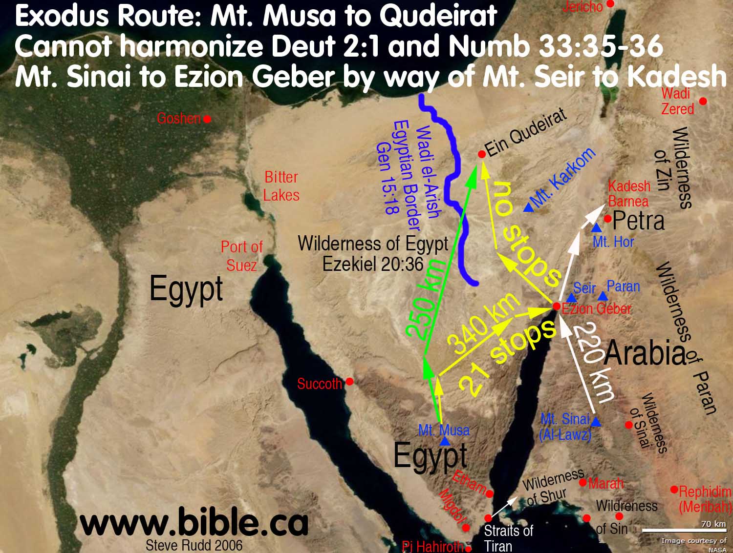
- Mt. Seir is the capital of the Edomites. (Gen 36:8) Edomite territory is the transjordan mountains just north of the Red Sea. Mt. Seir is located transjordan in modern Jordan. The Edomites never lived west of the Arabah valley, in the Sinai peninsula or the Negev before the Babylonian captivity of 586 BC. The Bible tells us that took 11 days to journey from Mt. Sinai to Mt. Seir to Kadesh: "It is eleven days' journey from Horeb by the way of Mount Seir to Kadesh-barnea." (Deuteronomy 1:2) For the traditional exodus route advocates, this verse has caused them a lot of trouble. Look at the yellow route in the map above. Israel must first travel due north of Mt. Musa because of the mountains, then travel north east, then through the middle of a major mount range to get to Ezion Geber. All this was 22 stops. Then they leave Ezion Geber and travel north and immediately must pass through a second major mountain range to Qudeirat. Phew! That was a lot of extra, unnecessary travelling. If we could just remove Num 33 and Deut 1 from out Bible, we could just travel from Mt. Musa to Qudeirat in almost a straight line (green route above) and save 90 km of unnecessary travelling. A direct the trip (green route) would only be 250 km long. The traditional route (yellow route) through Ezion Geber is 340 km long just doesn't work. However our proposed route (white route) from Mt. Sinai at Lawz in Arabia and Kadesh at Petra perfectly harmonizes Numbers 33:35-36 and Deuteronomy 1:2.
- Many exodus routes ignore the need to pass through Ezion
Geber between Sinai and Kadesh and randomly pick a nearby mountain as
their Mt. Seir. Here is an example of just such a proposed Exodus Route by
Emanuel Anati in 1985 AD. He retains Kadesh Barnea at Qudeirat, but
chooses Mt.
Karkom as his Mt. Sinai. His 11 day journey map (see the blue line)
completely ignores Numbers 33:35-36 and the need to pass through Ezion
Geber. Of course Mt. Karkom and Qudeirat are both well inside the promised
land, so both must be rejected. You can see where he randomly chose a
location for Mt. Seir at Jebel el-Arif Naqa. This kind of blindfolded
"pin the Mt. Seir on the Map" approach, is simply unacceptable.
Keep in mind that many others have put the blindfold on and choose at lest
10 other locations for Mt. Seir in the Sinai and Negev. Do also remember
that there are actually 22 stops between Sinai and Kadesh, not 11 as Anati
suggests. Deut 1:2 says that if someone was to make the trip, it is only a
distance of 11 days. However we can see from Num 33, that Israel took at
least 22 days to make the journey.

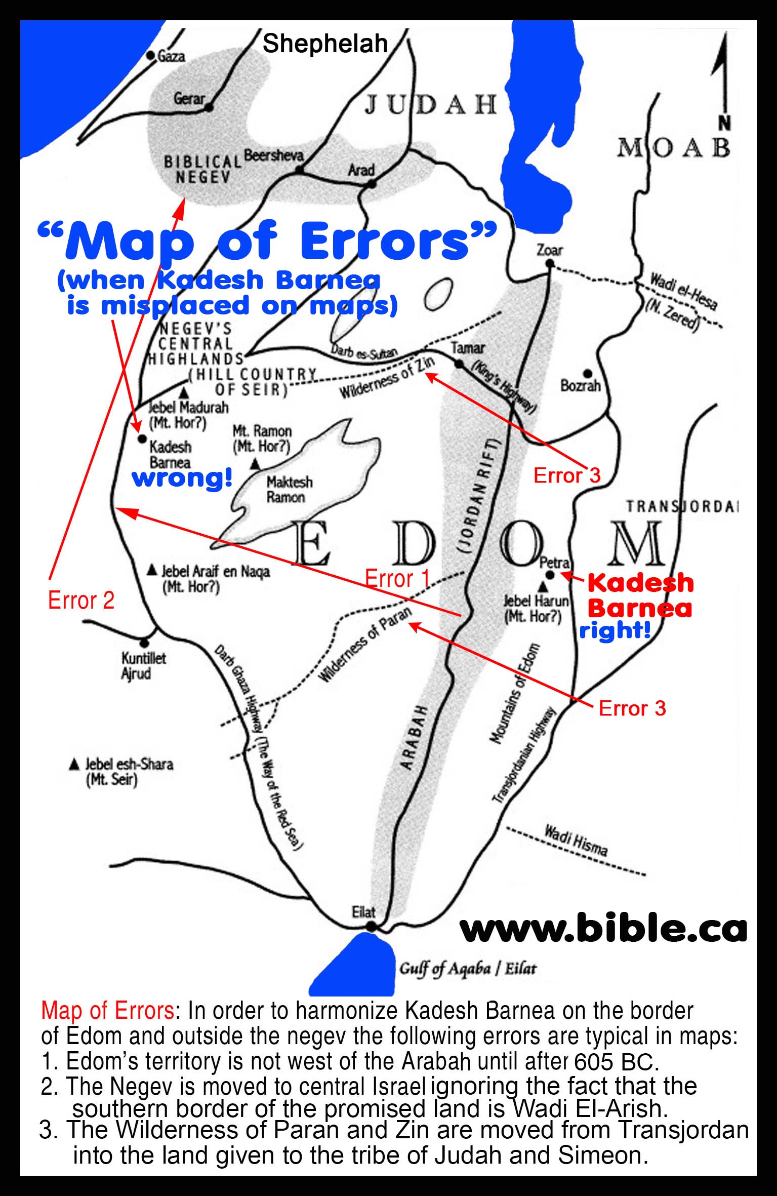
- None of the exodus took place in the Negev. No Bible verse
indicates Israel set foot in the Negev during their 40 years in the
wilderness. This fact has created a dilemma that has caused modern map
makers to create the mythical "Biblical Negev region" which is a
small crescent moon shaped area near Beersheba. In other words, the Negev
is not the large area south of Beersheba to the Gulf of Aqaba, but a tiny
area that includes Beersheba. All this to account for the fact that Israel
never set foot in the Negev before crossing the Jordan. Neither Kadish
Barnea or Mt. Sinai were in the Negev: Numbers 13:17; Deuteronomy 1:7.
Both Ein el-Qudeirat Mt. Karkom are in the Negev. Here in an example of
what I call, The map of errors". Because advocates of the traditional
exodus route believe Kadesh is located at Qudeirat, they must move a lot
of stuff around to make it work. Since the Bible says that Kadesh was
beside Edom, near Mt. Hor and not in the Negev, they just relocate it.
Notice in this map, they played, "Pin the Mt. Hor on the map" in
4 different places! Josephus
said Mt. Hor was located beside Petra. The Bible and archeology says that
Edom was not in the Negev at the time of the Exodus. But notice how they
have defined the Negev as this tiny area around Beersheba. They cannot
have the Negev any further south of this, or else their Kadesh (at
Qudeirat) is in the Negev. Well they can't have that... so they just
randomly redefine it! Such is counterproductive to truth and confusing to
the average Christian. It is just wrong.
- In 325 AD, Eusebius taught Kadesh was at Petra and that Aaron was buried on Mt. Hor at Petra.
- Historically, when the Israelites vacated Petra in 1406 BC to enter the promised land, Petra was taken over by the Edomites, then the Nabataeans who carved the famous "treasury" and the city of tombs we see today about between 300 BC -100 AD.
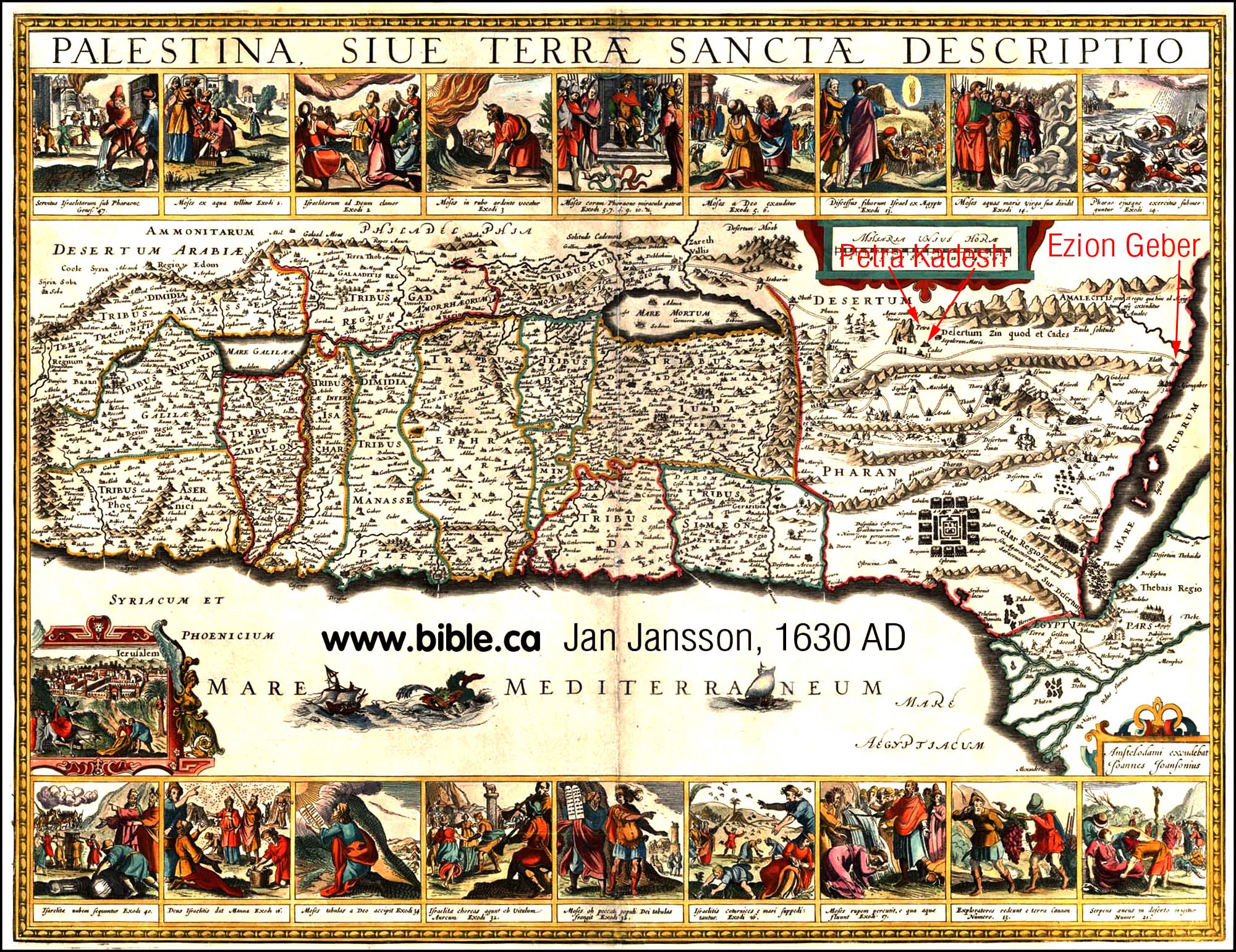
- Everyone believed Kadesh was at or near Petra until
1831 AD. This can be seen in historic maps. Petra was not rediscovered
until 1812 AD. Even though the maps of
the 1500's did not know where Petra was located, they always placed Kadesh
and Mt. Hor near or at Petra. Here is an example of a map from 1630 AD by
Jan Jansson. Notice that the Sinai peninsula and Gulf of Aqaba missing.
Notice he has Ezion Geber on the Red Sea. He has the entire exodus route
from Egypt in a line. Notice Stop 32 is Ezion Geber, stop 33 is Kadesh
Barnea (cades) and stop 34 is Mt. Hor. Both Kadesh and Hor are
Transjordan. Kadesh is at Petra. What is important, is that Jan Jansson
(like almost everyone before 1831 AD) placed Kadesh Transjordan even
before he knew the location of Petra which was rediscovered in 1812 AD by
Burckhardt. They didn't where Kadesh or Petra were on the map. But their
Bible led them to believe they were beside each other and transjordan.
Click on any of the maps on this page for a higher resolution image.
- Petra has an ancient tradition associated with Kadesh Barnea. The very name "Petra" [literally: rock] is derived from the rock that Moses struck. Eusebius even reported, that in his day, (325 AD) you could still see the rock that Moses struck for water. The 1 km long Siq ravine that runs through Petra is called "wadi Musa" or the river of Moses. The very unusual Nabataean city of tombs is a carryover from the fact that 2 million Hebrews died and were buried near Petra.
- We propose that Kadesh Barnea is either at Petra or just north of Petra.
|
|
|
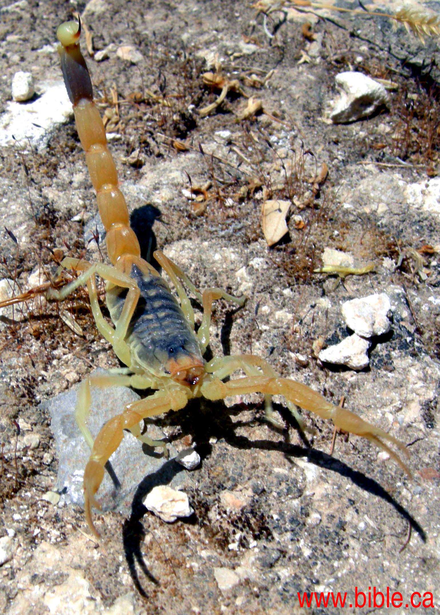 |
Bible proof the ascent of
scorpions is Transjordan, south of the Dead Sea Judges 1:34-36 "The border of the Amorites ran from the ascent of Akrabbim, from Sela [Petra] and upward." |
- The ascent of Akrabbim has been wrongly located inside the land of Judah at Ma'ale Aqrabim, just south east of the bottom of the Dead Sea. It is well inside the boundary of Judah. It was named Ma'ale Aqrabim by the Romans who paved the road in the about 135 AD, likely by Hadrian.
- Judges 1:34-36 proves that the ascent of Akrabbim is Transjordan: "The border of the Amorites ran from the ascent of Akrabbim, from Sela [Petra] and upward."
- This passage describes the territory of the Amorites in about 1350 BC. It describes how the Amorites were displaced out of Judah and the Promised land. The Amorites took over the southern half of the territory of Moab. Moab was displaced north.
- If the ascent of Akrabbim is located at Ma'ale Aqrabim, it means that the Amorites controlled the most important sections of Judah north to Engedi. This was not the case, so the ascent of Akrabbim must be located on the Transjordan side of the Arabah valley.
- The information above, is just a highly condensed version of the reasons why we chose the route we did.
- We propose that Israel crossed the Red sea at the Straits of Tiran, that Mt. Sinai is Mt. al-Lawz in Arabia and that Kadesh Barnea is at or just north of Petra, at Beidha.)
- We invite your comments, questions, criticisms and input. Contact the author.
www.bible.ca/archeology/bible-archeology-exodus-route.htm
http://www.bible.ca/archeology/bible-archeology-exodus-ancient-geographers-eusebius-onomasticon-323ad.htm
http://www.bible.ca/archeology/archeology.map
http://www.bible.ca/archeology/bible-archeology-maps.htm


Memang tidak mudah sih, tapi klo ada terjemah bahasa Indonesia nya yg bagus dan teliti jadi kami bisa mengerti dg jelas baik arti dan tujuan dari masalah tsb, apalagi akhir2 ini kita selalu di diskredit kan oleh mereka yang anti sama Islam, tolong dipikirkan dan terimakasih sekali atas pengertiannya dan bantuannya Wassalam
ReplyDeleteThis comment has been removed by the author.
ReplyDelete