FAKTA PARAN, SINAI DAN ARABIA
1. 700 BC: Hesiod (Greek Poet)
This is a modern interpretation map
based directly upon the geographic understanding of the middle east by a
Greek Poet named Hesiod who lived in 700 BC. Notice he has no understanding
of the Red sea, Persian Gulf or Israel for that matter.
This is a map based directly upon the
geographic understanding of the middle east by a Greek Poet named
Hesiod who lived in 700 BC. Notice he has no understanding of the Red
sea, or Israel for that 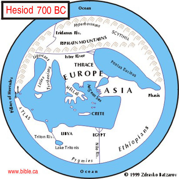
+++++++++++++++++++++++++++++++++++++++++++++++++++++++++++++++++++++++
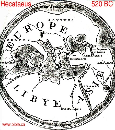
2. 520 BC: Hecataeus (Greek Philosopher)
This is a modern interpretation
map based directly upon the writings of a Greek Philosopher named Hecataeus who
lived in 520 BC. Notice, like Hesiod his predecessor, he no concept of Israel
and has a vague understanding of the Red sea as a single finger of water.
+++++++++++++++++++++++++++++++++++++++++++++++++++++++++++++++++++++++
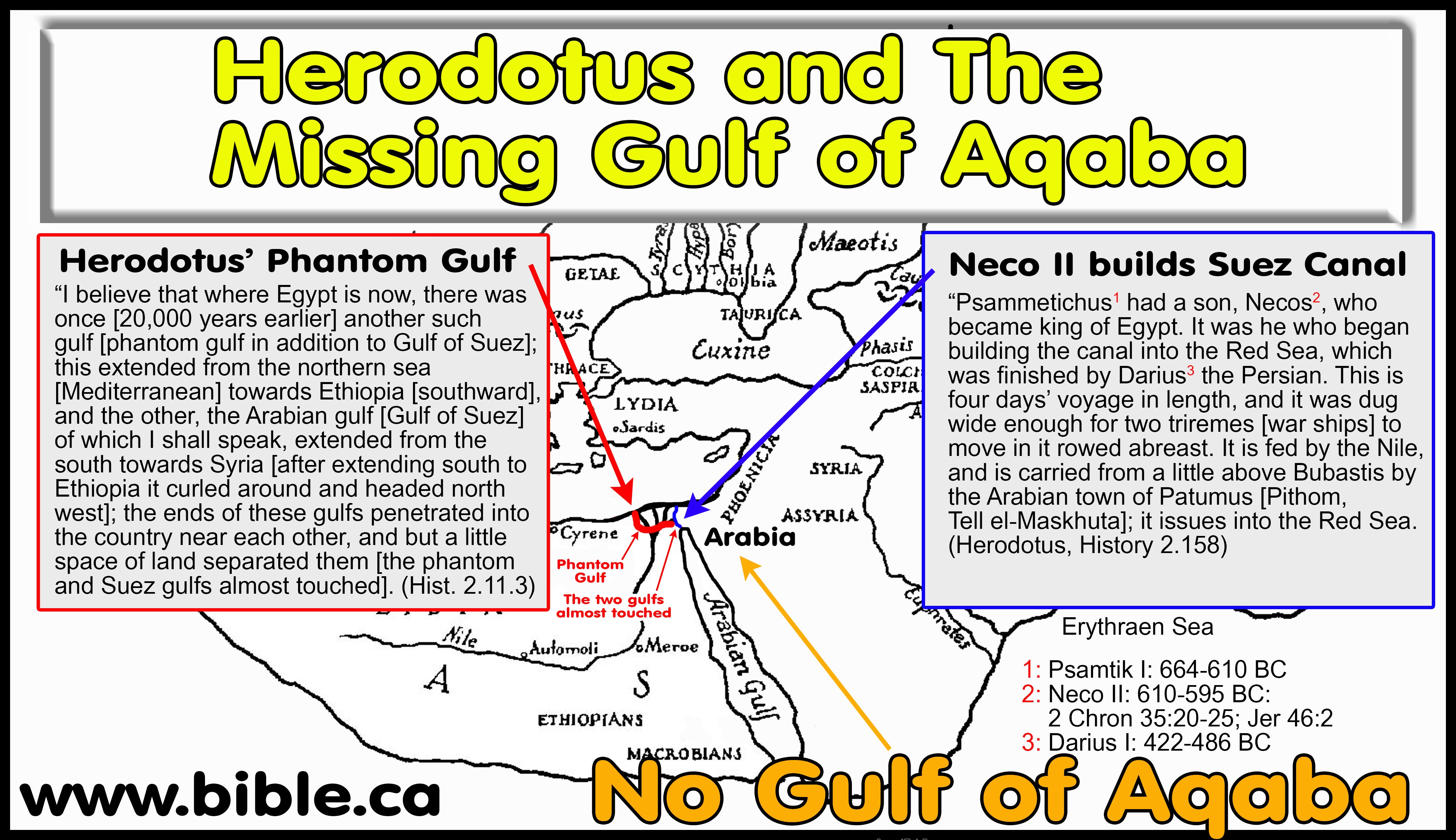
3. 484 BC: Herodotus
This is a modern interpretation map
based directly upon the writings of Herodotus.
The Suez
Canal was first completed in 500 BC: "This prince [Necos] was the
first to attempt the construction of the canal to the Red Sea - a work
completed afterwards by Darius the Persian - the length of which is four
days' journey, and the width such as to admit of two triremes being rowed
along it abreast. The water is derived from the Nile, which the canal leaves
a little above the city of Bubastis, near Patumus, the Arabian town, being
continued thence until it joins the Red Sea. (Herodotus 2.158-159, 484 BC)
No
concept of the Gulf of Aqaba, but a strange forked tongue at the top
of the Gulf of Suez: "the two gulfs ran into the land so as almost to
meet each other, and left between them only a very narrow tract of country.
(Herodotus 2.11, 450 BC)
4. 250 BC: Septuagint
The Septuagint LXX, translates
Gen 45:10; 46:34 as, "Goshen of Arabia".
More: Septuagint:
250 BC
Septuagint LXX
This is used as proof that in 250 BC, well before Paul's time of writing Gal 4:25, that everything east of the Nile was considered Arabia. It is suggested that the Septuagint merely reflected the geographical understanding of the time. Considering they had no concept of the Sinai Peninsula or the Gulf of Aqaba, the translators copied this error from their contemporary geographers. The Holy Spirit did not make this mistake, and the works, "of Arabia" are not in the original Hebrew text.
This is used as proof that in 250 BC, well before Paul's time of writing Gal 4:25, that everything east of the Nile was considered Arabia. It is suggested that the Septuagint merely reflected the geographical understanding of the time. Considering they had no concept of the Sinai Peninsula or the Gulf of Aqaba, the translators copied this error from their contemporary geographers. The Holy Spirit did not make this mistake, and the works, "of Arabia" are not in the original Hebrew text.
++++++++++++++++++++++++++++++++++++++++++++++++++++++++++++++++++++++++
5. 225 BC Demetrius the Chronographer
Demetrius believed that Mt. Sinai
was in Arabia. He lived and worked in Alexandria, which meant he had access
to the largest library in the world. Demetrius located Mt. Sinai in the city
of Madyan (al Bad) in northwestern Arabia. This information comes from
Eusebius in his work: Preaparatio Evangelica 9:29.1-3
++++++++++++++++++++++++++++++++++++++++++++++++++++++++++++++++++++++++++
6. 200 BC: Eratosthenes
More: Eratosthenes:
200 BC
Eratosthenes makes the same
geographical errors of his predecessors Herodotus, Hecataeus, Hesiod and Hecataeus
by ignoring Israel and having no working knowledge of the Gulf of Suez and
Aqaba. 1. In spite of this, Eratosthenes described "Arabia" in such
a way so as be equivalent to the Arabian Peninsula, which is modern Saudi
Arabia, to the exclusion of the Sinai Peninsula.
- Eratosthenes lived from 276 BC - 194 BC and was head librarian the great library at Alexandria. Eratosthenes is called the "father of geography" since he coined the word "geography" which we use to this day. He was also assigned the honorific because he wrote a book titled "Geographics". He also wrote a monograph on how to measure the circumference of the earth that was so precise, he used came within 500 miles of the actual value.
- Like many ancient writers, we do not have their original works, but know about them because others quoted their work. It is like reconstructing the Old Testament from places where the New Testament quotes the old. In this case, Strabo in 15 AD, quotes Eratosthenes.
- Eratosthenes makes the same geographical errors of his predecessors Herodotus, Hecataeus, Hesiod and Hecataeus by ignoring Israel and having no working knowledge of the Sinai Peninsula, Gulf of Suez and Aqaba.
- As you can see from the map that was drawn by following his writings, he saw the Red Sea as a single finger of water. But notice he places Arabia far south and away from Egypt.
- This is Strabo's account in 15 AD of what Eratosthenes said about Arabia: "But I return to Eratosthenes, who next sets forth his opinions concerning Arabia. He says concerning the northerly, or desert, part of Arabia, which lies between Arabia Felix [Yemen] and Coelê-Syria [east of Jordan] and Judaea, extending as far as the recess of the Arabian Gulf, that from the City of Heroes, [Heroönpolis or Goshen] which forms a recess of the Arabian Gulf near the Nile, the distance in the direction of the Petra of the Nabataeans to Babylon is five thousand six hundred stadia [1120 km, actual distance is 1200 km line of sight], the whole of the journey being in the direction of the summer sunrise [north-east] and through the adjacent countries of the Arabian tribes, I mean the Nabataeans and the Chaulotaeans and the Agraeans. ... Such, then, is Eratosthenes' account of Arabia; but I must also add the accounts of the other writers." (Strabo, Geography, 15 AD)
- "The southern Sinai peninsula, which was only beginning to attract the economic interests of the Romans at this time, mattered little to Alexandrians. But the Arabian peninsula mattered greatly: The merchants, dock workers and shopkeepers of Alexandria profited nicely from the massive trade that passed through their city to and from southern Arabia and India. For them, "Arabia" meant the Arabian peninsula. Precisely the same usage is found in the works of Alexandrian intellectuals such as the geographers Eratosthenes and Agatharchides. (Mt. Sinai in Arabia?, Allen Kerkeslager, Bible Review, BR 16:02, Apr 2000)
- Note: The Arabian Peninsula is defined as that area south and east of the Gulf of Aqaba and does not include the Sinai Peninsula.
- Even though Eratosthenes did not understand the Gulf of Aqaba, he described "Arabia" in such a way so as be equivalent to the Arabian Peninsula.
- So in spite of having no understanding of the Gulf of Aqaba, Eratosthenes described "Arabia" in such a way so as be equivalent to the Arabian Peninsula, which is modern Saudi Arabia, to the exclusion of the Sinai Peninsula.
7. 169 BC: Agatharchides
Agatharchides is unique in that
he is the only geographer before the 1800's AD, that understood the Gulf of
Aqaba, which he calls "Laeanites Gulf". He restricts
"Arabia" to south and east of the Gulf of Aqaba. Agatharchides did
not sail down the Laeanites Gulf, but says the Arabs live on the east shore,
not the left and that at the end of the Gulf, is Petra!
- "The southern Sinai peninsula, which was only beginning to attract the economic interests of the Romans at this time, mattered little to Alexandrians. But the Arabian peninsula mattered greatly: The merchants, dock workers and shopkeepers of Alexandria profited nicely from the massive trade that passed through their city to and from southern Arabia and India. For them, "Arabia" meant the Arabian peninsula. Precisely the same usage is found in the works of Alexandrian intellectuals such as the geographers Eratosthenes and Agatharchides. (Mt. Sinai in Arabia?, Allen Kerkeslager, Bible Review, BR 16:02, Apr 2000)
- To the ancient geographers, the "Erythraean Sea" was defined in a wide variety of ways which often broadly included the Red Sea, the Arabian Sea and the Persian Gulf. Agatharchides seems to follow this definition. Agatharchides makes no distinction between the Gulf of Suez and the main section of the Red Sea. He sees the Red Sea as one continuous finger of water and he calls the Red Sea, the "Arabian Gulf". He does, however, distinguish the Gulf of Aqaba from the Arabian Gulf (Red Sea) calling it the "Laeanites Gulf". Agatharchides calls the Gulf of Aqaba the "Laeanites Gulf" and the remaining straight section of the Red Sea that extends from the Persian Gulf to Egypt, the "Arabian Gulf".
- The words of Agatharchides have been reconstructed from three other ancient authors: Diodorus (49 BC), Strabo (15 AD), Photius (897 AD). The original script of Agatharchides, often has three readings or "fragments", much like the synoptic gospels. For example, the text runs with the following fragments: 87a, 87b, 88, 89a, 89b, 89c.This means there are two versions (fragments) of section 87, only one version (fragment) of section 88 and three versions (fragments) of section 89.
- It is clear that Agatharchides restricted the Arabs and Arabia to modern Saudi Arabia. He did not place the Arabs and Arabia anywhere in modern Sinai Peninsula.
- Agatharchides make no description of any kind of the modern Sinai Peninsula, like many other geographers in the ancient world, he just ignores it.
- Unlike other geographers before him, he was aware of the Gulf of Aqaba (he called it Laeanites Gulf) but interesting, his voyage and narrative do not take him to the end of this gulf. While he describes the east coast of the Red Sea down to the Arabian sea in great detail, but has almost no description of the Gulf of Aqaba except that the Nabataeans live along the east coast and that Petra is at the end of the Gulf. It is clear he did not sail this section, but was aware of its basic geography.
- His narrative begins at the Straits of Tiran, then move south to the Arabian Sea. He discusses Poseideion and then Palm Grove, which are obviously very near the Straits of Tiran.
- In fragment 89a, Agatharchides makes a very interesting observation. He says that if you draw a straight line from Tiran Island up the coastline, you will hit Petra. He says that the Nabataean Arabs inhabit the east coast of the gulf of Aqaba and that they control Petra.
- Translator Stanley M. Burstein, makes an error in equating Poseideion with a location at the north end of the Gulf of Suez and locating Palm Grove with El Tor in the modern Sinai Peninsula. A careful reading proves that Agatharchides began his narration at the "inner recesses"(fragment 87a) at the Straits of Tiran. Just as Agatharchides did not travel up the Gulf of Aqaba, hi narration for the Arabian side of the Red sea, began at the Straits of Tiran. We can prove that Poseideion is located at the straits of Tiran because Agatharchides says, "Immediately after the innermost recess (where Poseideion is located) is Palm-Grove. Burstein equates Palm Grove with El Tor, but this contradicts the pattern of Agatharchides since it is 210 km from where Burstein says Poseideion is located at the north end of the Suez canal. The final proof is that fragment 87b says "Adjacent to Poseidion is a Palm Grove". So Poseidion and Palm Grove are beside each other, not 210 km apart. Clearly both Poseidion and Palm Grove are at the Straits of Tiran on the Arabian side (east side) of the Red Sea.
- Fragment 90 says, "the next section of the coast ... The Garindanes ... a festival that was celebrated every four years in the Palm Grove" This proves that Palm Grove is in Saudi Arabia, since the section of coast occupied by the Garindanes was also in Saudi Arabia. In other words, they are going to celebrate the feast on the same side of the coast being directly connected with it.
- Fragment 90 says, "After sailing past this country [The Garindanes], one encounters the Laeanites Gulf [Gulf of Aqaba] around which there are many villages of the so-called Nabataean Arabs." So now Agatharchides' narration takes us into the Gulf of Aqaba for the first time. For the entire east shore he says it is occupied by the Nabataean Arabs.
- As Agatharchides' narrative continues, he moves down the east coast of the Red Sea to the Arabian Sea or the Erythraean Sea as he calls it.
- This is significant, for in the chapter before, Agatharchides discusses the western coast of the Red sea and there he starts in Egypt.
- This proves that Agatharchides defined Arabia, starting at the Straits of Tiran and the east shore of the Gulf of Aqaba.
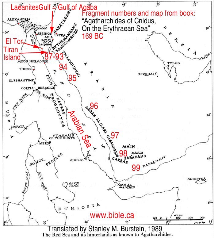 |
Note: The red numbers (87 - 99) in the map to the left, are from Burnstein's book and correspond to specific sections of text written by Agatharchides. |
73a. In the country of the Trogodytes there is also found the animal Greeks call `camelopard', an animal that, like its name, has in a certain sense a composite nature.' For it has the spotted coat of a leopard and is the size of a camel and very fast, and its neck is so long that it obtains its food from the tops of trees. (Agatharchides of Cnidus, On the Erythraean Sea 169 BC, translated by Stanley M. Burstein, 1989, book 5, fragment 73a. Photius 897 AD, Cod. 250.72, 455b)
44a. The fourth group of Fisheaters has dwellings of the following type. A huge mound of seaweed like a mountain has been built up from all eternity, and this whole pile has been solidly compacted by the constant heavy pounding of the waves so that it does not slide at all, since its mass is uniform and of one nature because of the mixing and blending with the sand. They excavate chambers the height of a man for themselves. The section at the top of the mound they leave undisturbed to serve as a sturdy roof, but below they make long tunnels which everywhere intersect. They make a small opening for light on the windward side and live quietly in the galleries. But when the tide comes in, they prepare for the hunt in the manner already described. (Agatharchides of Cnidus, On the Erythraean Sea 169 BC, translated by Stanley M. Burstein, 1989, book 5, fragment 44a. Photius 897 AD, Cod. 250.44, 450b)
Petra And The Arabian Coast of the Red Sea:
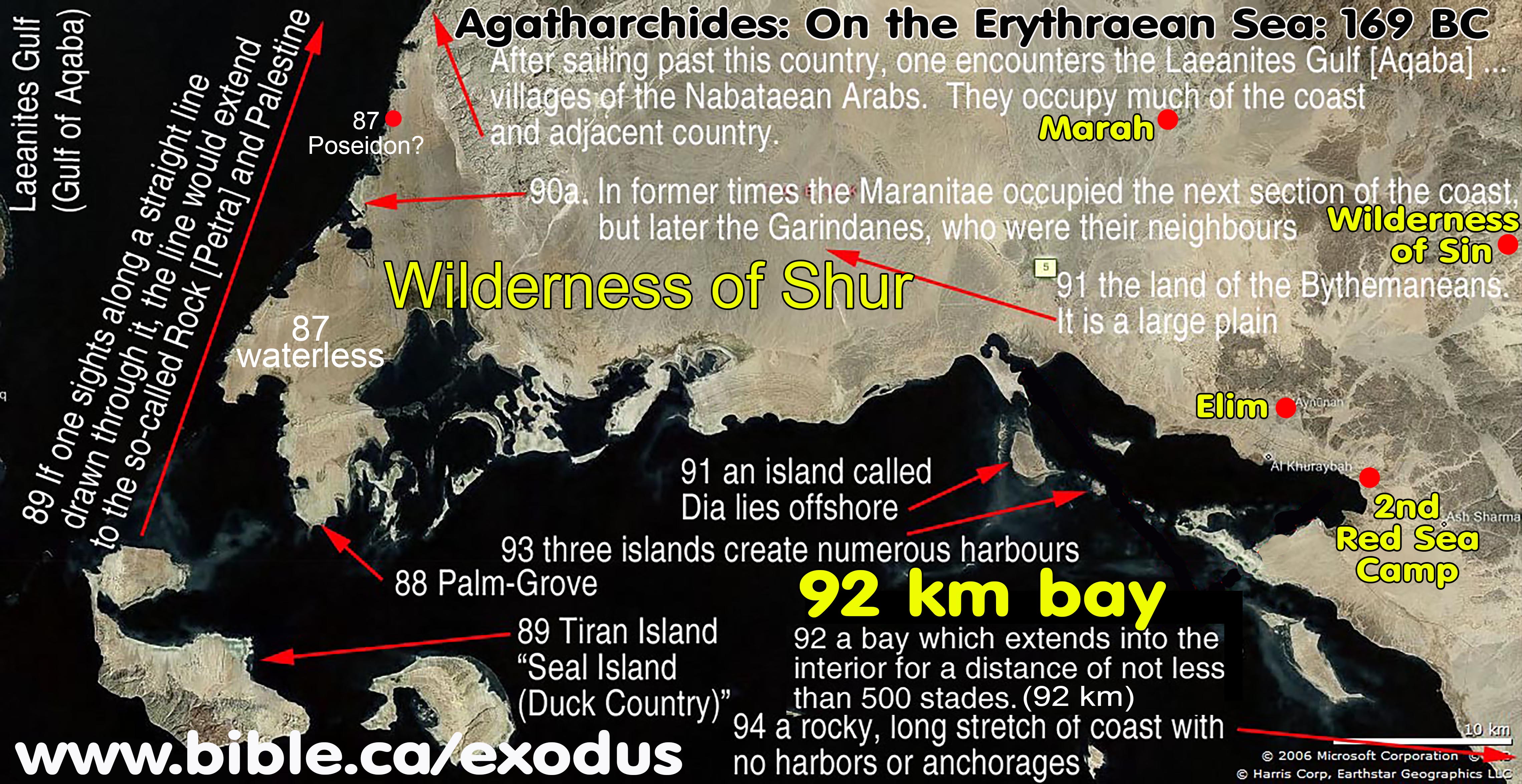
87a. But we shall take up the remaining portion, the opposite shore which joins Arabia, and describe it, beginning again from the innermost recess. This is named Poseideion and was founded by Ariston, who was dispatched by Ptolemy to explore Arabia as far as the ocean and established there an altar dedicated to Poseidon Pelagaeus. Immediately after the innermost recess is a place by the sea which is exceptionally highly regarded by the natives because of the benefit derived from it. The place is named Palm-Grove, and it contains an abundance of this kind of tree which is extraordinarily fruitful and particularly conducive to pleasure and luxury. All the nearby surrounding country, however, lacks springs and is fiery hot because of its southern orientation. For this reason the barbarians rightly designated as sacred the place that supports trees and that, although situated in the midst of the most desolate regions, supplied their food. For not a few springs and streams emerge in it that are not inferior in their coldness to snow. These make the land on either side of them green and pleasant in every way. There is also an ancient altar that is made of hard stone and bears an inscription in lettering that is archaic and unintelligible. The sanctuary is cared for by a man and a woman who occupy their sacred office for life. The inhabitants of this place are long-lived and make their beds in the trees because of their fear of wild animals. (Agatharchides of Cnidus, On the Erythraean Sea 169 BC, translated by Stanley M. Burstein, 1989, book 5, fragment 87a. Diodorus 49 BC, 3.42.1-4 )
87b. After saying these things about the Trogodytes and the neighbouring Aithiopians, Artemidorus turns to the Arabs, and describes first the Arabs who border on the Arabian gulf and are located opposite the Trogodytes, beginning from Poseidion. He says that this place is located further in than the Aelanites Gulf [of Aqaba]. Adjacent to Poseidion is a palm grove that is well-watered and is highly valued because the whole surrounding area is fiery hot, waterless and shadeless, but the fertility of the palms there is remarkable. A man and woman watch over the grove. They are appointed on a hereditary basis, wear skins and derive their sustenance from the palms. They build huts in the trees and sleep in them because of the numerous wild animals. (Agatharchides of Cnidus, On the Erythraean Sea 169 BC, translated by Stanley M. Burstein, 1989, book 5, fragment 87b. Strabo 15 AD, 16.4.18, C776)
88. The portion of the interior that is visible from the Palm-Grove is filled with rocky peaks of various heights, but the part that extends towards the sea is narrow and long. (Agatharchides of Cnidus, On the Erythraean Sea 169 BC, translated by Stanley M. Burstein, 1989, book 5, fragment 88. Photius 897 AD, Cod. 250.86, 457a)
89a. Adjacent to the coast just mentioned is a region people have named Duck Country because of the abundance of these creatures. Duck Country [Island of Tiran] itself lies near a very thickly wooded promontory. If one sights along a straight line drawn through it, the line would extend to the so-called Rock [Petra] and Palestine to which the Gerrhaeans, Minaeans and all the Arabs, whose settlements are nearby, bring frankincense, as is the report, together with cargoes of incense from the upper country. (Agatharchides of Cnidus, On the Erythraean Sea 169 BC, translated by Stanley M. Burstein, 1989, book 5, fragment 89a. Photius 897 AD, Cod. 250.87, 457a-457b)
89b. After sailing past the Palm-Grove one encounters near a promontory of the mainland an island which has been named Seal Island [Tiran Island] from the animals that live on it. For so great a number of these animals frequent these places that observers were amazed. The promontory, which is situated in front of the island, lies below the area called the Rock [Petra] and Palestine. It is to this region that the Gerrhaeans and Minaeans bring, as is the report, frankincense and other aromatic products from what is called upper Arabia. (Agatharchides of Cnidus, On the Erythraean Sea 169 BC, translated by Stanley M. Burstein, 1989, book 5, fragment 89b. Diodorus 49 BC, 3.42.5)
89c. Next in order is Seal Island [Tiran Island] which is named from the abundance of these animals. Near this island is a promontory which stretches towards the Rock [Petra] of the Arabs called Nabataeans and the country of Palestine. To this region the Minaeans, Gerrhaeans and all their neighbours bring cargoes of aromatic substances. (Agatharchides of Cnidus, On the Erythraean Sea 169 BC, translated by Stanley M. Burstein, 1989, book 5, fragment 89c. Strabo 15 AD, 16.4.18, C776)
90a. In former times the Maranitae occupied the next section of the coast, but later the Garindanes, who were their neighbours. The Garindanes gained control of the country in the following manner. During a festival that was celebrated every four years in the Palm Grove, which was described earlier, the neighbouring peoples would come from every direction to sacrifice in the sanctuary hecatombs of finely reared camels to the gods and, in addition, also to bring back to their homelands some of the water from it because of a tradition that a drink of it brings good health to those who make use of it. When, therefore, the Maranitae had gone to the festival for these reasons, the Garindanes slaughtered those who had been left behind in the country and then ambushed and wiped out those who were returning from the festival. Having thus emptied the country of its inhabitants, they divided up the plains which were fertile and produced rich pasturage for their flocks. This coast has few harbours and is broken up by numerous large mountains which, as they have a variety of colours, furnish an amazing sight to those sailing by it. After sailing past this country, one encounters the Laeanites Gulf [Gulf of Aqaba] around which there are many villages of the so-called Nabataean Arabs. They occupy much of the coast and not a little of the adjacent country which extends into the interior and contains a population that is unspeakably great as well as herds of animals that are unbelievably numerous. In ancient times they led a just life and were satisfied with the livelihood provided by their flocks, but later, after the kings in Alexandria had made the gulf [of Aqaba] navigable for merchants, they attacked those who suffered shipwreck. They also built pirate vessels and plundered sailors, imitating the ferocity and lawlessness of the Tauri in the Pontus. But later they were caught at sea by quadriremes and properly punished. (Agatharchides of Cnidus, On the Erythraean Sea 169 BC, translated by Stanley M. Burstein, 1989, book 5, fragment 90a. Diodorus 49 BC, 3.43.1-5)
90b. Then there is another stretch of coast, formerly called the land of the Maranitae, some of whom were farmers and some tent-dwellers, but now that of the Garindanes who destroyed the former people by treachery. For they attacked and killed some of them while they were conducting a certain festival that was celebrated every four years. They also set on and utterly destroyed the rest of the people. Then there is the Aelanites Gulf [Aqaba] and Nabataea, a land that is populous and rich in pasturage. These people also inhabit the nearby offshore islands. Formerly, they were peaceful, but later they began to use rafts to plunder those sailing from Egypt. They paid the penalty for this, however, since a fleet attacked and ravaged their country. (Agatharchides of Cnidus, On the Erythraean Sea 169 BC, translated by Stanley M. Burstein, 1989, book 5, fragment 90b. Strabo 15 AD, 16.4.18, C777)
91a. After what is called the Laeanites Gulf [of Aqaba], around which Arabs live, is the land of the Bythemaneans. It is a large plain, all of which is well watered and lush with vegetation, albeit only dog's tooth grass, lucerne and lotus as tall as a man. All crops are restricted to this, and people cultivate nothing else. For this reason there are many wild camels in the plain and numerous herds of antelope and gazelles, many flocks of sheep and untold numbers of onagers and cattle. Joined to these advantages, however, is a countervailing evil since the region abounds with lions, wolves and leopards so that the natural bounty of the land is the cause of misfortune for its inhabitants. (Agatharchides of Cnidus, On the Erythraean Sea 169 BC, translated by Stanley M. Burstein, 1989, book 5, fragment 91a. Photius 897 AD, Cod. 250.89, 457b)
91b. After these places there is a well-watered plain which, because of the streams that flow through it everywhere, grows dog's tooth grass, Lucerne and also lotus the height of a man. Because of the abundance and excellence of the pasturage it not only supports flocks and herds of all sorts in unspeakably great numbers but also wild camels and, in addition, deer and gazelles. In response to the abundance of animals which breed there, crowds of lions, wolves and leopards gather from the desert. Against these the herdsmen are compelled to fight day and night in defense of their flocks. Thus, the advantage of the country is the cause of misfortune to its inhabitants because Nature generally gives men together with good things those that are harmful. (Agatharchides of Cnidus, On the Erythraean Sea 169 BC, translated by Stanley M. Burstein, 1989, book 5, fragment 91b. Diodorus 49 BC, 3.43.6-7)
91c. Next there is a plain that is well-wooded, copiously supplied with water and full of grazing animals of all sorts including onagers. Wild camels, deer and gazelles also abound in it together with numerous lions, leopards and jackals. Further, an island called Dia lies offshore. (Agatharchides of Cnidus, On the Erythraean Sea 169 BC, translated by Stanley M. Burstein, 1989, book 5, fragment 91c. Strabo 15 AD, 16.4.18, C777)
92a.Next after this section of the coast is a bay which extends into the interior of the country for a distance of not less than five hundred stades. Those who inhabit the territory within the gulf are called Batmizomaneis and are hunters of land animals. (Agatharchides of Cnidus, On the Erythraean Sea 169 BC, translated by Stanley M. Burstein, 1989, book 5, fragment 92a. Photius 897 AD, Cod. 250.90, 457b)
92b. Sailing past these plains one encounters a bay which is of a paradoxical character. For it narrows to a point as it penetrates into the heart of the country. In length it extends for five hundred stades and is bounded on all sides by cliffs of amazing size. Its mouth is twisting and difficult of egress for a rock, which juts out to sea, blocks the entrance and make it impossible to sail in or out of the gulf. Further, when the current increases and the winds change, waves crash on the rocky shore and create eddies everywhere around the projecting rock. The people who inhabit the country beside the gulf, who are named the Banizomenes, support them-selves by hunting and eating the flesh of land animals. A very sacred temple has been established there which is highly revered by all the Arabs. (Agatharchides of Cnidus, On the Erythraean Sea 169 BC, translated by Stanley M. Burstein, 1989, book 5, fragment 92b. Diodorus 49 BC, 3.44.1-2)
92c. Then there is a bay, about five hundred stades in extent, encircled by mountains and with an entrance that is difficult to penetrate. Men who hunt wild land animals live around it. (Agatharchides of Cnidus, On the Erythraean Sea 169 BC, translated by Stanley M. Burstein, 1989, book 5, fragment 92c. Strabo 15 AD, 16.4.18, C777)
93a. Off shore from the territory just mentioned lie three islands which create numerous harbours. The first of these islands is named the Shrine of Isis, the second Soukabya and the third Salydo. All are uninhabited and densely covered with olive trees, not, however, the kind that grows in our countries but that native to these places. (Agatharchides of Cnidus, On the Erythraean Sea 169 BC, translated by Stanley M. Burstein, 1989, book 5, fragment 93a. Photius 897 AD, Cod. 250.91, 457b)
93b. Immediately after the stretch of coast just described are three offshore islands which provide numerous harbours. Historians record that the first of these is sacred to Isis. It is deserted but there are found on it stone foundations of ancient houses and steles inscribed with barbarian characters. The other islands are likewise also deserted, but they all are overgrown with olive trees that differ from those found in our countries. (Agatharchides of Cnidus, On the Erythraean Sea 169 BC, translated by Stanley M. Burstein, 1989, book 5, fragment 93b. Diodorus 49 BC, 3.44.3)
93c. Then there are three uninhabited islands that are full of olive trees, not those found in our countries but a local variety which we call Aithiopian, the gum of which, moreover, has medicinal power. (Agatharchides of Cnidus, On the Erythraean Sea 169 BC, translated by Stanley M. Burstein, 1989, book 5, fragment 93c. Strabo 15 AD, 16.4.18, C777)
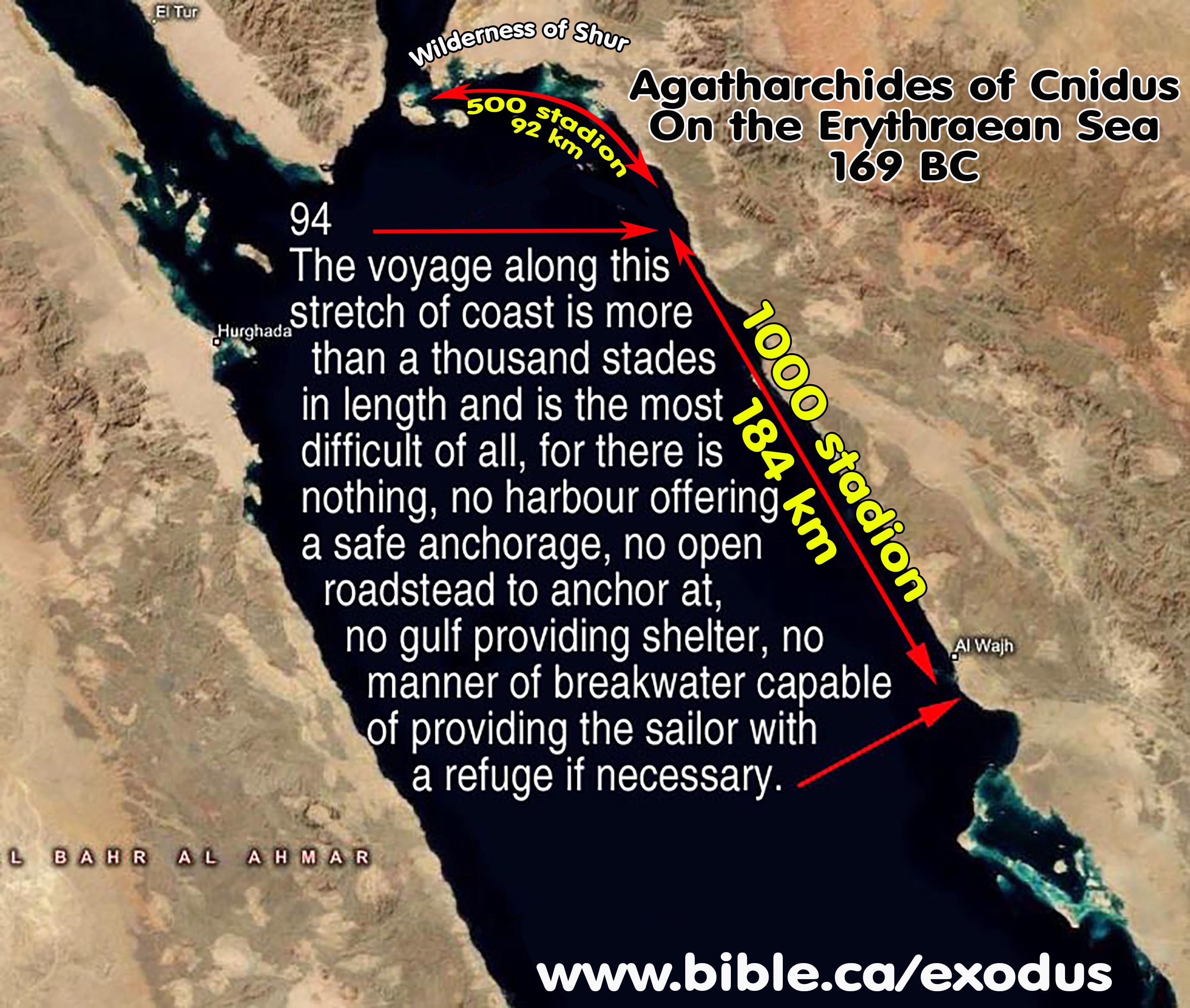
94a. After these offshore islands one can see a rocky and long stretch of coast. It is the territory of the Thamoudeni Arabs. The voyage along this stretch of coast is more than a thousand stades in length and is the most difficult of all, for there is nothing, no harbour offering a safe anchorage, no open roadstead to anchor at, no gulf providing shelter, no manner of breakwater capable of providing the sailor with a refuge if necessary. (Agatharchides of Cnidus, On the Erythraean Sea 169 BC, translated by Stanley M. Burstein, 1989, book 5, fragment 94a. Photius 897 AD, Cod. 250.92, 457b)
94b. After these islands the shore is full of sheer cliffs and difficult to sail along for a thousand stades. For there exists neither harbour nor roadstead for ships to anchor at and no breakwater to furnish needed shelter to sailors in distress. (Agatharchides of Cnidus, On the Erythraean Sea 169 BC, translated by Stanley M. Burstein, 1989, book 5, fragment 94b. Diodorus 49 BC, 3.44.4)
94c. Next is a rocky shore and after it a section of coast extending for about a thousand stades that lacks harbours and anchorages and is rough and difficult to sail along. For a rugged and high mountain stretches along it. Then rocky cliffs reach the sea and present a danger for which there is no recourse, especially at the time of the etesian winds and the storms that occur at that time. (Agatharchides of Cnidus, On the Erythraean Sea 169 BC, translated by Stanley M. Burstein, 1989, book 5, fragment 94c. Strabo 15 AD, 16.4.18, C777)
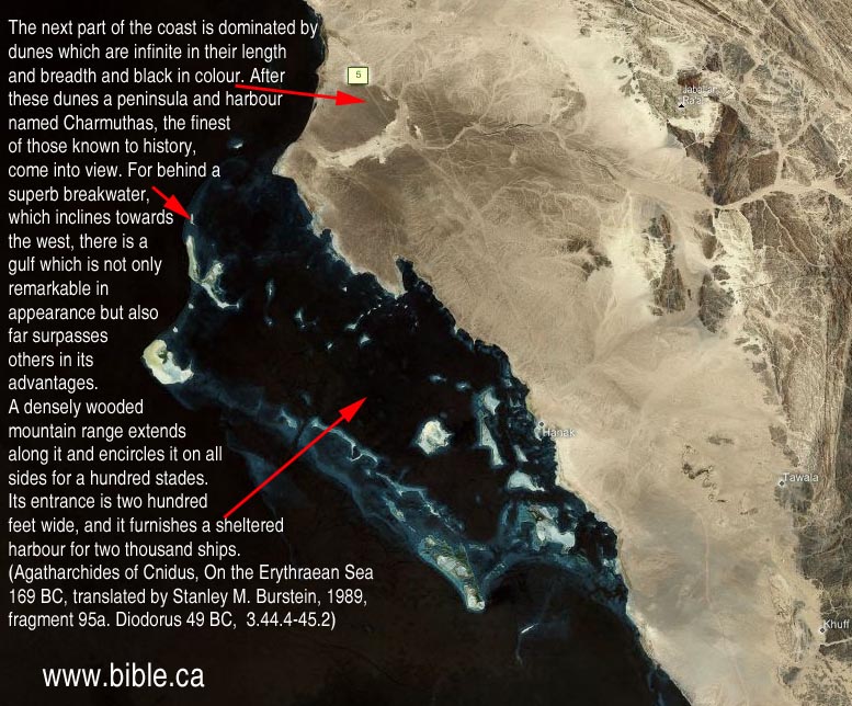
95a. A mountain range with sheer and frighteningly high rocks on its summits runs along this coast. At its base there are numerous sharp rocks in the sea, and behind them are ravines which have been eaten away from below and are twisted in shape. As these are interconnected and the sea is deep, the tide when it comes in and when it rushes back gives off a sound like a great thunder clap. The surf crashing in on the enormous rocks rises on high and produces an amazing amount of foam. Again when the tide is swallowed up in the hollows, it agitates the water so terrifyingly that those who unwillingly approach these spots almost suffer a premature death because of their terror. This coast, then, is occupied by the Arabs called Thamoundeni. A good sized gulf occupies much of the next segment of the coast. Scattered islands lie off it which are in appearance similar to the Echinades. The next part of the coast is dominated by dunes which are infinite in their length and breadth and black in colour. After these dunes a peninsula and harbour named Charmuthas, the finest of those known to history, come into view. For behind a superb breakwater, which inclines towards the west, there is a gulf which is not only remarkable in appearance but also far surpasses others in its advantages. A densely wooded mountain range extends along it and encircles it on all sides for a hundred stades. Its entrance is two hundred feet wide, and it furnishes a sheltered harbour for two thousand ships. In addition to these advantages it has an extremely good supply of fresh water since a large river flows into it. Also in the middle of the gulf there is an island which has a good supply of fresh water and is able to support gardens. In general it is very similar to the harbour at Carthage which is called Cothon. A multitude of fish from the sea congregate in it because of its calmness and the sweetness of the waters that flow into it. After sailing past these places five mountains, separate from one another, rise on high. Their peaks narrow to rocky knolls, producing an appearance similar to the pyramids in Egypt. Next is a circular gulf which is enclosed by large promontories. A trapezoidal shaped hill lies midway along a diagonal line drawn through the gulf. On the hill three temples, remarkable for their height, have been built for gods which are unknown to the Greeks but highly honoured by the natives. (Agatharchides of Cnidus, On the Erythraean Sea 169 BC, translated by Stanley M. Burstein, 1989, book 5, fragment 95a. Diodorus 49 BC, 3.44.4-45.2)
95b. Next is a gulf with scattered islands and in succession three extremely high dunes of black sand. After these is the harbour of Charmothas which is a hundred stades in circumference and has an entrance that is narrow and dangerous for all kinds of craft. A river also flows into it, and in the middle is an island that is well-wooded and suitable for cultivation. (Agatharchides of Cnidus, On the Erythraean Sea 169 BC, translated by Stanley M. Burstein, 1989, book 5, fragment 95b. Strabo 15 AD, 16.4.18, C777)

96a. After this segment of coast, not, however, immediately after it but some distance beyond, is an extremely well-watered stretch of coast and the mountain that is called Laemus. Its perimeter is indescribably great in extent, and it is covered over with trees of all kinds. (Agatharchides of Cnidus, On the Erythraean Sea 169 BC, translated by Stanley M. Burstein, 1989, book 5, fragment 96a. Photius 897 AD, Cod. 250.94, 457b)
96b. After these places is a damp stretch of coast that it is intersected by streams of sweet water that flow from springs. In this section of the coast there is a mountain called Chabinus which is overgrown with thickets of all kinds. (Agatharchides of Cnidus, On the Erythraean Sea 169 BC, translated by Stanley M. Burstein, 1989, book 5, fragment 96b. Diodorus 49 BC, 3.45.3)
97a. The Debae inhabit the region that borders on the mountainous district. Some are nomads and some are farmers. Through the middle of their country flows a river that is tripartite in nature. It carries down gold nuggets that are so obviously abundant that the mud that is deposited at its mouths gleams from afar. The inhabitants of this region are unskilled in working this sort of metal. They are extremely hospitable to strangers, not, however, to all men but to those who come to them from the Peloponnesus and Boeotia because of some mythical tale about Heracles. (Agatharchides of Cnidus, On the Erythraean Sea 169 BC, translated by Stanley M. Burstein, 1989, book 5, fragment 97a. Photius 897 AD, Cod. 250.95, 457b-458a)
97b. The land bordering the mountainous area is inhabited by Arabs who are called Debae. They are camel raisers who rely on this beast for all the most important necessities of life. They fight against their enemies from these animals, and they easily accomplish all their business by transporting their wares loaded on their backs. They live by drinking their milk, and they roam their whole country on racing camels, A river runs through the middle of their country which carries down so many nuggets of gold that the silt which is deposited at its mouths gleams. The natives are completely without experience in the working of gold, but they are hospitable to strangers, not to all visitors, however, but only to those from Boeotia and the Peloponnesus because of some ancient bond of kinship derived from Heracles with this people, which they say has been handed down in mythical form from their ancestors. (Agatharchides of Cnidus, On the Erythraean Sea 169 BC, translated by Stanley M. Burstein, 1989, book 5, fragment 97b. Diodorus 49 BC, 3.45.3-5)
97c. Then, there is a rugged stretch of coast, and after it some gulfs and the territory of nomads, who base their way of life on camels. For they conduct war from these animals, travel on them and are nourished with their milk and eat their flesh. A river flows through their country that brings down particles of gold, but they do not know how to refine gold. They are called Debae, some of them are nomads and some farmers. (Agatharchides of Cnidus, On the Erythraean Sea 169 BC, translated by Stanley M. Burstein, 1989, book 5, fragment 97c. Strabo 15 AD, 16.4.18, C777)
98a. The Alilaei and Casandreisi are neighbours of these people, and they possess a country that is not at all similar to those just described. For the air is neither cool nor dry nor fiery hot but is characterized by soft and thick clouds from which come even in summer rain storms and gentle showers. 2 Most of the land is very fertile, but not all of it is cultivated since the people are comparatively inexperienced. They do, however, mine gold in the land's underground strata and discover a great amount, not the sort that must be smelted from ore with knowledge and skill but the kind that occurs naturally and is called `unfired' by Greeks because of this fact. The smallest nugget of this kind of gold is the size of an olive pit, the mid-sized nugget that of the stone of a medlar and the largest is comparable to a walnut. They wear around their wrists and necks bands consisting of perforated gold nuggets alternating with transparent stones. They bring these to their neighbours and sell them cheaply, for they exchange bronze for three times its weight in gold and iron for twice its weight in gold. Silver is worth ten parts of gold since value is deter-mined by abundance and scarcity.' In such matters all life considers not nature but need. (Agatharchides of Cnidus, On the Erythraean Sea 169 BC, translated by Stanley M. Burstein, 1989, book 5, fragment 98a. Photius 897 AD, Cod. 250.96, 458a)
98b. The next region is inhabited by the Alilaei and Gasandi Arabs. It is not fiery hot like the nearby countries but is often covered with soft and dense clouds. From these come rains and gentle showers that make the summer season temperate. The land is extremely fertile and of exceptional quality, but it is not cultivated to its potential be-cause of the inexperience of the people. But they do find gold in natural galleries under the earth and collect a great amount of it, not the sort which is fused together from melted gold dust but native gold, and because of this circumstance it is called `unfired' As for the size of the nuggets, the smallest is found to approximate a fruit pit and the largest is not much smaller than a walnut. On their wrists and around their necks they wear this sort of gold, having bored a hole through it and strung it in alternation with transparent stones. As this kind of gold is abundant in their country and bronze and iron are rare, they exchange these goods with merchants on an equal basis. (Agatharchides of Cnidus, On the Erythraean Sea 169 BC, translated by Stanley M. Burstein, 1989, book 5, fragment 98b. Diodorus 49 BC, 3.45.6-8)
98c. Next is a people, who are more civilized people than the Debae and inhabit a country with a more temperate climate since it is both well-supplied with water and receives adequate rainfall. Gold is mined in their country, not particles, but gold nuggets requiring little refining, the smallest of which is the size of a fruit pit, the middle sized ones that of a medlar and the largest that of a walnut. They perforate them and make collars by stringing them on thread in alternation with transparent stones, and wear these around their necks and wrists. They also sell their gold to their neighbours cheaply, exchanging it at a rate of three to one for copper and two to one for silver both because of their inexperience in the working of gold and the scarcity of the metals for which it is exchanged, the need for which in their life is more pressing. (Agatharchides of Cnidus, On the Erythraean Sea 169 BC, translated by Stanley M. Burstein, 1989, book 5, fragment 98c. Strabo 15 AD, 16.4.18, C777-778)
99a. The Carbae occupy the region immediately after these people. Then follows a deep water harbour into which empty several springs. Immediately adjacent is the tribe of the Sabaeans, the greatest of the peoples in Arabia and the possessors of every sort of good fortune... (Agatharchides of Cnidus, On the Erythraean Sea 169 BC, translated by Stanley M. Burstein, 1989, book 5, fragment 99a. Photius 897 AD, Cod. 250.97, 458a-458b)
99b. After these peoples are those called Carbae and after them the Sabaeans who are the most populous of the Arab peoples. They inhabit the region called Eudaemon Arabia which bears most of the products considered valuable by us. It also supports herds of animals of all kinds in untold abundance... (Agatharchides of Cnidus, On the Erythraean Sea 169 BC, translated by Stanley M. Burstein, 1989, book 5, fragment 99b. Diodorus 49 BC, 3.46.1-5)
99c. Immediately adjacent is the very fertile country of the Sabaeans, a very large tribe, in whose territory are found myrrh, frankincense and cinnamon. On the coast there is also found balsam and a certain other very fragrant herb, the odour of which, however, quickly fades. (Agatharchides of Cnidus, On the Erythraean Sea 169 BC, translated by Stanley M. Burstein, 1989, book 5, fragment 99c. Strabo 15 AD, 16.4.19, C778)
+++++++++++++++++++++++++++++++++++++++++++++++++++++++++++++++++++++++++
Book of Jubilees 150 BC
The book of Jubilees clearly places Mt. Sinai in modern Saudi Arabia: "Mount Sinai the centre of the desert", in Shem's land.
Introduction:
- Ham settled in Egypt and the Sinai Peninsula and Canaan (the promised land).
- Shem settled in Saudi Arabia, but not the Sinai Peninsula or Egypt.
- The oldest and most complete manuscript of the Book of Jubilees was found among the Dead Sea Scrolls. Since the book claims an angel revealed the message to Moses on Mt. Sinai, it is obvious why every church in the world, except for the Ethiopian Orthodox Church, rejects it as pseudepigraphal ("Falsely signed: A forgery since Moses never wrote it). In spite of this, the Book of Jubilees is within the official canon of the Orthodox Church (Ethiopian), but is called the "Book of Division". It has value, however, as is a historical document that circulated among the Essenes in about 150 BC, so while Moses never saw it, we can learn something about the beliefs of that era.
- The book of Jubilees clearly places Mt. Sinai in modern Saudi Arabia. We know this because the book describes the territory for each of the three sons of Noah. We know that Shem is the father of all the Semitic peoples including Ishmaelites, Midianites, Arabs and Jews. They settled in modern Saudi Arabia and both sides of the Jordan but not Egypt or the modern Sinai Peninsula. It was Ham that the book of Jubilees says got the territory of Egypt and the modern Sinai Peninsula were the traditional Mt. Sinai (Mt. Musa) is located. When it describes the "portion" or territory for Shem, it actually says that Mt. Sinai is in the middle of the desert. Jebel al-Lawz would fit this description nicely. Since we know that the traditional Mt. Sinai at Mt. Musa was in Ham's territory, according to the book of Jubilees, we can safely conclude that they believed Mt. Sinai was in Saudi Arabia.
- And it came to pass in the beginning of the thirty-third jubilee [1569 A.M.] that they divided the earth into three parts, for Shem and Ham and Japheth, according to the inheritance of each, in the first year in the first week, when one of us who had been sent, was with them. And he called his sons, and they drew nigh to him, they and their children, and he divided the earth into the lots, which his three sons were to take in possession, and they reached forth their hands, and took the writing out of the bosom of Noah, their father. (Book of Jubilees, 8:10-11)
- "And there came forth on the writing as Shem's lot the middle of the earth which he should take as an inheritance for himself and for his sons for the generations of eternity, from the middle of the mountain range of Rafa, from the mouth of the water from the river Tina, and his portion goes towards the west through the midst of this river, and it extends till it reaches the water of the abysses, out of which this river goes forth and pours its waters into the sea Me'at, and this river flows into the great sea. And all that is towards the north is Japheth's, and all that is towards the south belongs to Shem. And it extends till it reaches Karaso: this is in the bosom of the tongue which looks towards the south. And his portion extends along the great sea, and it extends in a straight line till it reaches the west of the tongue which looks towards the south: for this sea is named the tongue of the Egyptian Sea. And it turns from here towards the south towards the mouth of the great sea on the shore of (its) waters, and it extends to the west to 'Afra, and it extends till it reaches the waters of the river Gihon, and to the south of the waters of Gihon, to the banks of this river. And it extends towards the east, till it reaches the Garden of Eden, to the south thereof, [to the south] and from the east of the whole land of Eden and of the whole east, it turns to the east and proceeds till it reaches the east of the mountain named Rafa, and it descends to the bank of the mouth of the river Tina. "This portion came forth by lot for Shem and his sons, that they should possess it for ever unto his generations for evermore. And Noah rejoiced that this portion came forth for Shem and for his sons, and he remembered all that he had spoken with his mouth in prophecy; for he had said: 'Blessed be the Lord God of Shem And may the Lord dwell in the dwelling of Shem.' And he knew that the Garden of Eden is the holy of holies, and the dwelling of the Lord, and Mount Sinai the centre of the desert, and Mount Zion -the centre of the navel of the earth: these three were created as holy places facing each other. (Book of Jubilees 8:12-20)
- "And Ham divided amongst his sons, and the first portion came forth for Cush towards the east, and to the west of him for Mizraim, and to the west of him for Put, and to the west of him [and to the west thereof] on the sea for Canaan. And Shem also divided amongst his sons, and the first portion came forth for Ham and his sons, to the east of the river Tigris till it approaches the east, the whole land of India, and on the Red Sea on its coast, and the waters of Dedan, and all the mountains of Mebri and Ela, and all the land of Susan and all that is on the side of Pharnak to the Red Sea and the river Tina. And for Asshur came forth the second Portion, all the land of Asshur and Nineveh and Shinar and to the border of India, and it ascends and skirts the river. And for Arpachshad came forth the third portion, all the land of the region of the Chaldees to the east of the Euphrates, bordering on the Red Sea, and all the waters of the desert close to the tongue of the sea which looks towards Egypt, all the land of Lebanon and Sanir and 'Amana to the border of the Euphrates. (Book of Jubilees 9:1-5)
- For ye celebrated this festival with haste when ye went forth from Egypt till ye entered into the wilderness of Shur; for on the shore of the sea ye completed it. And after this law I made known to thee the days of the Sabbaths in the desert of Sin[ai], which is between Elim and Sinai. (Book of Jubilees, 49:23 - 50:2)
- The statement, "Mount Sinai the centre of the desert", indicates the location of Mt. Sinai to in the land of Shem, not Ham.
- Since Ham settled in Egypt and the Sinai Peninsula and Canaan (the promised land) and Shem settled in Saudi Arabia, but not the Sinai Peninsula or Egypt, it is clear that the book of Jubilees did not view Mt. Sinai to be in the Sinai Peninsula, but in Saudi Arabia.
- The best choice for the location of Mt. Sinai it Mt Lawz, in north Saudi Arabia.
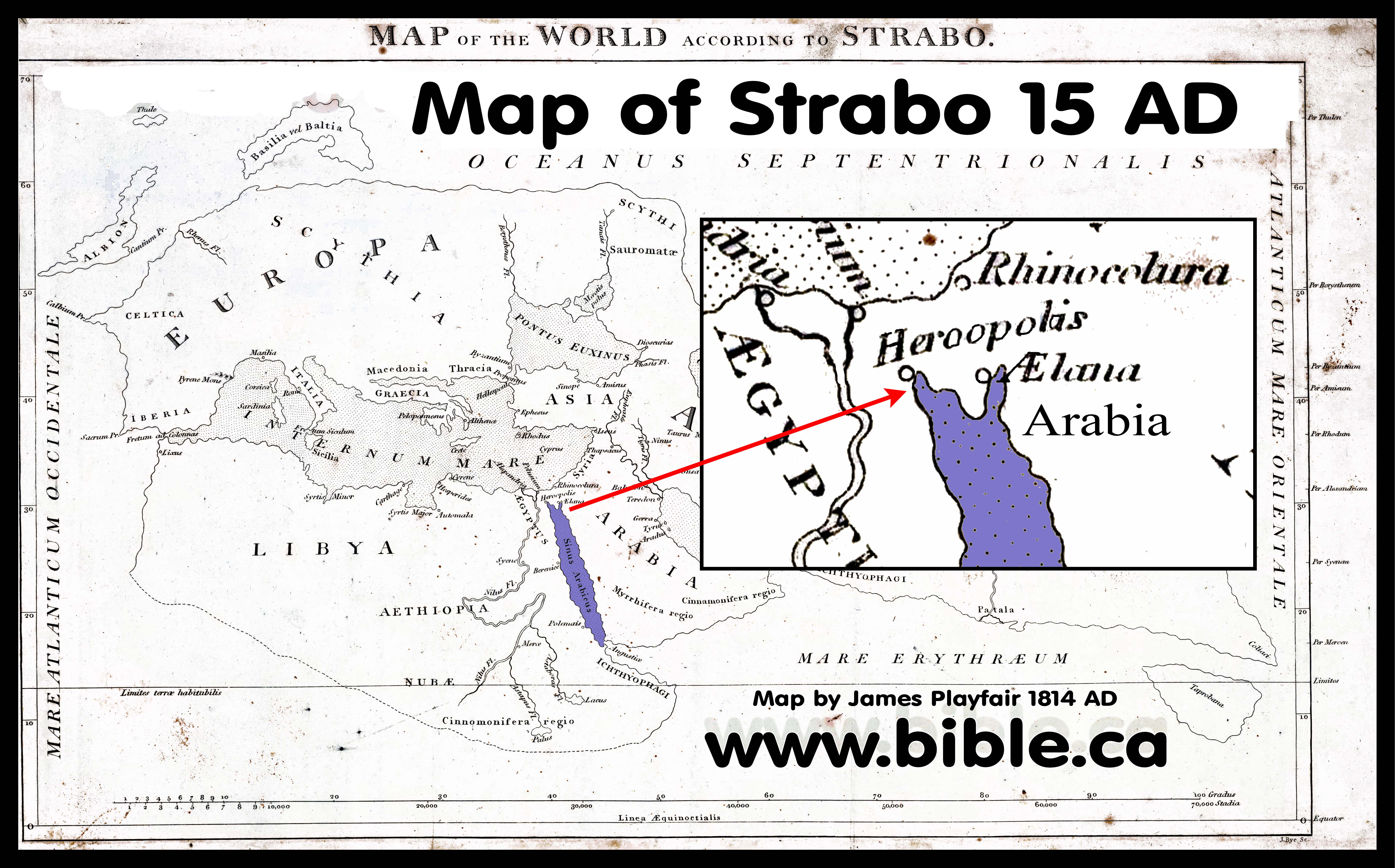
Strabo 15 AD
Introduction:
- Strabo was a Greek geographer who lived from 64 BC to 24 AD. Maps have been constructed from his writings, "Geography" and like all his predecessors, Eratosthenes, Herodotus, Hesiod and Hecataeus, he viewed the Red Sea as a single finger of water.
- There is no evidence in Strabo's "Geography" that he knew about the Gulf of Aqaba. To him there were two boundaries, the Gulf of Suez and the Persian Gulf, in between which was Arabia. So Strabo can hardly be used as proof that Arabia in the time of Paul was viewed as bordering on Goshen. The Holy Spirit never condoned these human geographic errors.
- We could find no evidence that he understood the actual shape, size and position of the Gulfs of Suez and Aqaba or the Sinai Peninsula.
- Strabo does, however, have a good working knowledge of Israel. He is the first geographer to give Israel mention.
- When you read Strabo's "Geography" it is clear that we had before him all the maps and notes of his predecessors. In fact, without Strabo, who quotes Eratosthenes, Hesiod, Herodotus, Hecataeus, we might never have known what they wrote! But is equally clear, that Strabo wrongly assumed that their descriptions were accurate. Strabo repeats the errors of Eratosthenes, Herodotus, Hesiod and Hecataeus by making Goshen the boundary of Egypt and Arabia. This is because he was unaware of the Gulf of Aqaba, so he believed that Arabia extended from Saudi Arabia into the modern Sinai Peninsula as one continuous land mass.
- A typical example of his error is found in Strabo's "Geography" 2:5:32 where he says, "the whole of Arabia Felix (which is bounded by the whole extent of the Arabian Gulf [Gulf of Suez] and by the Persian Gulf), and all the country occupied by the Tent-Dwellers and by the Sheikh-governed tribes (which reaches to the Euphrates and Syria)". Arabia Felix was actually south of the Gulf of Aqaba, but Strabo doesn't know the Gulf of Aqaba exists.
- After Mesopotamia come the countries this side of the Euphrates. These are: the whole of Arabia Felix (which is bounded by the whole extent of the Arabian Gulf and by the Persian Gulf), and all the country occupied by the Tent-Dwellers and by the Sheikh-governed tribes (which reaches to the Euphrates and Syria). Then come the peoples who live on the other side of the Arabian Gulf and as far as the Nile, namely, the Ethiopians and the Arabs, and the Egyptians who live next to them, and the Syrians, and the Cilicians (including the so called "Trachiotae"), and finally the Pamphylians. (Strabo, Geography 2:5:32)
- "Above Judaea and Coelê-Syria [east of Dead Sea] , as far as Babylonia and the river-country of the Euphrates towards the south, lies the whole of Arabia, with the exception of the Scenitae in Mesopotamia. Now I have already spoken of Mesopotamia and the tribes that occupy it; but as for the parts on the far side of the Euphrates, those near its outlets are occupied by Babylonians and the tribe of the Chaldaeans, of whom I have already spoken; and of those parts that follow after Mesopotamia as far as Coelê-Syria [east of Dead Sea] , the part that lies near the river, as well as Mesopotamia, is occupied by Arabian Scenitae, who are divided off into small sovereignties and live in tracts that are barren for want of water. These people till the land either little or none, but they keep herds of all kinds, particularly of camels. Above these people lies an extensive desert; but the parts lying still farther south than their country are held by the people who inhabit Arabia Felix, as it is called. The northern side of Arabia Felix [Near Midian] is formed by the above-mentioned desert, the eastern by the Persian Gulf, the western by the Arabian Gulf, and the southern by the great sea that lies outside both gulfs, which as a whole is called Erythra. [Red Sea] (Strabo, Geography 16:3:1)
- "Now the Persian Gulf is also called the Persian Sea; and Eratosthenes describes it as follows: its mouth, he says, is so narrow that from Harmozi, the promontory of Carmania, one can see the promontory at Macae in Arabia; and from its mouth the coast on the right, being circular, inclines at first, from Carmania, slightly towards the east, and then towards the north, and, after this, towards the west as far as Teredon and the outlet of the Euphrates; and it comprises the coast of the Carmanians and in part that of the Persians and Susians and Babylonians, a distance of about ten thousand stadia. I have already spoken of these peoples.(Strabo, Geography 16:3:2)
- Along the whole of the coast of the Red Sea, down in the deep, grow trees like the laurel and the olive, which at the ebb tides are wholly visible above the water but at the full tides are sometimes wholly covered; and while this is the case, the land that lies above the sea has no trees, and therefore the peculiarity is all the greater. Such are the statements of Eratosthenes concerning the Persian Sea, which, as I was saying, forms the eastern side of Arabia Felix. (Strabo, Geography 16:3:6)
- This is Strabo's account in 15 AD of what Eratosthenes said about Arabia: "But I return to Eratosthenes, who next sets forth his opinions concerning Arabia. He says concerning the northerly, or desert, part of Arabia, which lies between Arabia Felix [Yemen] and Coelê-Syria [east of Dead Sea] and Judaea, extending as far as the recess of the Arabian Gulf, that from the City of Heroes, [Heroönpolis or Goshen] which forms a recess of the Arabian Gulf near the Nile, the distance in the direction of the Petra of the Nabataeans to Babylon is five thousand six hundred stadia [1120 km, actual distance is 1200 km line of sight], the whole of the journey being in the direction of the summer sunrise [north-east] and through the adjacent countries of the Arabian tribes, I mean the Nabataeans and the Chaulotaeans and the Agraeans. ... Such, then, is Eratosthenes' account of Arabia; but I must also add the accounts of the other writers." (Strabo, Geography 16:4:2)
- "Since, in my description of Arabia, I have also included the gulfs which pinch it and make it a peninsula, I mean the Persian and Arabian Gulfs, and at the same time have gone the rounds of certain parts both of Egypt and of Ethiopia, I mean the countries of the Troglodytes and the peoples situated in order thereafter as far as the Cinnamon-bearing country, I must now set forth the remaining parts that are continuous with these tribes, that is, the parts in the neighbourhood of the Nile; and after this I shall traverse Libya, which is the last remaining subject of my whole geography. And here too I must first set forth the declarations of Eratosthenes. (Strabo, Geography 17:1:1)
- Between the Tanitic and Pelusiac mouths lie lakes, and large and continuous marshes which contain many villages. Pelusium itself also has marshes lying all round it, which by some are called Barathra, [pits] and muddy ponds; its settlement lies at a distance of more than twenty stadia from the sea, the wall has a circuit of twenty stadia, and it has its name for the pelos [mud] and the muddy ponds. Here, too, Egypt is difficult to enter, I mean from the eastern regions about Phoenicia and Judaea, and from the Arabia of the Nabataeans, which is next to Egypt; these are the regions which the road to Egypt traverses. The country between the Nile and the Arabian Gulf is Arabia, and at its extremity is situated Pelusium; but the whole of it is desert, and impassable for an army. The isthmus between Pelusium and the recess of the gulf at Heroönpolis [Goshen] is one thousand stadia, but, according to Poseidonius, less than one thousand five hundred; and in addition to its being waterless and sandy, it contains a multitude of reptiles, the sand-burrowers. (Strabo, Geography 17:1:21)
- The first canal, as one proceeds from Pelusium, he says, is the one which fills the Marsh-lakes, as they are called, which are two in number and lie on the left of the great river above Pelusium in Arabia; and he also speaks of other lakes and canals in the same regions outside the Delta. There is also the Sethroïte Nome by the second lake, although he counts this Nome too as one of the ten in the Delta; and two other canals meet in the same lakes. (Strabo, Geography 17:1:24)
- From Heliupolis, then, one comes to the Nile above the Delta. Of this, the parts on right, as one sails up, are called Libya, as also the parts round Alexandria and Lake Mareotis, whereas those on the left Rome called Arabia. Now Heliupolis is in Arabia, but the city Cercesura, which lies near the observatories of Eudoxus, is in Libya; a kind of watch-tower is to be seen in front of Heliupolis, as also in front of Cnidus, with reference to which Eudoxus would note down his observations of certain movements of the heavenly bodies. (Strabo, Geography 17:1:30)
- "It has been stated elsewhere that in the neighborhood of the quarry of the stones from which the pyramids are built, which is in sight of the pyramids, on the far side of the river in Arabia, there is a very rocky mountain which is called "Trojan," and that there are caves at the foot of it, and a village near both these and the river which is called Troy, being an ancient settlement of the captive Trojans who accompanied Menelaüs but stayed there." (Strabo, Geography 17:1:34)
- "Then one comes to Iopê, [Jaffa] where the seaboard from Egypt, though at first stretching towards the east, makes a significant bend towards the north. Here it was, according to certain writers of myths, that Andromeda was exposed to the sea-monster; for the place is situated at a rather high elevation — so high, it is said, that Jerusalem, the metropolis of the Judaeans, is visible from it; and indeed the Judaeans have used this place as a seaport when they have gone down as far as the sea; but the seaports of robbers are obviously only robbers' dens. To these people belonged, not only Carmel, but also the forest; and indeed this place was so well supplied with men that it could muster forty thousand men from the neighbouring village Iamneia and the settlements all round. Thence to Mt. Casius near Pelusium the distance is a little more than one thousand stadia; and, three hundred stadia farther, one comes to Pelusium itself. But in the interval one comes to Gadaris, which the Judaeans appropriated to themselves; and then to Azotus and Ascalon. The distance from Iamneia to Azotus and Ascalon is about two hundred stadia. The country of the Ascalonitae is a good onion-market, though the town is small. Antiochus the philosopher, who was born a little before my time, was a native of this place. Philodemus, the Epicurean, and Meleager and Menippus, the satirist, and Theodorus, the rhetorician of my own time, were natives of Gadaris. Then, near Ascalon, one comes to the harbour of the Gazaeans. The city of the Gazaeans is situated inland at a distance of seven stadia; it became famous at one time, but was razed to the ground by Alexander and remains uninhabited. Thence there is said to be an overland passage of one thousand two hundred and sixty stadia to Aela, a city situated near the head of the Arabian Gulf. This head consists of two recesses: one extending into the region near Arabia and Gaza, which is called Aelanites, after the city situated on it, and there, extending to the region near Egypt in the neighbourhood of the City of Heroes, [goshen] to which the overland passage from Pelusium is shorter; and the overland journeys are made on camels through desert and sandy places; and on these journeys there are also many reptiles to be seen." (Strabo, Geography 16:2:28-30)
- "As for Judaea, its western extremities towards Casius are occupied by the Idumaeans and by the lake. The Idumaeans are Nabataeans, but owing to a sedition they were banished from there, joined the Judaeans, and shared in the same customs with them. The greater part of the region near the sea is occupied by Lake Sirbonis and by the country continuous with the lake as far as Jerusalem; for this city is also near the sea; for, as I have already said, it is visible from the seaport of Iopê [Jaffa]. This region lies towards the north; and it is inhabited in general, as is each place in particular, by mixed stocks of people from Egyptian and Arabian and Phoenician tribes; for such are those who occupy Galilee and Hiericus [Jericho] and Philadelphia and Samaria, which last Herod surnamed Sebastê. [Augusta] But though the inhabitants are mixed up thus, the most prevalent of the accredited reports in regard to the temple at Jerusalem represents the ancestors of the present Judaeans, as they are called, as Egyptians." (Strabo, Geography 16:2:34)
- Strabo and Josephus describe the moat that was north of the Antonia Fortress.
- "At any rate, when now Judaea was under the rule of tyrants, Alexander was first to declare himself king instead of priest; and both Hyrcanus and Aristobulus were sons of his; and when they were at variance about the empire, Pompey went over and overthrew them and rased their fortifications, and in particular took Jerusalem itself by force; for it was a rocky and well-watered fortress; and though well supplied with water inside, its outside territory was wholly without water; and it had a trench cut in rock, sixty feet in depth and two hundred and sixty feet in breadth; and, from the stone that had been hewn out, the wall of the temple was fenced with towers. Pompey seized the city, it is said, after watching for the day of fasting, when the Judaeans were abstaining from all work; he filled up the trench and threw ladders across it; moreover, he gave orders to rase all the walls and, so far as he could, destroyed the haunts of robbers and the treasure-holds of the tyrants. Two of these were situated on the passes leading to Hiericus, I mean Threx and Taurus, and others were Alexandrium and Hyrcanium and Machaerus and Lysias and those in the neighbourhood of Philadelphia and Scythopolis in the neighbourhood of Galilaea." (Strabo, Geography 16:2:40, 15 AD)
- "At this Pompey was very angry, and put Aristobulus into the prison, and came himself to the city, which was strong on every side, excepting the north, which was not so well fortified, for there was a broad and deep ditch, that encompassed the city, and included within it the temple, which was itself encompassed about with a very strong stone wall. (58) Now there was a sedition of the men that were within the city, who did not agree what was to be done in their present circumstances, while some thought it best to deliver up the city to Pompey; but Aristobulus's party exhorted them to shut the gates, because he was kept in prison. Now these prevented the others, and seized upon the temple, and cut off the bridge which reached from it to the city, and prepared themselves to abide a siege; (59) but the others admitted Pompey's army in, and delivered up both the city and the king's palace to him. So Pompey sent his lieutenant Piso with an army, and placed garrisons both in the city and in the palace, to secure them, and fortified the houses that joined to the temple, and all those which were more distant and without it. (60) And in the first place, he offered terms of accommodation to those that were within; but when they would not comply with what was desired, he encompassed all the places thereabout with a wall, wherein Hyrcanus did gladly assist him on all occasions; but Pompey pitched his camp within [the wall], on the north part of the temple, where it was most practicable; (61) but even on that side there were great towers, and a ditch had been dug, and a deep valley begirt it round about, for on the parts towards the city were precipices, and the bridge on which Pompey had gotten in was broken down. However, a bank was raised day by day, with a great deal of labor, while the Romans cut down materials for it from the places round about; (62) and when this bank was sufficiently raised, and the ditch filled up, though but poorly, by reason of its immense depth, he brought his mechanical engines, and battering-rams from Tyre, and placing them on the bank, he battered the temple with the stones that were thrown against it, and had it not been our practice, from the days of our forefathers, to rest on the seventh day, this bank could never have been perfected, by reason of the opposition the Jews would have made; for though our law gives us leave then to defend ourselves against those that begin to fight with us and assault us, yet does it not permit us to meddle with our enemies while they do anything else. (Josephus, Ant 14.57-63)
- Strabo viewed the Red sea as a single finger of water and had no concept of the Gulf of Aqaba or the Sinai peninsula.
- He viewed the Arabia as a peninsula of land between the Red sea (Arabian Gulf) and the Persian gulf: "in my description of Arabia, I have also included the gulfs which pinch it and make it a peninsula, I mean the Persian and Arabian Gulfs" (Strabo, Geography 17:1:1)
- His misunderstandings were echoed right down to 1800 AD.
 ++++++++++++++++++++++++++++++++++++++++++++++++++++++++++++++++++++++++++++
Apion (Josephus against Apion) 45 AD
Introduction:
- Apion was a Egyptian who hated the Jews and invented lies and misrepresentations to belittle the Jewish people.
- We have no writings from Apion, except those sections Josephus quotes and refutes.
- Josephus exposes Apion's fictitious version of the exodus.
- Apion, the satanic liar, is the only one in history we could find before 300 AD, who said that Mt. Sinai was located in the Sinai Peninsula. However Apion clearly considered this region to NOT be part of Arabia.
- Apion hated the Jewish people and all we know of his views are through the eyes of how Josephus refuted him.
- Some use Josephus' dialogue with Apion as proof that Mt. Sinai is located near the traditional location of Mt. Musa in the modern Sinai Peninsula. Note that it was Apion who said this, not Josephus. The entire section called, "Against Apion" is a rebuttal of Apions false teachings about how the Jews got to the promised land and were actually of Egyptian origin.
- Everything Apion says about the exodus is untrue. Every single fact and detail is a fabricated lie.
- Apion taught that Jews were originally Egyptians.
- Apion taught that it took only 6 days for the 120,000 Jews to travel from Egypt to the promised land.
- Apion taught that the Jews had a disease called "buboes" when they left Egypt and that is why they rested on the Sabbath on the seventh day.
- Josephus points out Apion's contradiction in timing: First Apion says they made the exodus in 6 days. Second Apion says they spent 40 days at the foot of Mt. Sinai. Josephus mockingly points out this glaring contradiction in the time chronology.
- In Apion's 6 day exodus, perhaps he meant they traveled for six days, but in the midst, they had a 40 day layover. More than likely, Apion was just carelessly throwing out misinformation to confuse with little regard for consistency.
- But since a central part of Apion's teaching is a 6 day exodus, the mountain would not be Mt. Musa, but somewhere further north along the "way of the Philistines". They simply did not have the time to travel down to Mt. Musa then over to the promised land.
- For Apion to suggest a 6 day exodus, shows us that such would be possible. When liars create a scenario, the basic details must be reasonable, otherwise they will be rejected immediately as false. So we accept Apion's testimony that the trip from Egypt to the promised land can be done in 6 days. It is 330 km from Goshen to Jerusalem. This means Apion believed it reasonable for 120,000 sick Jews to travel 55 km per day.
- Apion actually hurts those who attempt to make Paul's statement of Mt. Sinai being in Arabia. (Gal 4:25) We also noticed that Apion did not believe the traditional location of Mt. Sinai (ie. Mt. Musa or somewhere north) as being in Arabia. Apion said, "a mountain that lay between Egypt and Arabia". Between Egypt and Arabia, not in Arabia.
- So contrary to what Paul taught, Apion said Mt. Sinai was not in Arabia.
- "As for the number of those that were expelled out of Egypt, he [Apion] hath contrived to have the very same number with Lysimaehus, and says they were a hundred and ten thousand. He then assigns a certain wonderful and plausible occasion for the name of Sabbath; for he says that "when the Jews had traveled a six days' journey, they had buboes in their groins; and that on this account it was that they rested on the seventh day, as having got safely to that country which is now called Judea; that then they preserved the language of the Egyptians, and called that day the Sabbath, for that malady of buboes on their groin was named Sabbatosis by the Egyptians." And would not a man now laugh at this fellow's trifling, or rather hate his impudence in writing thus? We must, it seems, take it for granted that all these hundred and ten thousand men must have these buboes. But, for certain, if those men had been blind and lame, and had all sorts of distempers upon them, as Apion says they had, they could not have gone one single day's journey; but if they had been all able to travel over a large desert, and, besides that, to fight and conquer those that opposed them, they had not all of them had buboes on their groins after the sixth day was over; for no such distemper comes naturally and of necessity upon those that travel; but still, when there are many ten thousands in a camp together, they constantly march a settled space [in a day]. Nor is it at all probable that such a thing should happen by chance; this would be prodigiously absurd to be supposed. However, our admirable author Apion hath before told us that "they came to Judea in six days' time;" and again, that "Moses went up to a mountain that lay between Egypt and Arabia, which was called Sinai, and was concealed there forty days, and that when he came down from thence he gave laws to the Jews." But, then, how was it possible for them to tarry forty days in a desert place where there was no water, and at the same time to pass all over the country between that and Judea in the six days? And as for this grammatical translation of the word Sabbath, it either contains an instance of his great impudence or gross ignorance; for the words Sabbo and Sabbath are widely different from one another; for the word Sabbath in the Jewish language denotes rest from all sorts of work; but the word Sabbo, as he affirms, denotes among the Egyptians the malady of a bubo in the groin. 3. This is that novel account which the Egyptian Apion gives us concerning the Jews' departure out of Egypt, and is no better than a contrivance of his own. But why should we wonder at the lies he tells about our forefathers ..." (Josephus, Against Apion 2-3)
- In Apions fabricated Exodus account, he places Mount Sinai in the Sinai Peninsula. However this would not give any help to those who accept the choice of Constantines mother, Queen Helina at Mt. Musa, in 325 AD. Apion's location of Mt. Sinai would be somewhere north of a line due east of the northern tip of the Gulf of Suez.
- Apion rules out Mt. Sinai located at Mt. Musa.
- Apion says that his location of Mt. Sinai, in the Sinai Peninsula, is NOT IN ARABIA.
- Apion says there were only 120,000 Jews in the exodus. The Bible records about 600,000 men over age 20, which would make the total number about 2.5 million Jews. Since Apion is trying to downplay and mock Jewish history, this number is certainly LOWER than the accepted number among Jews at the time. This is very bad news for those who believe the total number of the exodus Jews was between 5000 and 35,000 in number. Click here for a detailed study of the number of Jews in the exodus.
Philo of Alexandria and the Exodus Route: 50 AD (Jewish philosopher)
Introduction:
- Philo was a Jewish philosopher who was born in Alexandria, Egypt. His family was powerful and influential with ties, through his brother Alexander's son by marriage to the daughter of Herod Agrippa.
- Whereas Philo's Greek predecessors, Eratosthenes, Herodotus, Hesiod and Hecataeus, (with the exception of Strabo) ignored Israel, Philo focused on Israel.
- Philo was just one generation ahead of Josephus, who used Philo as a resource. For example, both Philo and Josephus say that Mt. Sinai was "the highest of the mountains" of the region. Philo views Arabia as the land of Midian. He does not repeat the errors of his Greek predecessors by saying Goshen was part of Arabia. He seems to have a working knowledge of both the Gulfs of Suez and Aqaba.
- Philo describes the route to the Red Sea crossing as "a long and desolate journey through the wilderness, destitute of any beaten road, at last arrived at the sea which is called the Red Sea" an "oblique path", "off the main road", a "pathless track" and a "rough and untrodden wilderness". Two passages in the Bible describe this "wilderness before the crossing point": Judges 11:16; Exodus 13:18. Philo describes it in detail.
- This not only rules out the Bitter Lakes and a North Suez crossing point, it also proves Mt. Sinai cannot be in the Sinai Peninsula.
- Philo's description of the Red Sea crossing is puzzling. He describes Moses taking "an oblique path" off the main road and described the route as a "pathless track" and a "rough and untrodden wilderness". He also says that Moses "guessed" it must lead to the Red Sea. This would rule out the Bitter Lakes and the Suez as crossing points, since the Suez was a major shipping port for Egypt and only 120 km from Goshen with major roads leading to it. Since Darius had built a shipping Canal from the Mediterranean to the Suez, which was fed by the Nile near Goshen, there would be no guess work as to how to get to the Suez. They wouldn't need to guess the route since many of them probably were slaves at both seaports and the canal.
- This description therefore, fits the Straits of Tiran crossing almost perfectly. But if Moses took the coastal Plain on the east side of the Suez, there would be little guess work on this route too. He could just follow the coast. So the route in Philo's mind, seems to favour a central path down to the Straits of Tiran rather than taking the coastal plain.
- He then describes the camp where they crossed: "not being able to escape, for behind was the sea, and in front was the enemy, and on each side a vast and pathless wilderness". Philo doesn't comment on why Pharoah felt the "wilderness had shut them in". He seems to describe Israel camped with the sea in front, the army directly behind them and a wilderness on the left and right. We have concluded that Philo was giving a non-technical description because he does not perfectly describe any of the proposed crossing points, including the Bitter Lakes, Suez, Nuweiba, or the Straits of Tiran. The best fit is clearly the Straits of Tiran because of the graphic emphasis on the pathless and rough wilderness that preceded the crossing of the Red Sea. This wilderness before the crossing point is almost always overlooked: Judges 11:16; Exodus 13:18. Philo describes it in detail.
- Both Philo and Josephus, who came after, say that Mt. Sinai is the tallest mountain in the region. The current choice for Mt. Sinai, chosen by Queen Helena in a dream in 325 AD at Mt. Musa, is not the tallest mountain. Another mountain located beside Mt. Musa is taller.
- "Nothing suggests that Philo used 'Arabia' to refer to the Nabatean kingdom." (David Frankfurter, editor, Pilgrimage and Holy Space in Late Antique Egypt, 1988, chapter by Allen Kerkeslager, Jewish Pilgrimage and Jewish Identity in Hellenistic and Early Roman Egypt, p 166)
- "In addition to his use of the terms "Arab" and "Arabia," Philo gives us an even more direct indication of where he believed Mt. Sinai was. He describes the Israelites wandering eastward all the way across the Sinai peninsula to the southern edge of Palestine just before the revelation at Sinai. Philo thus places Mt. Sinai somewhere east of the Sinai peninsula and south of Palestine—in other words, in northwestern Arabia. Philo adds one more detail to our collection of traditions about Mt. Sinai; he says that Moses "went up the highest and most sacred of the mountains in its region." (Mt. Sinai in Arabia?, Allen Kerkeslager, Bible Review, BR 16:02, Apr 2000)
- "Why did he say, "On that day, God made a covenant with Abraham, saying, To thy seed will I give this land, from the river of Egypt to the great river Euphrates?" (Genesis 15:19). The literal expression describes the boundaries of the space which lies in the middle, between the two rivers Egyptus [wadi el-Arish] and Euphrates, for anciently the river was also called by the same name as the district, Egypt, as the poet also testifies when he says- "And in the river Egypt did I fix My double-oared ships."" (Philo, Questions and Answers on Genesis, 3:16)
- But on that day it happened by some chance that certain merchants [Ishmaelites] who were accustomed to convey their merchandise from Arabia to Egypt were travelling that way, and so the eleven brethren drew Joseph up out of the pit and sold him to them" (Philo, On Joseph 15)
- As they urged these arguments to the king he [Moses] retreated to the contiguous country of Arabia [Midian], where it was safe to abide, entreating God that he would deliver his countrymen from inextricable calamities" (Philo On the Life of Moses, I 47)
- "Therefore, turning aside from the direct road he found an oblique path, and thinking that it must extend as far as the Red Sea, he began to march by that road, and, they say, that a most portentous miracle happened at that time, a prodigy of nature, which no one anywhere recollects to have ever happened before; (166) for a cloud, fashioned into the form of a vast pillar, went before the multitude by day, giving forth a light like that of the sun, but by night it displayed a fiery blaze, in order that the Hebrews might not wander on their journey, but might follow the guidance of their leader along the road, without any deviation. Perhaps, indeed, this was one of the ministers of the mighty King, an unseen messenger, a guide of the way enveloped in this cloud, whom it was not lawful for men to behold with the eyes of the body. XXX. (167) But when the king of Egypt saw them proceeding along a pathless track, as he fancied, and marching through a rough and untrodden wilderness, he was delighted with the blunder they were making respecting their line of march, thinking that now they were hemmed in, having no way of escape whatever. And, as he repented of having let them go, he determined to pursue them, thinking that he should either subdue the multitude by fear, and so reduce them a second time to slavery, or else that if they resisted he should slay them all from the children upwards. (168) Accordingly, he took all his force of cavalry, and his darters, and his slingers, and his equestrian archers, and all the rest of his light-armed troops, and he gave his commanders six hundred of the finest of his scythe-bearing chariots, that with all becoming dignity and display they might pursue these men, and join in the expedition and so suing all possible speed, he sallied forth after them and hastened and pressed on the march, wishing to come upon them suddenly before they had any expectation of him. For an unexpected evil is at all times more grievous than one which has been looked for, in proportion as that which has been despised finds it easier to make a formidable attack than that which has been regarded with care. (169) The king, therefore, with these ideas, pursued after the Hebrews, thinking that he should subdue them by the mere shout of battle. And, when he overtook them, they were already encamped along the shore of the Red Sea. And they were just about to go to breakfast, when, at first, a mighty sound reached them, as was natural from such a host of men and beasts of burden all proceeding on with great haste, so that they all ran out of their tents to look round, and stood on tip-toes to see and hear what was the matter. Then, a short time afterwards, the army of the enemy came in sight as it rose over a hill, all in arms, and ready arranged in line of battle. XXXI. (170) And the Hebrews, being terrified at this extraordinary and unexpected danger, and not being well prepared for defence, because of a scarcity of defensive armour and of weapons (for they had not marched out for war, but to found a colony), and not being able to escape, for behind was the sea, and in front was the enemy, and on each side a vast and pathless wilderness, reviled against Moses, and, being dismayed at the magnitude of the evils that threatened them, began, as is very common in such calamities, to blame their governors, and said: (171) "Because there were no graves in Egypt in which we could be buried after we were dead, have you brought us out hither to kill and bury us here? (Philo, On the Life of Moses, 1:165-171)
- "Now the beginning of his divine inspiration, which was also the commencement of prosperity to his nation, arose when he was sent out of Egypt to dwell as a settler in the cities of Syria, with many thousands of his countrymen; for both men and women, having accomplished together a long and desolate journey through the wilderness, destitute of any beaten road, at last arrived at the sea which is called the Red Sea. Then, as was natural, they were in great perplexity, neither being able to cross over by reason of their want of vessels, nor thinking it safe to return back by the way by which they had come. And while they were all in this state of mind, a still greater evil was impending over them; for the king of the Egyptians, having collected a power which was far from contemptible, a vast army of cavalry and infantry, sallied forth in pursuit of them, and made haste to overtake them, that he might avenge himself on them for the departure which he had been compelled by undeniable communications from God to permit them to take." (Philo, On the Life of Moses, 2:246-248)
- "For, having gone up into the highest and most sacred mountain in that district in accordance with the divine commands, a mountain which was very difficult of access and very hard to ascend, he is said to have remained there all that time without eating any of that food even which is necessary for life; and, as I said before, he descended again forty days afterwards, being much more beautiful in his face than when he went up, so that those who saw him wondered and were amazed, and could no longer endure to look upon him with their eyes, inasmuch as his countenance shone like the light of the sun." (Philo, On The Life Of Moses, 2:70)
- Philo refutes a Red Sea crossing at both the Bitter Lakes and the North tip of the Gulf of Suez.
- This in turn refutes the traditional location of Mt. Sinai chosen in a dream by Constantine's mother in the middle of the Sinai Peninsula.
- Philo's use of the terms Arab and Arabia, were restricted to the land east of the Gulf of Aqaba where Jethro and the Ishmaelite lived, and he never says the Sinai Peninsula is Arabia.
Ptolemy 150 AD
Introduction:
- Claudius Ptolemy (Klaudios Ptolemaios) 90-168 AD.
- A Greek who lived in the Roman Capital of Egypt, (Alexandria), and headed the library at Alexandria from 127 to 150 A.D.
- In spite of the more accurate mapping of both Philo and Josephus 100 years earlier, Ptolemy carries on the long tradition of Greek geographers (Strabo, Eratosthenes, Herodotus, Hesiod and Hecataeus) who incorrectly understood the Red Sea as a single finger of water.
- As we can see, this error carried into the 16th century. Here are are four maps drawn in the16th century based upon representations of Ptolemy's writings of 150AD.
- This explains why people might confuse Arabia as bordering on Goshen. The geography of the day did not see the Sinai Peninsula between the Gulfs of Aqaba and Suez.
- Joannes Schott 1503 AD, read Ptolemy and drew this map from his writings:
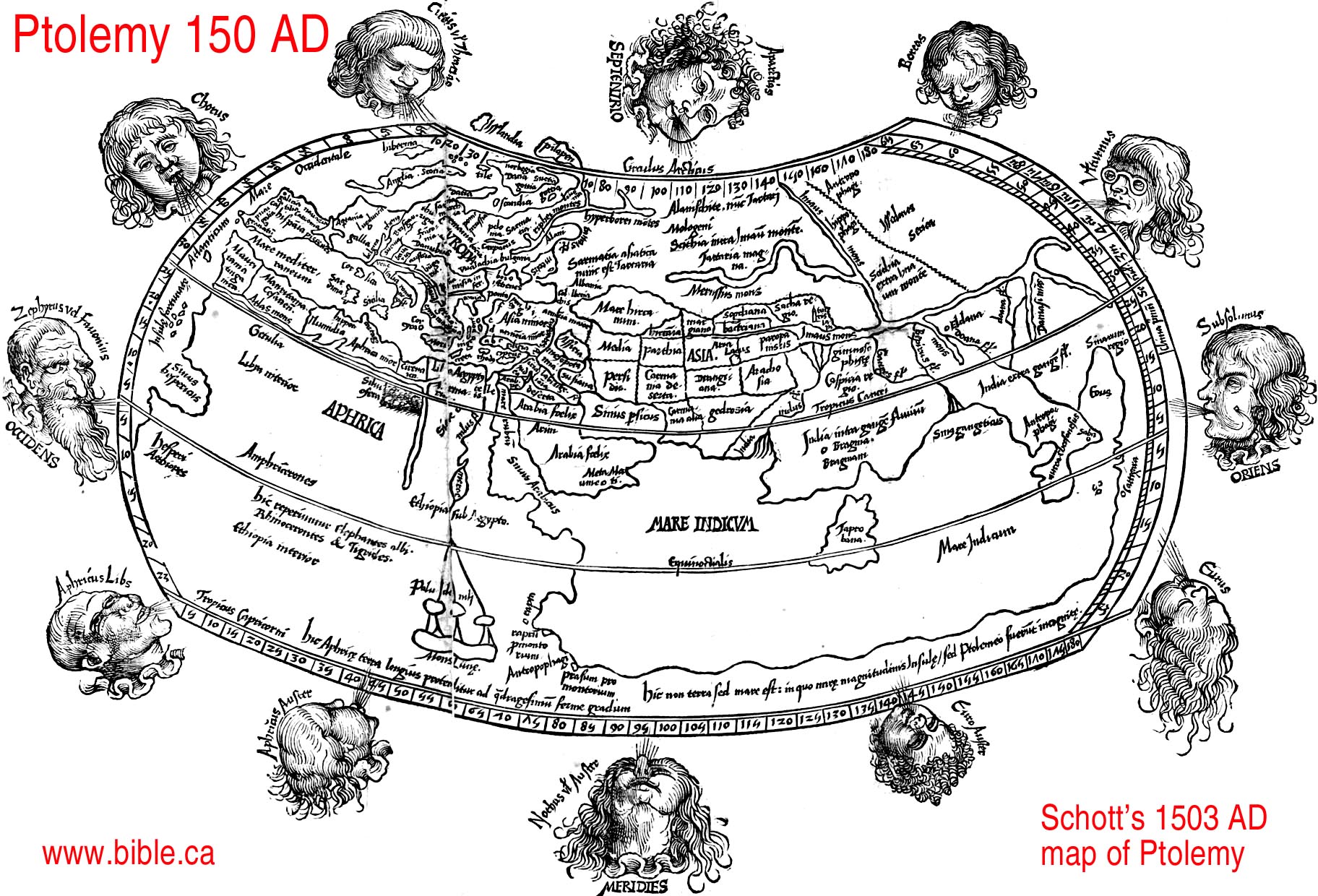
- Joannes Ruysch 1508 AD, read Ptolemy and drew this map from his writings:
- J.Pentius De Leucho 1511 AD, read Ptolemy and drew this map from his writings:
- P Heinricum Petrum 1545 AD, read Ptolemy and drew this map from his writings:
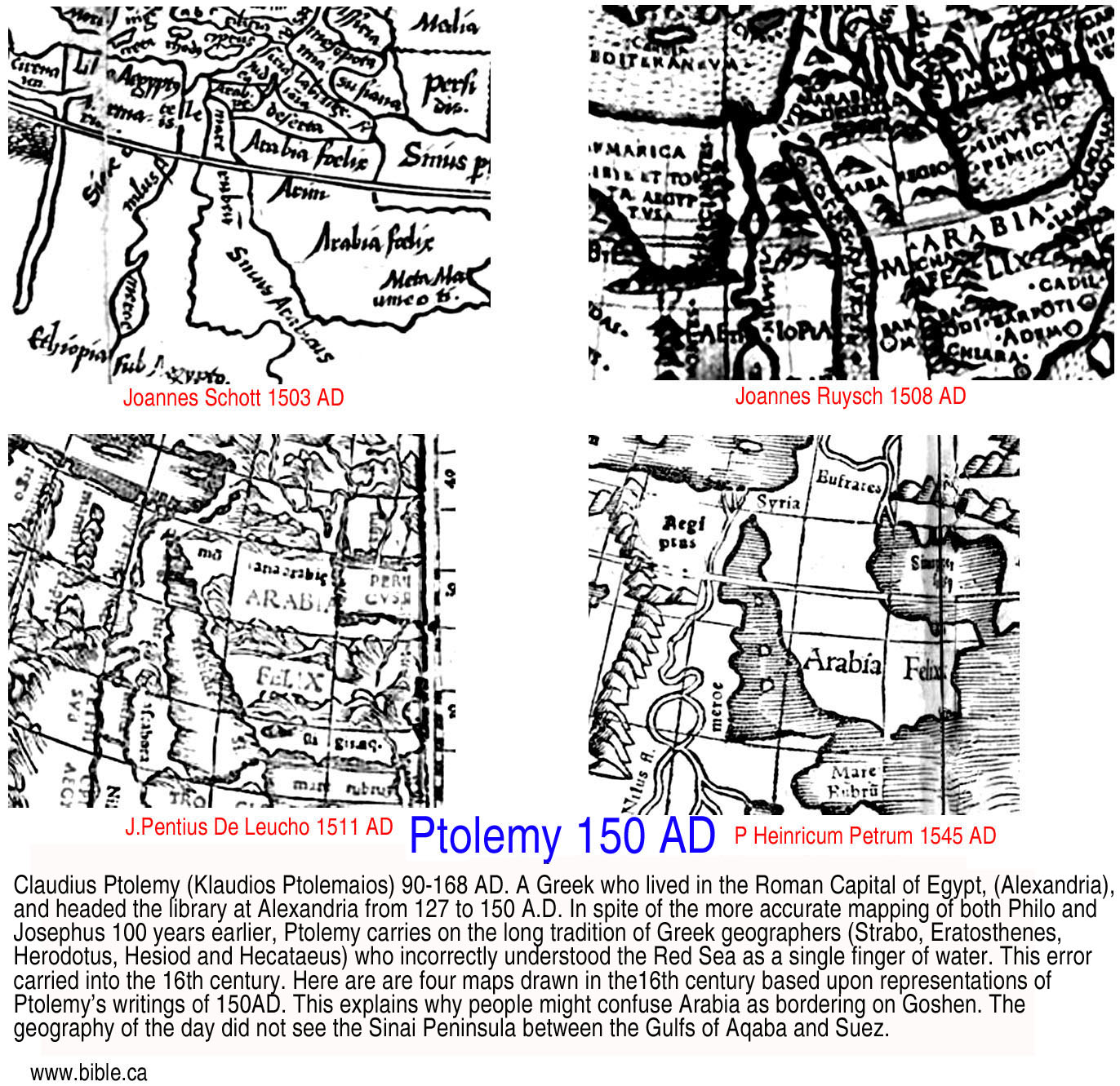
Conclusion:
- Ptolemy had no concept of the Sinai Peninsula or the Gulf of Suez.
- This error would persist until 1800 AD.
Justin Martyr 165 AD
- Justin said that that Moses saw the burning bush in Arabia.
- "Moses was ordered to go down into Egypt and lead out the people of the Israelites who were there, and while he was tending the flocks of his maternal uncle in the land of Arabia, our Christ conversed with him under the appearance of fire from a bush" (Justin Martyr, First Apology, Ch 62, Its Imitation by Demons)
- The Romans annexed Petra and called it Arabia. Therefore Justin's statement is no more help than Paul's in Gal 4:25, that Mt. Sinai is in Arabia.
Introduction:
- Ein El-Qudeirat means "Fountain of Omnipotence" or "Fountain of God s Power"
- If you want to take the easy short cut and skip all the reasons from the Bible, history and archeology why Qudeirat cannot be Kadesh, Click here to learn the true location of Kadesh Barnea now.
- For an detailed summary of the search for Kadesh Barnea see also: Chronological History of "The search for Kadesh"
- John Rowlands goes down in history as the man who plunged the search for Kadesh Barnea in to the "Dark Ages" (1881 AD - present). But Ein Qedeis would be just another desert spring without Henry Clay Trumbull who is responsible for literally deceiving the entire world into believing it was Kadesh Barnea. The "one-two punch" of Rowland-Trumbull moved the worlds attention for the location of Kadesh from the Transjordan Arabah to where it has been presently located on all Bible maps since 1916 AD. Although in 1842 AD John Rowlands was the very first man in history to suggest Ein Qedeis was Kadesh Barnea, it became the majority opinion choice for Kadesh Barnea from 1881 - 1916 AD. Before 1881, everyone was looking for it in the Arabah Valley area or near Petra as Joseph said it was. After 1916, Qudeirat became the choice and is still to this very day. We however reject both Qedeis and Qudeirat as Kadesh Barnea and believe it is located at or near Petra. This "similarity of name" argument became the most important "proof" that Kadesh Barnea had been found at Ein Qedeis until Ein el-Qudeirat dethroned Ein Qeudeis in 1916 AD. Scholars like Keil & Delitzsch in 1867 AD, William Smith's Bible Dictionary in 1884 AD and the New Advent Catholic encyclopedia, Cades, 1917 AD all focused upon the similarity of name. But all this was thrown aside and forgotten when a larger spring was found 6 km north at Qudeirat. Ein El-Qudeirat means "Fountain of Omnipotence" or "Fountain of God s Power". This has nothing to do with any connection with God bringing water from the rock with Moses, but the fact that Qudeirat is the largest spring in the entire Sinai Peninsula for a 100 km radius! Not surprising that they would call it "God's powerful spring."
- God said in Ex 13:17-18 that He would lead them out of Egypt away from the very area that Qudeirat is located near. Why go to all the trouble of avoiding an area of the Philistines for 2 years at Mt. Sinai, only to have them camp on the Philistines doorstep for 38 years?
- Although discovered years earlier, Ein El-Qudeirat was first
identified as Kadesh Barnea in 1916 AD. It has been the worlds
unfortunate choice for Kadesh ever since even to the present time.
Virtually all Bible maps incorrectly place Kadesh at Qudeirat.
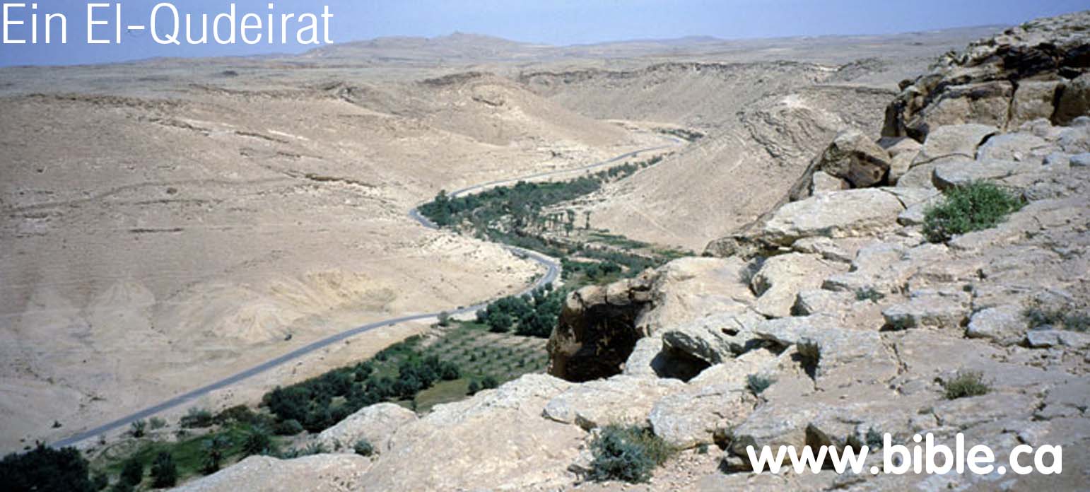
- "L. Woolley and T.E. Lawrence described the site and its eight-towered fortress and suggested that it be identified with biblical Kadesh-Barnea (The Wilderness of Zin, PEFA 3 [1914-19151, pp. 52-57, 69-71). The site was surveyed in 1934 by N. Glueck, in 1937 by R. de Vaux, and in 1956 by Y. Aharoni. In 1956, M. Dothan carried out excavations in the fortress of Kadesh-Barnea (1EJ 15 [19651, pp. 134-151)." (Kadesh-Barnea, 1976, Rudolph Cohen, Israel Exploration Journal, 1976 AD, p 201)
- Woolley and Lawrence (1914-15) suggested associating the relatively well-watered area of Tell el-Qudeirat in north-eastern Sinai with Biblical Kadesh Barnea, the main place of sojournment of the ancient Israelites in the desert following the Exodus from Egypt. Though many scholars have accepted the above suggestion, there is so far no independent evidence to confirm this viewpoint. (The Bible and Radiocarbon Dating, Thomas E. Levy, Higham, Bruins, Plicht, 2005, p352)
- Qudeirat was the largest spring in the entire modern Sinai
Peninsula: Dothan writes: "The tell is located near `Ein el Qudeirat, in
Wadi el Ein, the richest spring in Sinai, which has a flow of about 40
cu. m per hour. This spring, which today is channeled into an irrigation
network, and extends over some 2 km (Pl. 25, A), forms the largest
oasis of northern Sinai. (The Fortress at Kadesh-Barnea, M Dothan, 1965)
Gunneweg also says the same: "The Iron Age II fortress of Qadesh Barnea (nowadays called Tell 'Ein el-Qudeirat) is located in Wadi el 'Ein, a well ('Ein) which has fed the largest oasis of the southern Negev as well as northern Sinai from early times until the present (Dothan 1965, 134; Woolley and Lawrence 1914. 69-71; Cohen 1983, 93-4)". (Edomite, Negev, Midianite Pottery: Neutron Activation Analysis, Gunneweg, 1991 AD)
"In fact, Ein-Qedeis is a shallow pool of water surrounded by a desert wasteland. Ein-Qedeis could not have been a major ancient center like Kadesh-Barnea. ... Its strategic location on two important ancient routes, its abundance of water and its correspondence with Biblical geography makes this the most likely candidate; no other site offers a convincing alternative. ... The springs of Ein el-Qudeirat are the richest and most abundant in the Sinai; they water the largest oasis in northern Sinai. (Did I Excavate Kadesh-Barnea? absence of Exodus remains poses problem, Rudolph Cohen, 1981 AD) - "Has the site been correctly identified? If so, why have we found no
remains from the Exodus period? ... Thus far our excavations have
yielded nothing earlier than the tenth century B.C.—the time of King
Solomon. (Did I Excavate Kadesh-Barnea? absence of Exodus remains poses problem, Rudolph Cohen, 1981 AD)
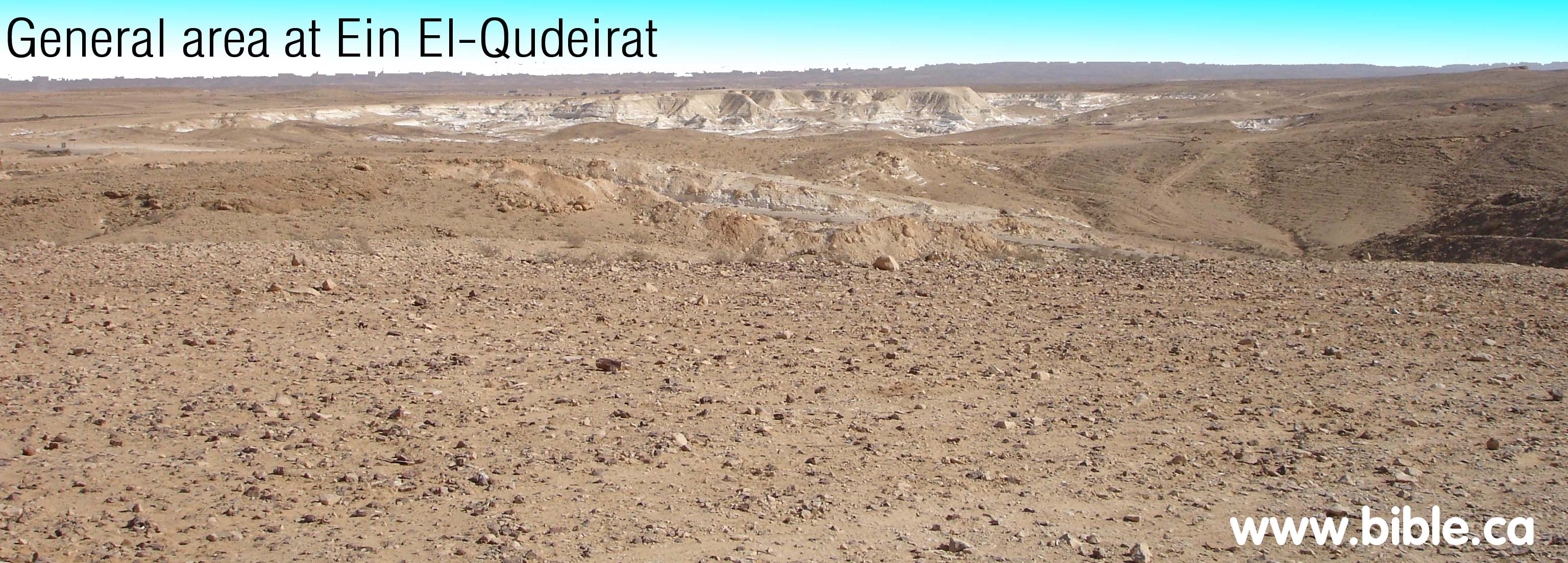
- Ein El-Qudeirat is located in Wadi el Ein, a narrow dry valley that is a few kilometers long.
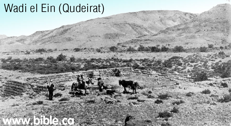
- Four ostracons were found at Qudeirat. This one was found in the
youngest (highest) level about 700 BC. It is a conversion chart between
Hebrew and Egyptian numbering systems.

- Ein El-Qudeirat cannot be Kadesh Barnea because it directly contradicts the Bible. Qudeirat is located 27 km inside the promised land. The wadi Al-Arish, or River of Egypt, was the formal stated boundary between Egypt and Israel (Gen 15:18). It is also the western boundary of the land of Judah. (Num 34:5; Josh 15:4,47; 13:5; 1 Ki 8:65) It is absurd to suggest that the children of Israel spent 38 years "wandering in the wilderness" well inside the promised land. This reason alone is all that is needed for anyone who believes the Bible to reject Ein El-Qudeirat as Kadesh Barnea. It is important to remember that the modern border of Israel since 1948 AD is at least 35 km east of where the border was in 1406 BC. Many people miss the fact that Qudeirat is actually located in the promised land because they are looking at modern maps.
- Ezion-Geber is
a major Achilles heel to Ein El-Qudeirat being Kadesh Barnea. The
exodus route from Mt. Sinai to Kadesh went directly through Ezion-Geber.
While we may not be sure of where Kadesh was located, we can be
absolutely certain about the location of Ezion-Geber. It was located
near modern Elat, on the north shore of the Gulf of Aqaba. Almost every
exodus route map in the back of every Bible today has the route
correctly passing through Ezion-Geber, but for those who are familiar
with the geography of the area, they know that there is an enormous
mountain range between the Sinai desert and Ezion-Geber. If Mt. Musa is
Mt Sinai (the traditional location for Mt. Sinai at St. Catherine's
Monastery, since 325 AD) and Ein El-Qudeirat is Kadesh, this means that
Israel had to twice cross this huge mountain range: Once to get from the
flatlands of the Sinai desert to the Red Sea. Then cross the mountains a
second time (basically back tracking) onto the Sinai flatlands north to
Qudeirat. Such a trip is even more absurd in light of the fact that
Ezion-Geber is only one stop away from Kadesh Barnea (Num 33:36) and
located inside Edomite territory. (1 Ki 9:26; 2 Chron 8:17)
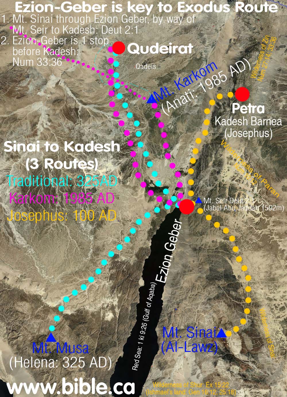
- Josephus, (50-110 AD) and Eusebius
(325 AD) says Mt. Hor (Aaron's burial place) was located at or near
Petra. Josephus' opinion would represent the basic views of the Jewish
world at the time of Christ. He is the oldest reliable historian who
actually tells us where Mt. Hor is located. Eusebius goes even further
and says that Kadesh Barnea is located at Petra. Eusebius represents the
views of the time of queen Helena, who chose the site for Mt. Sinai at
St. Catherine's Monastery in a vision. (Of course she was wrong about
Mt. Sinai.) What is also striking is that although Petra would have
certainly been marked on the Madaba map in
a section defaced by the Muslims in 700 AD, Ein Qudeirat is missing
from a section of the map that remains. In other word, If Kadesh was
located at Qudeirat, it would have been in the section we can see today
that the Muslims did not destroy. Qudeirat should be located close to
the large red text, "lot of Simeon".
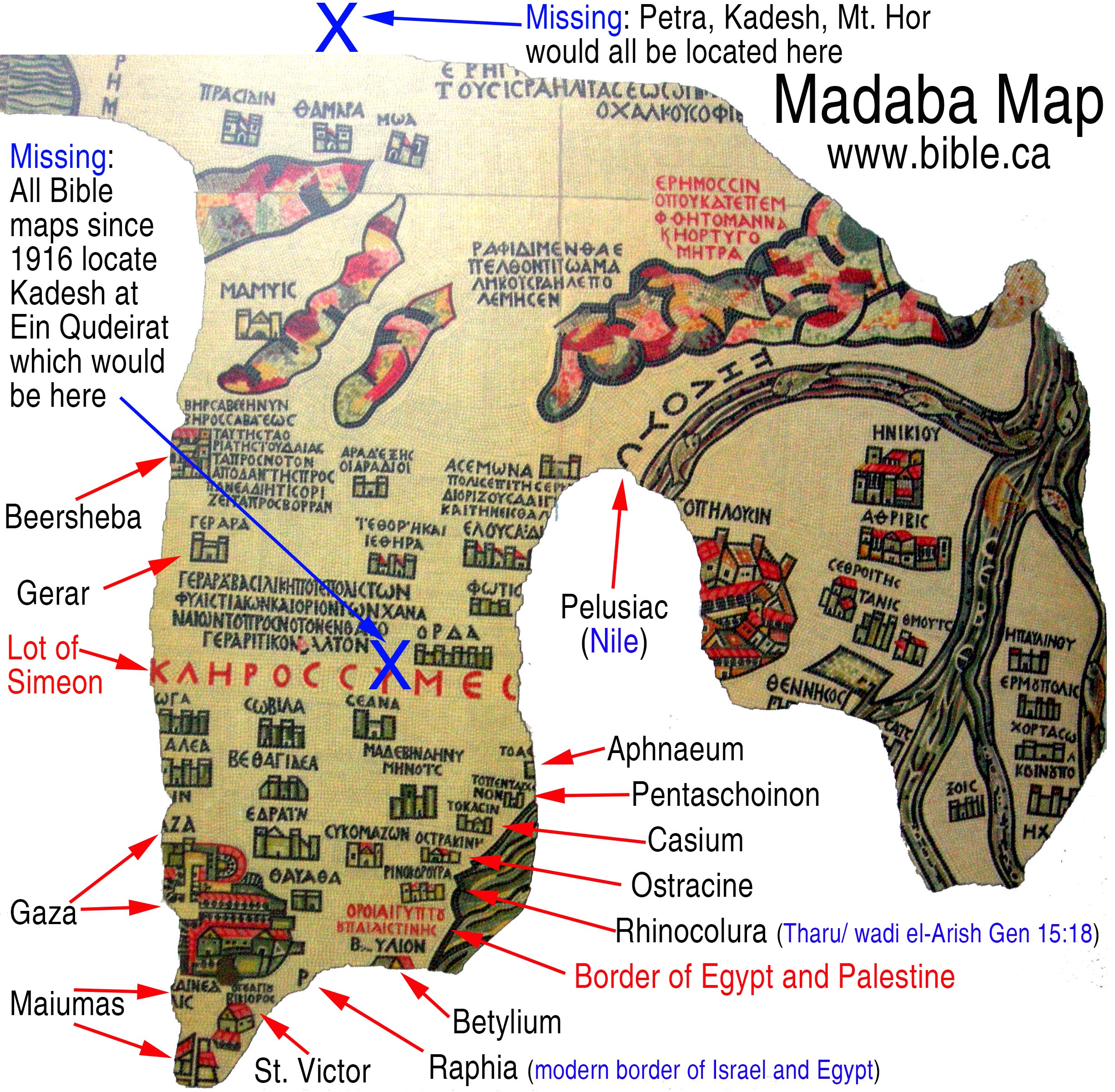
- Kadesh Barnea, if located at Qudeirat, as most today wrongly believe, should be located on the map in a section that is not damaged. It is not located there. No where on the
- Qudeirat is the largest oasis in the Sinai Peninsula. Add the nearby oasis' at Quseima , Muweilih and Qedeis to Qudeirat and it simply does not fit the general description of Kadesh being a place where Israel bitterly complained about having no water. This is the place where Moses had to strike the rock to bring water for Israel. More details on Moses striking the rock at Kadesh.
- If it wasn't for the deceptions of Henry Clay Trumbull in 1884 AD, everyone would have continued to look for Kadesh transjordan, at or near Petra or in the Arabah valley. Trumbull's lies about the "New England look" of Qedeis, tricked the world into thinking it was Kadesh. 15 years later, when the next person arrived at Qedeis, it was rejected as Kadesh and Ein El-Qudeirat became the new location for Kadesh. Qudeirat is only 6 km north of Qedeis.
- Archeologists have found nothing in the entire Quseima area which includes Qedeis and Qudeirat, that is older than the time of Solomon (950 BC). Archeologically, we do find a series of military border fortresses built by Solomon at each of these locations, but this is 450 years too late to be connected with the exodus of 1446 BC.
- Ein El-Qudeirat is located at the most important and central crossroads of the Sinai. There are four different crossroads that all converge in the Quseima area: Darb Esh-Sherif, Darb El Ghazza, Darb Ez Aaul, Darb El Arish. Since God was molding the culture and religion of the Hebrews during their 40 years in the wilderness, it makes no sense for God to have Israel spend 38 years in one of the most multi-cultural places in the middle east. God tucked Israel off in an isolated corner so he could cultivate his nation to worship him. Attempting to do this at the ancient equivalent of "Time Square" is significantly unlikely.
- 2.5 million people died at Kadesh. There are no mass grave sites located anywhere near Ein El-Qudeirat.
- Ein El-Qudeirat is located at least 100 km away from the land of Edom. Kadesh Barnea was located near the border of Edom. While many modern maps show the territory of Edom beside the Quseima area, this is not supported by archeology, but circular logic. They reason that Edom's border was located beside Kadesh, and since they falsely assume Kadesh is located at Ein El-Qudeirat, they just "pencil in" the land of Edom, nearby and randomly chose a new location for Mt. Seir and Mt. Hor where Aaron was buried! The problem is that both archeology and the Bible agree that Edom's territory was transjordan until after the Babylonian captivity of 586 BC.
- It makes absolute non-sense of the story of asking Edom for permission to cross their territory to enter the promised land. They would just head straight north for Beersheba and not go the extreme long route across the Negev to the Arabah, then south to Ezion Geber, the east then north to Mt. Nebo where Moses died. Of course the Edomite did not even begin to inhabit any part of Judah until after 700 BC.
|
Chronological History of the search for Kadesh 2000 BC - 2009 AD |
 |
| The four springs of the Quseima area: | |||
|
Map of the Quseima area showing the location of Ein Muweileh.
|
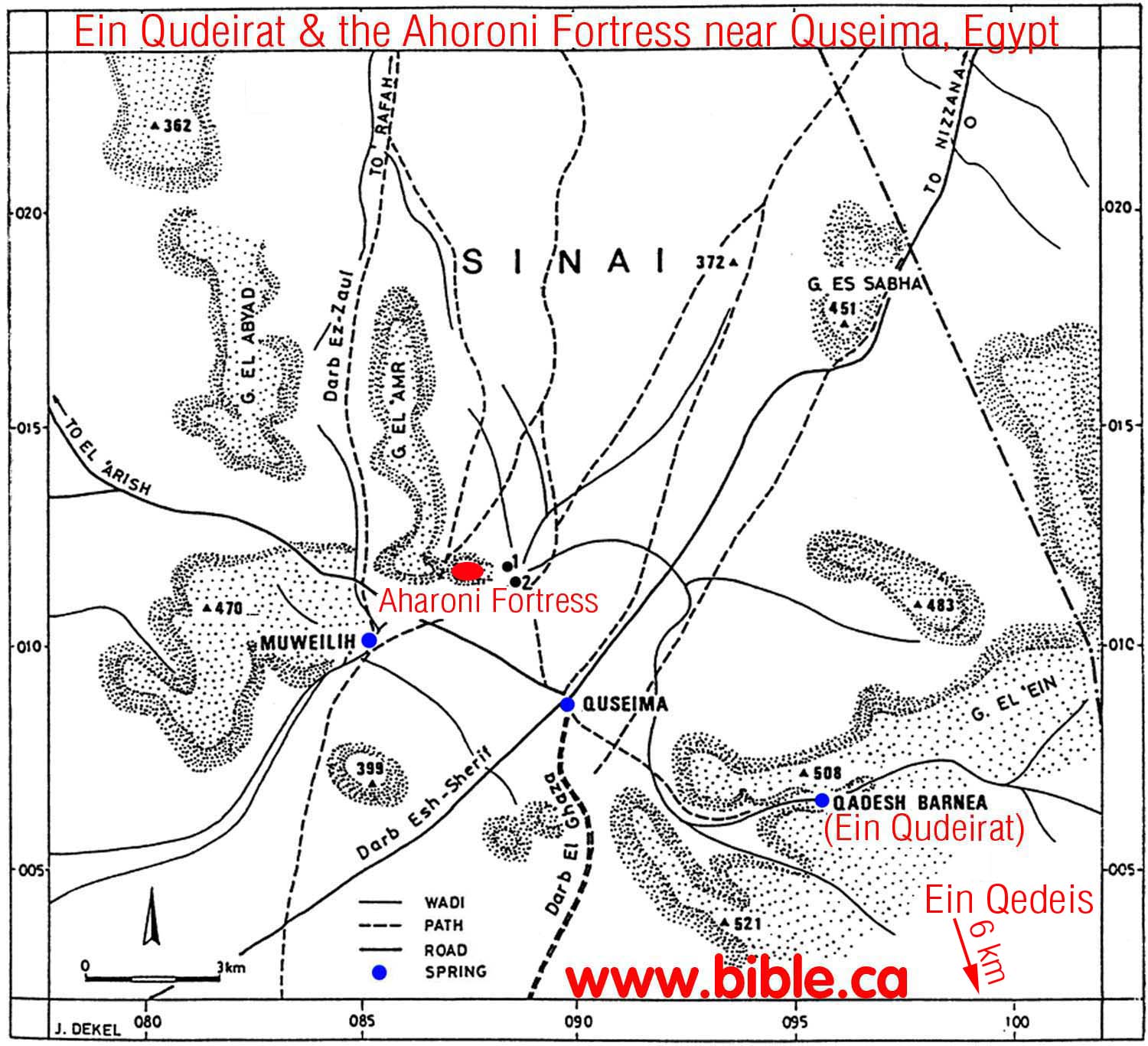 |
||
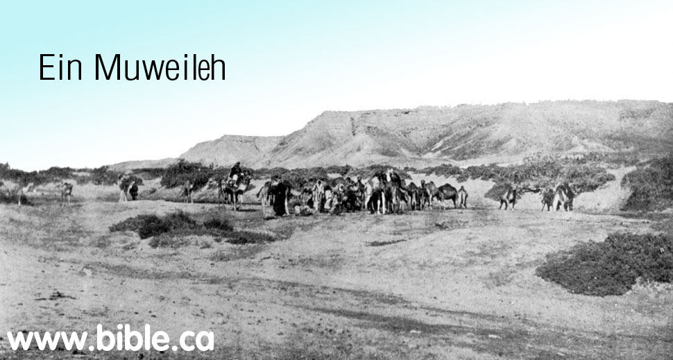
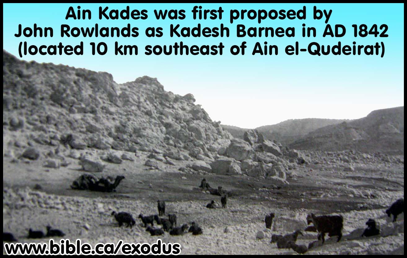
- The largest oasis area in the modern Sinai will produce many major roads from all directions. Quseima was the "Time Square" or "Grand Central Station" of the Sinai.
- Quseima is the center of a four major ancient crossroads (Darb Esh-Sherif, Darb El Ghazza, Darb Ez Aaul, Darb El Arish)
- Not only was Qudeirat the largest single oasis in the Sinai, it was one of four springs in close proximity to each other. The four springs of the Quseima district are listed here from largest to smallest: Qudeirat, Qedeis, Quseima and Ein Muweileh.
- Solomon built three border fortresses in close proximity to four of the springs: Forts were located at Quseima (which had two springs nearby) and Qudeirat and Qedeis. From a strategic point of view, the Quseima fortress was the most important because it was the most westerly and therefore closest to the Egyptian border and it overlooked the crossroads. The border between Egypt and Israel as stated in the Bible, is the wadi el-Arish.
- Meshel comments on the fortress at Quseima: "The summit, 390 m above sea level, rises some 140 m above the surrounding plain, permitting excellent observation in three directions. Among the more prominent points visible from the summit are the tip of the Qadesh Barnea oasis and the little oasis of Quseima, as well as Ein Muweilih. If there is any connection between the fortress and the routes formerly running through the plain, the fortress was clearly an excellent lookout point." ("Aharoni Fortress" near Quseima, Zeev Meshel, 1994 AD)
- Dothan comments on the network of roads that all converge in the Quseima area: "Nearby, there is an ancient crossroad: one road runs from Suez to Beersheba and Hebron, via Bir Hasana, Quseima and Nissanah (evidently Derekh Shur -or, ii-r); the other is a branch of the via maris originating from el-`Arish or Rafiah and continuing through Quseima and Kuntilla down to the Gulf of 'Aqaba. At the oasis and in the neighbouring region there are scattered remains of many temporary and permanent settlements, dating from the Palaeolithic, the Middle Bronze I and the Israelite, the Persian and the Roman-Byzantine periods. The large permanent settlement situated near the spring is Tell el-Qudeirat, which lies on the main road leading through the oasis." (The Fortress at Kadesh-Barnea, M Dothan, 1965)
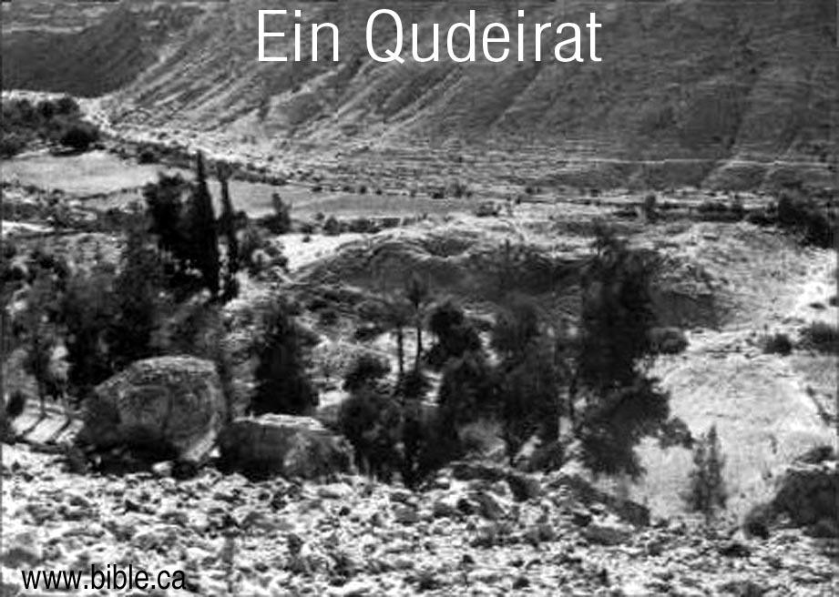 |
1916 -2004 AD: Ein el Qudeirat Ein el-Qudeirat |
- NOTE: For a complete summary of the search for Kadesh Barnea see: Chronological History of "The search for Kadesh". The section below only deals with Qudeirat, the period of 1916 AD - present.
- In 1882, after Henry Clay Trumbull's one hour visit to Qedeis and choosing it as Kadesh Barnea, he traveled 6 km north to visit Ein El-Qudeirat. Like his deceptive account of the greenery at Qedeis, his account at Ein El-Qudeirat were also full of lies. He talked about dense vegetation and a 60 foot wide river and a 14 foot waterfall at Ein El-Qudeirat. Today, most of the vegetation is the result of modern irrigation techniques and it still isn't as "lush" as Trumbull described it. AYN EL-QADAYRAT DISCOVERED: The signs of fertility in this spur were far greater than in the main wady. Grass and shrubs and trees were in luxuriance, and the luxuriance increased at every step as we pushed on. One tree, called by our Arabs a " seyal " (or acacia), but not showing thorns like the acacias of the lower desert, exceeded in size any tree of the sort we had ever seen. Its trunk was double ; one stock being some six feet in girth ; the other, four feet and a-half. The entire sweep of the branches was a circumference of nearly two hundred and fifty feet, according to our pacing of it. "With such trees as that in the desert, it were easy enough to get the seyal, or shittim. wood, of suitable size for the boards and bars of the tabernacle. Still the luxuriance of vegetation increased. Then, as we proceeded, came the sound of flowing, and of foiling water. A water channel of fifteen to twenty yards in width, its stream bordered with reeds or flags, showed itself at our feet between the hills. We moved eastward along its southern border. Above the gurgling sound of the running stream, there grew more distinct the rush of a torrent-fall. As we pressed toward its source, the banks of the stream narrowed and rose, and we clambered them, and found our way through dense shrubbery until we reached the bank of the fountain-basin. There we looked down into a pool some twelve to fourteen feet below us; into which a copious stream rushed from out the hillside at the east, with a fall of seven or eight feet. The hillside from which this stream poured was verdure-covered, and the stream seemed to start out from it, at five or six feet below our level. The dense vegetation prevented our seeing whether the stream sprang directly out of an opening in the hillside, or came down along a concealed channel from springs yet farther eastward; but the appearance was of the former. Waving flags, four or five feet high, bordered this pool, as they bordered the channel below it. Our dragoman enthusiastically compared the fountain to that of Banias, away northward, at the source of the Jordan. It was certainly a wonderful fountain for the desert s border. Its name Ayn el-Qadayrat the " Fountain of Omnipotence," or " Fountain of God s Power," was not inappropriate, in view of its impressiveness, bursting forth there so unexpectedly, as at the word of Him who " turneth the wilderness into a standing water, and dry ground into water springs." No wonder that this fountain was a landmark in the boundary line of the possession, which had been promised of God to his people, as " a land of brooks of water, of fountains and depths that spring out of valleys and hills." Viewed merely as a desert-fountain, Ayn el-Qadayrat was even more remarkable than Ayn Qadees ; although the hill-encircled wady watered by the latter, was far more extensive than Wady Ayn el-Qadayrat; and was suited to be a place of protected and permanent encampment, as the latter could not be. Perhaps it ought to be mentioned, that the "date-palms " which Scetzen spoke of as watered by this fountain, were not seen by us. Yet they may have been elsewhere; or indeed, they may have existed in his day, although not now remaining. There was a peculiar satisfaction in looking at this remarkable fountain, when at last we had reached it. No visit to it had been recorded by any traveler in modern times. Seetzcul and Robinson, and Rowlands, and Bonar and Palmer, and others, had been told of it, and had reported it accordingly; but no one of them claimed to have seen it. In view of all that these travelers had said, and after his own careful search for it, up and down the wady, Bartlett, (as has already been mentioned) had come to the conclusion that no such fountain existed that, in fact, Wady el-Ayn, the Wady of the Well, was a wady without a well. To put our eyes on it, therefore, the very day of our seeing Ayn Qadees, was enough to drive out of mind all thought of our dangers and worry on the way to it. We congratulated one another all around; and Muhammad Ahmad was promised anew that he should go into that book" Silk Bazar," and all." (Kadesh-Barnea Henry Clay Trumbull, 1884 AD)
- In 1905 Nathaniel Schmidt visited Qudeirat and rejected it as Kadesh and chose Petra instead. In 1981 AD, Rudolph Cohen misrepresented Nathaniel Schmidt as the first one to identify that Ein el-Qudeirat was Kadesh. In fact Schmidt considered Weibeh, Kades and Qudeirat, rejected them all and concluded that Kadesh was at Petra: "It seems to me even more probable that Petra was the original scene of these stories." (Kadesh Barnea, Nathan Schmidt, Journal of Biblical Literature, Vol 29, no 1, 1910 AD, p75-76) Cohen says: "In 1905, Nathaniel Schmidt first identified Kadesh-Barnea as the modern site of Ein el-Qudeirat. Schmidt marshalled his arguments: "The sheltered position, the broad stream of water... Its strategic location on two important ancient routes, its abundance of water and its correspondence with Biblical geography makes this the most likely candidate; no other site offers a convincing alternative. ... The springs of Ein el-Qudeirat are the richest and most abundant in the Sinai; they water the largest oasis in northern Sinai." (Did I Excavate Kadesh-Barnea? absence of Exodus remains poses problem, Rudolph Cohen, 1981 AD)
- In 1914, Woolley and Lawrence compared the two sites of Qedeis and Qudeirat and decided that Kadesh Barnea was somewhere in the Quseima district, most likely at Qudeirat, since it was the largest of four springs: "Strategically the Kossaima district agrees well with what we know of Kadesh-Barnea. ... These roads running out to north, south, east and west - all directions in which journeys were planned or made from Kadesh-Barnea - together with its abundance of water and wide stretch of tolerable soil, distinguish the Kossaima plain from any other district in the Southern Desert, and may well mark it out as the headquarters of the Israelites during their forty years of discipline.(The Wilderness of Zin, C. Leonard Woolley and T. E. Lawrence, CH IV, Ain Kadeis And Kossaima, 1914-1915 AD)
- Woolley and Lawrence knew that they would have to abandon the traditional location of Mt. Hor beside Petra and chose a new location of the burial place of Aaron, basically at random: "To choose today out of the innumerable hills of the country one particular peak to be the scene of Aaron's burial shows, perhaps, an uncatholic mind; but as long as the tradition of Jebel Harun passes muster, so long the existence of recognized roadways between the mountain and the Kossaima plain must influence our judgment." (The Wilderness of Zin, C. Leonard Woolley and T. E. Lawrence, CH IV, Ain Kadeis And Kossaima, 1914-1915 AD)
- Woolley and Lawrence published their book in 1916 AD in which they chose Ein El-Qudeirat as Kadesh Barnea, and the entire world jumped on board with them.
- Woolley and Lawrence really had only superficial information when they chose Qudeirat as Kadesh. They made many mistakes typical of the science of archeology of the time. For example, at Tell el-Kheleifeh (ancient Elat) "Glueck threw out most of the common wheel-made pottery he excavated; he did not realize this common wheel-made pottery was far more reliable for dating purposes than the handmade pottery he saved.)" (Jezirat Faraun: Is This Solomon's Seaport?, Alexander Flinder, 1989 AD) This was 25 years after Woolley and Lawrence excavated at Qudeirat. Who knows what errors they made?
- It is interesting that Woolley and Lawrence wrongly wondered if the fort at Qudeirat already existed when Moses arrived. Of course, this was in 1916 AD and now we know that the remains at Qudeirat were built some 400 years after Moses, by Solomon. Today, we know that Ein El-Qudeirat, is not even Kadesh Barnea, so Moses was never even here: "At a later date Moses, writing to the King of Edom, described Kadesh as `a city in the uttermost of thy border' (Numbers xx, 16). The word `city' is a vague one, and probably only means a settlement, perhaps a district, like the modern Arabic beled which is used to mean town, village, district, or country. In the former sense it might be used of such hut-settlements as those of Muweilleh and Kossaima; but would most temptingly apply to the fortress of Ain Guderat [Qudeirat], should we assume - we cannot prove it - that the fort was already built when Moses came." (The Wilderness of Zin, C. Leonard Woolley and T. E. Lawrence, CH IV, Ain Kadeis And Kossaima, 1914-1915 AD)
- Excavations at Qudeirat were carried out 1914-1915 AD by Woolley and Lawrence. They published their finds in the book The Wilderness of Zin. This book convinced the world that Qudeirat was in fact Kadesh and so it so to the present time.
- Shortly after 1916 AD, the world rejected Ein El Qedeis for Kadesh. The new location for Kadesh was about 10 km north at Ein el-Qudeirat after Woolley and Lawrence published their book. Qudeirat has been the almost undisputed location for Kadesh Barnea from 1916 to the present time. However Qudeirat simply cannot be Kadesh Barnea for a long list of reasons discussed elsewhere.
- Today Ein El-Qudeirat is still the location for Kadesh Barnea in almost every Bible map produced. This is a grave mistake since Kadesh Barnea is located transjordan, near or at Petra, right where Josephus and Eusebius in the Onomasticon said it was.
Map of the Quseima area:
|
|
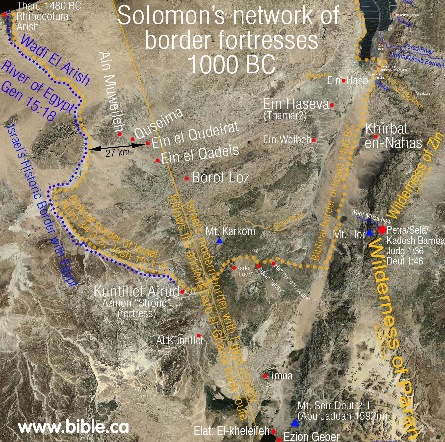 |
- Ein El-Qudeirat, was the location of one of Solomon's fortresses he built to protect the border in 950 BC. For more details see: Solomon's network of military border fortresses.
- When Woolley and Lawrence first came upon the fortress in 1914, they imagined that the structure predated Moses: "should we assume - we cannot prove it - that the fort was already built when Moses came." (The Wilderness of Zin, Woolley and Lawrence, 1914-1915 AD)
- Next thing you know they proclaim the site to be Kadesh Barnea with the expectation that further detailed archeological evidence would prove such. Darwin had the same wishful thinking when he assumed future discoveries of fossilized animals would give direct evidence evolution between ape and man. Today anthropology has proven Darwin wrong and archeology has proven Woolley and Lawrence wrong. Although millions of fossilized animals have now been found not one is transitional as Darwin expected. Likewise, after extensive archeological investigation of Qudeirat, nothing earlier than the time of Solomon has been found. Darwin hoped for the missing link that is still missing. Woolley and Lawrence hoped for the missing "pottery" that would prove that Moses lived there for 38 years. Rudolph Cohen echoed the same hopes of Woolley and Lawrence, yet in 2008, we still have found nothing earlier than 950 BC at the site.
- We consider the late Rudolph Cohen to be the world's top authority on Qudeirat. He recognized the dilemma that the lack of archeological evidence posed to Qudeirat being the correct location for Kadesh Barnea: "Has the site been correctly identified? If so, why have we found no remains from the Exodus period? ... Thus far our excavations have yielded nothing earlier than the tenth century B.C. - the time of King Solomon." (Rudolph Cohen)
- The late Rudolph Cohen, like Darwin also expected further discoveries to vindicate the site as Kadesh. Although he noted that he had excavated down to virgin soil, he also noted that only a portion of the site had been excavated down to virgin soil. He indicated his hopes that future excavations (still have not been done today) would provide the evidence he lacked.
- Rudolph Cohen recognizes that all the man made structures at Qudeirat do not predate Solomon but were part of the border fortress network.
- "The earliest of Kadesh-barnea's three successive fortresses is 10th
century B.C. in date and presumably belongs to the above-discussed
fortress network. However, while most of the other fortresses demolished
in Pharaoh Shishak's assault were permanently abandoned, the fortress
at Kadesh-barnea was twice rebuilt and reoccupied. In the 8th-7th
centuries a solid-walled fortress was erected on the site, and in the
7th-6th centuries B.C. a towered fortress was introduced, paralleled
only by another large fortress, of similar type, at H. `Uza (above).
Thus, of all the Iron Age sites in the Central Negev, Kadesh-barnea
alone was twice singled out for reconstruction. This may, of course, be
explained by its strategically crucial location at the juncture of two
main desert routes. Alternatively, it is possible that the site was
particularly sacred to the Israelites of the Monarchy because of its
association with Moses and the Exodus, and that the fortress was
therefore important for religious as well as practical reasons. This, to
be sure, is conjectural at present. In any event, the final fortress at
the site remained in use until the end of the Iron Age and was
evidently destroyed, along with the Kingdom of Judah, in the Babylonian
campaign (Malamat 1968, 1975)." (The Iron Age Fortresses in the Central Negev, Rudolph Cohen, 1979 AD)

- Tel Qudeirat in 1905 before any excavation: Schmidt:
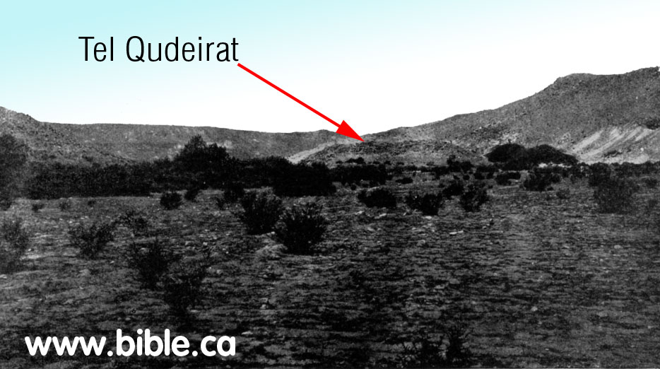
- "The sites excavated by Cohen have all produced remains of the typical 10th-century "four-room house" associated with Israelite settlements throughout the country." (Kadesh Barnea: Judah's Last Outpost, Carol Meyers, 1976 AD)
- "The central Negev was settled only during the United Monarchy, when King Solomon followed a deliberate pattern of expansion and construction of forts." (Kadesh Barnea: Judah's Last Outpost, Carol Meyers, 1976 AD)
- "The earliest fortress at Kadesh-Barnea [Qudeirat] belonged to an extensive fortress network which ran across the Central Negev, extending south from present-day Dimona, past Yeruham and Sde Boker, to the edge of the erosion crater of Makhtesh Ramon, and then turning west toward the site of Kadesh-Barnea. Scores of such fortresses have been recorded since Woolley and Lawrence's pioneering survey in 1914. In my opinion, this network of fortresses was established by King Solomon to protect his trade routes and to secure his southern border. Most of these fortresses were occupied only briefly, and were apparently destroyed in the course of Pharaoh Shishak's invasion of Palestine in about 920 B.C. following King Solomon's death (1 Kings 14:25-26). After Pharaoh Shishak's attack, the Kingdom of Judah withdrew to its old boundary along the Beersheva basin, and the fortress network in the Central Negev was never rebuilt. At Kadesh-Barnea, however, a fortress was re-established in the eighth-seventh centuries B.C. over its predecessor's remains. (Did I Excavate Kadesh-Barnea? absence of Exodus remains poses problem, Rudolph Cohen, 1981 AD)
- "Our archaeological excavations have revealed the ruins of three Iron Age (Israelite) fortresses on the tell, each, except for the first, built over its predecessor. These fortresses date from the tenth to the sixth centuries B.C. and provide important data which help flesh out the tangled history of this period. ... It is significant that, of all the Iron Age fortresses in the Central Negev and Sinai, only Kadesh-Barnea was twice rebuilt." (Did I Excavate Kadesh-Barnea? absence of Exodus remains poses problem, Rudolph Cohen, 1981 AD)
- 950 BC Solomon:
"Oldest of three fortresses: 950 BC (bottom layer, last excavated down
to virgin soil): The remains of a third fortress, the earliest, were
found in the southeastern corner of the tell. ... We were able to date
this earliest fortress at Kadesh-Barnea by discovering on its floor in
an ash layer wheel-made and hand-made pottery characteristic of the
tenth-ninth centuries B.C. This fortress was established on virgin soil; nothing earlier appears. (Did I Excavate Kadesh-Barnea? absence of Exodus remains poses problem, Rudolph Cohen, 1981 AD)
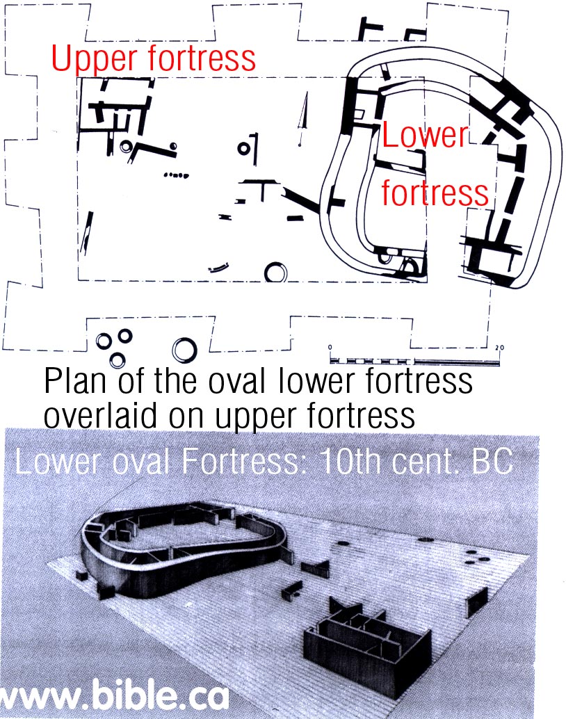
- 800 BC:
"Second of three fortresses: 800 BC (middle layer, second excavated):
Underneath this uppermost fortress were the remains of another, earlier
fortress. ... dated to the eighth-seventh centuries B.C. (Did I Excavate Kadesh-Barnea? absence of Exodus remains poses problem, Rudolph Cohen, 1981 AD)

- 700 BC:
"Youngest of three fortresses: 700 BC (top layer, first excavated): The
uppermost, and therefore latest, fortress at Kadesh-Barnea ...belonging
to the seventh-sixth centuries B.C.(Did I Excavate Kadesh-Barnea? absence of Exodus remains poses problem, Rudolph Cohen, 1981 AD)
"The final fortress remained in use until the end of the Iron Age and evidently was destroyed, along with the kingdom of Judah, in the course of Nebuchadnezzar's campaign. Afterward, as related above, there are merely some signs of Persian occupation in a limited number of areas on the tell." (Excavations At Kadesh-Barnea: 1976-1978, Ein el-Qudeirat, Rudolph Cohen, 1981 AD)
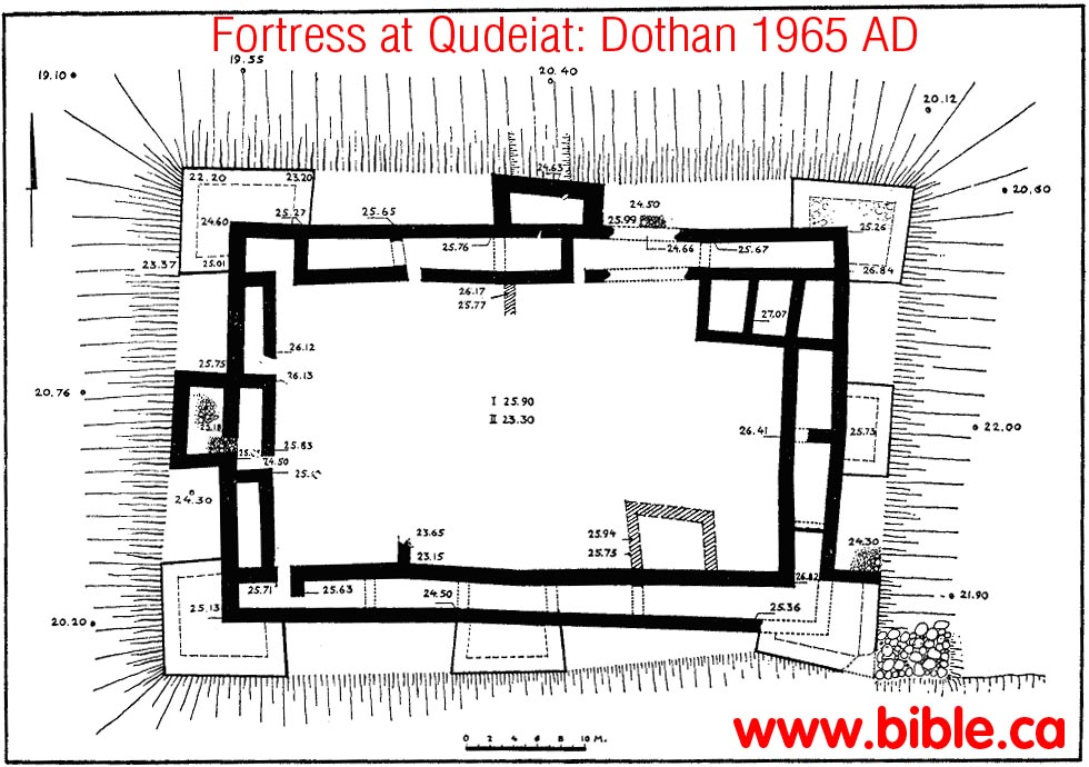
- "The Qadesh Barnea fortress has three complexes corresponding to phases spanning about 300 years; they are called the upper, middle and lower fortress. `Edomite' pottery has only been found within the ashes from the conflagration of the upper fortress in the context of Cypro-Phoenician juglets, a collection of tens of handmade, coarse `Negbite' pots, and a predominance of Judahite vessels reminiscent of the seventh to sixth century BC (Cohen 1983, 100)." (Edomite, Negev, Midianite Pottery: Neutron Activation Analysis, Gunneweg, 1991 AD)
- "The excavations this season were focused on the northern, southern and eastern part of the mound and confirmed our previous conclusion that three fortresses had been erected on the site, each one built over its predecessor's remains." (Kadesh-Barnea, 1979, Rudolph Cohen, Israel Exploration Journal, 1980 AD, p 235-236)
- "Fortresses with Towers. Two examples of this type of fortress are known in the Central Negev: Kadesh-barnea and H. Uza. a. Kadesh-barnea. The fortress of Kadesh-barnea (Grid Reference 0949 X 0064) is located on Tell 'Ain, at the most important desert juncture in this region (fig. 9). It was first surveyed by Woolley and Lawrence in 1914, and their identification of the site with biblical Kadesh-barnea is generally accepted today. In 1956 excavations carried out by M. Dothan on behalf of the Department of Antiquities (1965: 134-51) illuminated numerous details of the fortress plan, fixing the date of its erection to the 9th-8th centuries B.C. and the date of its destruction to the 7th-6th centuries B.C. In 1976 and 1978 further excavations were carried out by the author (Cohen 1976a: 201-2; Meyers 1976). His findings indicate that the upper fortress was built during the reign of Josiah on the remains of two earlier fortresses, built likewise one over the other (fig. 10). The latest fortress is a rectangular structure (ca. 60 X 41 m.), consisting of casemate walls around a central courtyard (fig. 11b). It has eight projecting towers, also roughly rectangular, one in each corner and one in the middle of each of the four sides. The walls, ca. 1 m. in width and preserved to a height of ca. 1.20 m., are of rough-hewn local limestone blocks. In the past three seasons of excavations most of the casemate rooms have been exposed in all four sides of the fortress. Their sizes vary considerably: width, from ca. 2-3 m.; length, from ca. 5-10 m. The towers also vary in size, but those in the corners are consistently larger than those in the middle of the walls. The northeastern tower, for example, which was exposed in the excavations, projects ca. 4.50 m. from both the northern and eastern casemate walls, but, being set somewhat further to the west, its northern side is ca. 10 m., while its eastern side is only ca. 8 m. By contrast, the tower in the middle of the fortress' eastern wall projects ca. 3.50 m. from the casemate line and is ca. 7.50 m. long. Additional rooms were built in the courtyard against the southern casemate wall. The location of the gate has not yet been determined. The beaten-earth floors of the casemate rooms were covered with an ash layer, in which were found both wheel-made and "Negev" pottery. The wheel-made vessels belong to the standard repertoire of the 7th-6th centuries B.C. and include bowls, juglets, oil-lamps, cooking-pots, and flasks (fig. 12). Among the "Negev" pottery were oil-lamps and several small bowls. The northernmost room in the eastern casemate wall, which was especially rich in pottery finds, also yielded fragments of an ostracon, on which were a number of lines in ancient Egyptian writing. Two Hebrew ostraca were found in the central courtyard; the first features three consecutive letters (zayin, het, tet) and may be part of an alphabet (fig. 13). The second has four or five extremely blurred lines which have not yet been deciphered. As mentioned above, this late Iron Age fortress had been built over the remains of two earlier fortresses. The middle fortress (fig. 11 a) dates to the 8th-7th centuries B.C. Although it features a solid wall instead of casemate rooms, it seems to have had exactly the same groundplan as its successor—including projecting towers—and thus provides an earlier example of the towered-fortress type. The groundplan of the earliest fortress is still unknown, but it, too, had casemate rooms, and on the basis of its pottery it can be dated to the 10th century B.C. The excavations showed that this fortress had been erected on virgin soil." (The Iron Age Fortresses in the Central Negev, Rudolph Cohen, 1979 AD)
- We note here that Ussishkin rejects the idea that the fortresses were destroyed and rebuilt three times. Rather he takes the view of one continuous use that underwent two renovations: "In summary, it seems that the fortress was in use for a relatively long period of time, and the structures in it were rebuilt or changed three times, while the fortifications and the water system were continuously in use without interruption or change. We thus have here a good example of a monumental structure which lasted for a long time, while the adjoining domestic structures existed for a shorter period." (The Rectangular Fortress at Kadesh Barnea, David Ussishkin, 1995 AD)
- This ostracon was found in the youngest (highest) level
about 700 BC. It is a conversion chart between Hebrew and Egyptian
numbering systems.
- "On the floor of one of the rooms, partially excavated last year, and located north of the southern casemate line, a large ostracon (Pl. 32:C) was discovered (max. length: 30 cm.; max. width: 22 cm.; average thickness: 5 mm.). Pieced together from 11 fragments, it is still incomplete, with four fragments obviously missing. While its study is in a preliminary stage, it is possible to state that the ostracon contains six vertical columns consisting mainly of hieratic numerals and weight symbols. The first column is apparently a list of units of measurement, similar to those employed in the well-known Arad ostraca. The second column, though partially missing or blurred, lists the hieratic numerals from 1 to 9, from 10 to 100 in units of tens and from 100 to 700 in units of hundreds. The third column con-tinues this list from 800 to 1000, again in units of hundreds, and from 1000 to 10,000 in units of thousands. In fact, the numerals 7000, 8000 and 9000 are missing, but can be surmised. Interestingly, the final figure (10,000) is indicated by the hieratic numeral 10 (A) and in Hebrew letters alafim (i.e. 'thousands). All these hieratic numerals in the second and third columns are preceded by the symbol of a unit of grain. In the fourth column, the counting recommences with 1. This list breaks off in a missing fragment, but then resumes, again from 1, but now preceded by the so-called 'shekel sign' (x), continuing to 40. The beginning of the fifth column is lost, but presumably included the numerals 50 and 60, preceded by the shekel sign. Intact are the numerals 70 to 100 in tens. and 100 to 900 in hundreds — all preceded by the shekel sign. This list concludes with the numerals 1000 to 4000 in thousands, but without the shekel sign. The beginning of the sixth column is similarly lost, but evidently contained the numeral 5000. The surviving portion lists the numerals 6000 to 10.000 in thousands, once again without the shekel sign. Detailed scholarly treatments of this important ostracon will shortly be published by A. Lemaire and H. Verenus. The author would like to state his preliminary opinion that, in view of the repetitive character of the list (with the numbers written several times, sometimes with shekel signs and sometimes without). the ostracon probably comprises a kind of exercise in scribal recording. Hieratic numerals have already appeared on other ostraca from Arad and elsewhere in Judah, but, unlike those scholars who see in the hieratic numerals an indication of either Egyptian control or mercenary troops, the author believes that they represent a purely cultural influence. This ex-plains why the Egyptian numerals appear together with the normal Hebrew signs for the shekel and the unit of one thousand." (Kadesh-Barnea, 1979, Rudolph Cohen, Israel Exploration Journal, 1980 AD, p 235-236)
- The oldest fortress is the oval one built by Solomon in 950 BC. Beneath the oval fortress is virgin soil.
- "The earliest fortress on the site was erected seemingly on virgin soil in the 10th-9th centuries B.C.E. Its ground plan, as explained previously, has not been determined, but it evidently belonged to a wide-ranging fortress network then existing in the Central Negev. These fortresses begin near present-day Dimona, continue south past Yeroham and Sede Boger, skirt the edge of the erosion crater of Makhtesh Ramon, and then turn west; here they form a southerly line as far as Kadeshbarnea. Dozens of such fortresses have been located since the survey of Woolley and Lawrence, and many have been excavated over the past 12 years—mainly by the author sometimes in conjunction with Z. Meshel (Cohen 1970: 6-24; 1976: 3450; Meshel 1977: 110-35). The fortresses were built according to one of three distinct ground plans—being either roughly oval, rectangular, or square—but clearly belong to the same historical period. In the author's opinion, they were established by King Solomon. As is well known, he was a powerful and energetic ruler, who sought to consolidate the gains of his predecessor, David, by fortifying cities, constructing storehouses, and founding distant trading posts—such as Ezion-geber, on the Red Sea shores. Accordingly, a network of Central Negev fortresses would have served both in protecting the vital overland trade routes and in forming a bulwark against incursions from the south. An interesting parallel exists between this line of fortresses in the Central Negev and the description (Josh 15:1-4) of the southern limits of the tribe of Judah. Thus, these fortresses also define the southern border of Israel at the time of its greatest extent." (Excavations At Kadesh-Barnea: 1976-1978, Ein el-Qudeirat, Rudolph Cohen, 1981 AD)
- "Previous to this season's excavations, the ground plan of the lowest, earliest fortress was unknown. This season, a new area was opened on the north-eastern side of the site, outside the walls of the later fortresses, and between two of their projecting towers. In this area were found the remains of casemate walls belonging to the earliest fortress. The outer wall is 1.5 m. wide, while the inner wall is only 0.9 m. wide. A 7-m. segment of this wall was exposed; it is curved, and continues underneath the foundations of the later fortress, giving the distinct impression that the ground plan is oval, like that of the nearby and contemporary fortress at 'El Qudeis. On the floor of the two casemate rooms, in a layer of ashes, was found a large number of pottery vessels, again belonging to two main types: wheel-made pottery characteristic of the tenth century B.C.E., among which should be especially noted two pithoi, three storage jars, two juglets and an oil lamp; and hand-made 'Negbite' pottery, including numerous fragments of cooking pots and kraters, and a complete chalice. Three iron arrowheads were also found in these rooms." (Kadesh-Barnea, 1979, Rudolph Cohen, Israel Exploration Journal, 1980 AD, p 235-236)
- "The walls of the third (earliest) fortress were uncovered only in the south-eastern corner of the mound. It seems that this fortress also had casemate rooms. A section of one of these rooms was exposed, the internal width of which was about 3 m. It emerged that this fortress had been erected on virgin soil. The pottery found in a layer of ashes on its floors again belongs to two types. The first consists of wheel-made pottery characteristic of the tenth-ninth centuries B.C., among which should be especially noted three complete vessels: a spouted juglet, a 'black juglet', and a pyxis. The second type is hand-made 'Negev' pottery including numerous fragments of bowls and kraters." (Kadesh-Barnea, 1978, Rudolph Cohen, Israel Exploration Journal, 1978 AD, p 197)
- "It seems that only a single rectangular fortress was built above the early oval one" (The Rectangular Fortress at Kadesh Barnea, David Ussishkin, 1995 AD)
- "The remains of the lowest, and earliest fortress are buried under some 4 m of debris, and its walls consequently were uncovered only in the southeastern corner of the tell. It appears, nevertheless, that this fortress also had casemate rooms. A section of one of these rooms was exposed, the inner width of which was ca. 3 m. The ground plan of this fortress has not yet been determined, but it apparently was established on virgin soil. The pottery, found in a layer of ashes that covered its beaten-earth floors, included both wheel-made and handmade types. The wheel-made vessels are characteristic of the 10th-9th centuries B.C.E., and particularly noteworthy among them were three undamaged items: a juglet with a spout, a "black" juglet, and a pyxis. The crude handmade pottery included numerous cooking-pot sherds." (Excavations At Kadesh-Barnea: 1976-1978, Ein el-Qudeirat, Rudolph Cohen, 1981 AD)
- More on Negev Pottery.
- ""Negev" pottery cannot be used for dating purposes. On the contrary, it must be dated on the basis of wheel-made pottery found with it. The earliest Negev pottery has been dated in this way to about the 13th or 12th century B.C., the period of the Exodus. [note: the exodus took place in 1446 BC, not 1250 BC as Cohen thinks] Our excavations at Kadesh-Barnea indicate that Negev ware continued to be produced until the end of the Iron Age—that is, until the destruction of the First Temple in 587 B.C. The Negev ware found at Kadesh-Barnea included cooking pots, kraters, cups, and bowls of various kinds, some with knobs or ledge-handles, which seem to imitate wheel-made bowls from elsewhere in the country. Among the more unusual items, which have expanded the corpus of known "Negev" types, are three oil lamps, a small chalice and the incense burner, referred to above. These more experimental forms are associated primarily with the later levels of the site." (Did I Excavate Kadesh-Barnea? absence of Exodus remains poses problem, Rudolph Cohen, 1981 AD)
- It is important to realize that the four springs at the Quseima area have been in continuous use from before the time of Abraham. We do not doubt that evidence will one day be found that predates the Solomonic fortress network. The problem is that this evidence must specifically show that the Hebrews were here for 38 years between 1444 and 1406 BC.
- "The problem of Kadesh-Barnea is simply stated: Has the site been correctly identified? If so, why have we found no remains from the Exodus period?" ... "But, where are the remains from the time of Moses (and of Abraham), from the period of the Exodus, and from the era of the Judges which we would expect to find if this site is, indeed, Kadesh-Barnea? Thus far our excavations have yielded nothing earlier than the tenth century B.C.—the time of King Solomon." (Did I Excavate Kadesh-Barnea? absence of Exodus remains poses problem, Rudolph Cohen, 1981 AD)
- "How can we explain this? First of all, the identification of the site is not absolutely certain. The strategic location of the fortress is certainly what we could expect if it is Kadesh-Barnea, the border settlement described in Joshua 15:1-3. On the other hand, we have no written evidence, such as ostraca, establishing that this was the border settlement referred to in Joshua." (Did I Excavate Kadesh-Barnea? absence of Exodus remains poses problem, Rudolph Cohen, 1981 AD)
- "Whereas the Beer-sheba Basin remained inhabited throughout the Iron Age, the central Negev was settled only during the period of the United Monarchy, when (especially) King Solomon seems to have followed a deliberate pattern of expansion and of construction of forts. After the 10th century, the southern border of Judah receded: Cohen discovered that all the Iron Age sites in the Central Negev contained remains which dated only to the 10th century." (Kadesh Barnea: Judah's Last Outpost, Carol Meyers, 1976 AD)
- Dothan gives his evidence for the settlement that existed before the first fortresses were built by Solomon. This evidence is based solely on Negev ware Pottery: "The Pre-Fortress Finds: Most of the finds in this group are sherds of hand-made vessels (Pl. 30, A). The ware is coarse and the clay mixed with straw. The firing is mediocre and the vessels are never slipped. Most of the pottery are deep bowls with flat or thickened rims (Fig. 4 : 1-5) . In addition, hole-mouth jars and store-jars with thick rounded rims, flaring outwards or inwards, were found (Fig. 4 : 6-10) . Some of the bowls and hole-mouth jars had pairs of ledge handles below the rim or high up on the sides (Fig. 4 : 12-17; P1. 30, B); only one loop-handle was found. On one of the hole-mouthed jars a potter's mark appears (Fig. 3 : 11) . Prior to the excavations at Kadesh-barnea, no material of this sort had been reported from other Palestinian sites, with the exception of a vessel discovered in the excavation of Etzion-geber3 and described by Prof. N. Glueck as a 'crucible'. Glueck identified the vessels found at Kadesh-barnea with those unearthed in the lowest level at Etzion-geber. Vessels of this type were later found by Dr. Y. Aharoni during a survey at `Ein Qudeis, and especially at Ramat Matred in the central Negev4. At all these sites, pottery of this type dates from the 10th century or the start of the 9th century B.C.E." (The Fortress at Kadesh-Barnea, M Dothan, 1965)
- "Dothan identified three periods of occupation: a pre-fortress period, containing only hand-made pottery which he dated to the 10th century; the fortress itself with pottery from a very long time-span — the 9th to the 7th centuries; and a post-fortress period of scattered Persian remains." (Kadesh Barnea: Judah's Last Outpost, Carol Meyers, 1976 AD)
- Cohen dismisses the view of Dothan of the "pre-fortress" period based upon Negev Pottery alone: "Dothan discovered no indication of different building phases during the time of the fortress's existence, but he recognized both pre- and postfortress settlement periods on the site. The pre-fortress findings consisted of crude handmade pottery—mainly bowls, deep pots, and hole-mouth jars. Although these sherds could not be connected with wheel-made vessels or building remains, he dated them, on the basis of similar pottery finds at Ezion-geber, Ramat Matred, and elsewhere in the Negev, to the 10th or early 9th century B.C.E. (Dothan 1965: 139; 1977: 697)." (Excavations At Kadesh-Barnea: 1976-1978, Ein el-Qudeirat, Rudolph Cohen, 1981 AD)
- "The earliest remains on the site derive from the 10th century B.C.E. the age of David and Solomon. In the Bible, however, Kadesh-barnea is connected with the much earlier epoch of Moses and the 40-year wandering. This is an apparent inconsistency, and it should be asked if the excavations at Kadesh-barnea have contributed, in one way or another, to the understanding of Israel's early traditions. It should be stated clearly at the outset that the answer to this is equivocal. It could be argued that the lack of any evidence for pre-10th-century B.C.E. settlement on the site supports the position of those who maintain that there is no historical basis for the early traditions of the Old Testament—specifically, in this case, for those concerning Moses and the wanderings in the desert. Before reaching this conclusion, however, some cautionary considerations should be kept in mind. First, the identification of the site is not absolutely certain. Although the author is convinced that the site of Tell el-Qudeirat is Kadesh-barnea, documentary evidence is lacking. The excavations, furthermore, have reached virgin soil in only very restricted places on the tell, and if there are earlier remains, they might not have extended over the entire area of the later fortresses. Apart from this, the author believes that there may be a connection between the concentration of settlements from MB I throughout the region in question and the biblical tradition of a prolonged sojourn at Kadesh barnea. Leaving these issues aside, the mere fact that, of all the numerous Iron Age fortresses in the Central Negev, Kadesh-barnea alone was rebuilt twice is in itself highly intriguing. This may, of course, be explicable on the basis of its strategically important location at the junction of two main desert routes. But it is also possible that the site was particularly sacred to the Israelites of the Monarchy because of its association with the traditions of Exodus and therefore had a religious, as well as practical, role. " (Excavations At Kadesh-Barnea: 1976-1978, Ein el-Qudeirat, Rudolph Cohen, 1981 AD)
- "Only a small portion of Solomon's Fortress has been excavated, so there may still be new surprises and information available: "Below the earlier fortress are 10th-century remains. So far these have been recovered only in one pit, and it cannot yet be ascertained whether these remains are also part of a fortress. Only further excavation will determine this. But in general, the depth of debris has been surprising the deepest trench has already uncovered 6 m. of debris, and virgin soil has yet to be reached." (Kadesh Barnea: Judah's Last Outpost, Carol Meyers, 1976 AD)
- Although the oldest oval fortress was excavated by Cohen, there are sections of the two younger fortresses that have not excavated down to virgin soil. Cohen expects to find exodus period (1444 BC) evidence under the areas of the older fortresses that have not yet been excavated down to virgin soil level.
- Cohen suggests that the reason Qudeirat is the only one of three fortresses in the Quseima area that was rebuilt twice, is for sentimental reasons, since it was Kadesh Barnea. In other words, the fortresses were memorial structures in addition to military outposts. While this is possible, it is unlikely, since nothing has been discovered in any of the three forts that were built, that suggests the location was Kadesh. It such had been found, we would surely have heard about it!
- So that is the sum of the archeological evidence that Kadesh is located at Qudeirat: "Nothing yet, but lets keep digging" and the fact it is the only fortress Solomon built that was rebuilt twice because of its sentimental connection with the 38 years Israel spent there while sojourning in the wilderness before they entered the promised land. Need we remind you that Qudeirat was located 28 KM inside the formal stated border of the promised land: Wadi el-Arish?
- Qudeirat was the only fortress Solomon built, that was rebuilt two additional times, with the exception of Ezion-Geber, which was rebuilt once.
- Cohen says: "it is also possible that the site was particularly sacred to the Israelites of the Monarchy because of its association with the traditions of Exodus and therefore had a religious, as well as practical, role." (Excavations At Kadesh-Barnea: 1976-1978, Ein el-Qudeirat, Rudolph Cohen, 1981 AD)
- The reason Qudeirat was rebuilt twice (three buildings) is not for sentimental reasons, as Cohen suggests, but because of the large water supply. Remember there were four springs in the Quseima area.
- What is true today in Israel was true in 950 BC: "Its all about the water"
- We find Cohen's opinion to be wishful thinking in light of the fact that he admits nothing from the exodus has ever been found there.
- The real reason why the fortress at Qudeirat was rebuilt twice: Simply put, it was Israel's claim of sovereignty over the two eastern springs at Qudeirat and Qedeis. Egypt had control and sovereignty over the two western springs at Quseima and Muweileh. There was obviously an agreement between Egypt and Israel to share the water resources. Qudeirat was Israel's "stake in the ground" that guaranteed their half share of the water at the largest oasis in the Sinai.
- At the time of Solomon, Israel's border extended all the way to the Wadi el-Arish. However, after Pharaoh Shishak destroyed the entire network of fortresses, the border moved east to share the water. At that time, Egypt and Israel agreed that the border divided the springs so that each had two, Qudeirat is the location that the Jews built to protect the water at Qudeirat and Kades. Egypt would get the water from the springs at Quseima and Ein Muweileh. It also divided the control of the four ancient trade routes that intersected just west of Qudeirat. So you have the Egyptians on the west of this major crossroads of traffic and two springs completely under their control and the Hebrews on the east of the major crossroads with two springs of their own. Qudeirat represented the western most point of control of the Judean kingdom under Uzzah and Josiah. Qudeirat was the "border town" between Egypt and Israel after 900 BC.
- We reject Cohen's suggestion that sentimentality is why Qudeirat was rebuilt twice. Remember, the springs in the Quseima area were the largest in the entire modern Sinai Peninsula. Qudeirat was the largest of the four springs, need we say more? It is obvious why Qudeirat was built three times! Its all about the water!
- For an examination of radiocarbon dating see click here.
- The science of radiocarbon dating and the process which dates are selected is rather unreliable at best. Typically a single sample will be tested and retested until a date close to what the person who submitted it is looking for is produced. Then, that result is chosen as "the date" even though 20 other dates were rejected. This is well documented, but not well known by the general public. For example "1470 Scull" was tested over 40 times until they got the date they were looking for. Skull 1470 discovered by Richard Leakey is supposed to be an ancestor to man, too. Leakey and others obtained 41 potassium-argon dates for this skull, all of which they rejected because the date obtained was not "right"? Finally Leakey used an argument based on the size of pigs teeth found in the strata to get the date for skull 1470 that he thought was correct. Here is a discussion specifically about radiocarbon 14 dating.
- In 2005, Hendrick J. Bruins, Johannes van der Plicht published their analysis of the three fortresses in light of Radiocarbon dating tests conducted on all three fortress levels including other sites in the Negev.
- In summary, they vindicated Cohen's view that there were three distinct levels of occupation (not two) separated by periods of non use. Regarding the upper fortress, they vindicated Cohen's date and that it was destroyed in 586 BC by Babylon. The middle and lower fortresses, however, they shifted the dating to about 150 years old. In other words, based upon radiocarbon dating, they suggested, that the middle square fortress was built by Solomon and destroyed by Shishak and the lower fortress was built about 1100 BC. Cohen said that the lowest/oldest oval fortress was built by Solomon and destroyed by Shishak.
- The radiocarbon dates that Bruins and van der Plicht came up with do provide, on face, a rather shocking rebuke of Ussishkin's/Finkelstein's view that there are two occupation levels, the earliest being long after Solomon died. What is more sure, is that there are three occupation dates. What is less sure, is the relative dating of all three. In other words, given the nature of all radiometric dating, specific dates are always less important than relative dates from a single site.
- Even Bruins and van der Plicht admit that the presence of charcoal on the site would give a slightly older date than the actual date: "We note that the old-wood effect may lower the date to some extent at Tell el-Qudeirat" (The Bible and Radiocarbon Dating, Thomas E. Levy, Higham, Bruins, Plicht, 2005, p362) Given the fact that the lowest fortress was indeed burnt with fire, this by their own admission, reduce the 150 years with which they differ with Cohen.
- The radiocarbon dates do not help in identifying the site as Kadesh Barnea, since there is still a 300 year gap of occupation from the first oval fortress back to the exodus of 1446 BC.
- "The 14C date associated with the destruction of the Middle Fortress at Tell el-Qudeirat is considerably older (10th-9th centuries BCE in the 1a range) than the age suggested by Cohen (1983, 1993a) in the mid-7th century BCE. One radiocarbon date of a destruction layer outside the eastern revetment wall is certainly a reason to regard the result as preliminary with regard to the Middle Fortress. Yet the four radiocarbon dates of the three fortresses are internally coherent in terms of stratigraphy and must he taken into account. In terms of possible regional correlations between architecture and governmental planning, it should he noted that both Stratum V and IV of Tel Beer Sheva had a solid wall, like the Middle Fortress at Tell el-Qudeirat. Casemate walls built on top of the remains of the previous solid walls occur at Tel Beer Sheva in Stratum III (Herzog 1993) and at Tell el-Qudeirat with the Upper Fortress (Cohen 1983, 1993a). Herzog (1993) suggested that Stratum V of Tel Beer Sheva-characterised by a solid wall—might have been destroyed by Pharaoh Shishak. The only "C date from Tell el-Qudeirat that might fit the Shishak campaign is the destruction layer associated with the Middle Fortress, which also had a solid wall. The elliptical Lower Fortress was smaller and had a different shape than the rectangular Middle and Upper Fortresses at Tell el-Qudeirat, which are decisively younger in age. Most Iron Age settlements in the Negev-Sinai region are characterised by elliptical or irregular shaped fortresses, including Horvat Haluqim, Nahal Ha'Elah and the Lower Fortress at Tell el-Qudeirat. The most probable calibrated 14C date of 1103-1050 BCE for the destruction of the Lower Fortress is about 150 years older than the suggested date for its destruction by Cohen (1980, 1983, 1993a). The above '4C date would place the Lower Fortress firmly in the Iron I period, as favoured by Rothen-berg (1972, 1988), Aharoni (1978), Herzog (1983), Finkelstein (1984, 1988) and considered possible by Meshel (1979). We note that the old-wood effect may lower the date to some extent at Tell el-Qudeirat. However, the powdery charcoal mixed with soil from the destruction layer of the Lower Fortress is generally not characteristic for old wood. Large trees of an old age tend to give chunks of recognizable woody charcoal, such as found often at Tel Dan. But even the radiocarbon results from such woody charcoal at Tel Dan are only rarely older than 50 or 60 years in comparison to short-lived seeds (Bruins et al. [Chapter 19, this volume]). Therefore, particularly in arid regions, usually devoid of trees, the inherent age of fine charcoal is in most cases probably not more than 10-30 years, or even much less. Annual vegetation growing after the winter rains withers in the spring. Burning of such vegetation would give short-lived powdery charcoal similar in age to seeds. Desert shrubs are older than annual plants and charcoal derived from such shrubs may have an age of ca. 2 to 20 years, occasionally even older, but on average below 10 years. Though the exception may always be present, a small to medium old-wood effect is probably the rule." (The Bible and Radiocarbon Dating, Thomas E. Levy, Higham, Bruins, Plicht, 2005, p362)
- "The Lower Fortress: The oldest archaeological remains discovered at Tell el-Qudeirat were found at a depth of about 5 m below the surface of the mound. The Lower Fortress had an elliptical ground plan, about 27 m in diameter, with casemate rooms around a central courtyard. In addition, several buildings and silos were found to the west of the fortress. Many types of pottery vessels were found in the ash covered floors of the casemate rooms (Cohen 1983, 1993a). The excavator (Cohen 1980, 1983, 1993a) suggested that the Lower Fortress was established during the reign of Solomon and destroyed in the course of Pharaoh Shishak's campaign, all in the 10th century BCE. The western profile of Square K-67 in the centre of tell el-Qudeirat, which exhibited the upper-most destruction layer 50 cm below the surface of the tell, also exposed the lowermost destruction layer at a depth of about 5 m. A sample of fine powdery charcoal mixed with soil was taken from this destruction layer by the first author, again in 1981, in cooperation with Cohen, who considered this layer to represent the destruction of the Lower Fortress. The dark ash layer, about 10 cm thick, covered a 20 cm thick layer of loessial soil, also containing a few pieces of charcoal, indicating past human activity predating the dark ash layer. Below the loessial soil lies a 'virgin' layer of fine gravel mixed with sandy loam (Bruins 1986). The fine charcoal sample from the ash layer was measured in Groningen and yielded a radio-carbon date of 2930 ±. 30 BP (GrN-12330, Fig. 21.6). The la calibrated age ranges are 1210-1200 (5.5%), 1191-1177 (8.1%), 1162-1141 (12.7%), 1131-1107 (13.3Vo), 1103-1050 (28.6%) BCE. The 2a calibrated ages are 1258-1235 (6.5%), 1215-1016 (88.9%) BCE. The most probable calibrated age range of 1103-1050 BCE would place the destruction layer in the first half of the 11th century BCE, which is about 150 years older than the suggested destruction, according to Cohen, by Shishak around 925 BCE. Alternative "C dating options, albeit of lower relative probability, include the 12th century and even the 13th century BCE, while the 11th century BCE is the youngest possible date in the 2o range. A possible old-wood effect of the charcoal is unlikely to move the date into the first half of the 10th century BCE, as this would require a lowering of the date by about 150 BP years. It was shown from the Upper Fortress at Tell el-Qudeirat that the difference between charred seeds and fine charcoal can be quite small, that is, only 20 BP years!" (The Bible and Radiocarbon Dating, Thomas E. Levy, Higham, Bruins, Plicht, 2005, p356)
- "Comparing the Iron Age 14C dates from Sinai and Negev with those from Khirbet en-Nahas in the eastern Arabah Valley in Jordan (Levy et al. 2004), it is quite remarkable that grosso modo [in a rough way] a similar BP time range is found for the older part of the Iron Age. The oldest dates are 2930 ± 30 BP (GrN-12330) in relation to the Lower Fortress at Tell el-Qudeirat and 2906 ± 39 BP (HD-14057) concerning the Slag Mount East (Hauptmann 2000). Moreover, also the period 2880-2825 BP appears in both areas." (The Bible and Radiocarbon Dating, Thomas E. Levy, Higham, Hendrick J. Bruins, Johannes van der Plicht, 2005, p363)
- "In conclusion, the radiocarbon dates from the three successive fortresses at Tell el-Qudeirat are internally consistent in stratigraphic terms. The results indicate that the Upper Fortress was probably destroyed by the Babylonian campaigns, as suggested by Cohen, though a 601/600 BCE historical destruction date would fit better than the alternative 586 BCE option. The Middle Fortress appears older than suggested by Cohen. It is the only radiocarbon date that can possibly be linked, in chronological terms, with the Shishak campaign. The thick solid wall of this fortress appears similar in architectural construction to that of Stratum V of Tel Beersheba, the destruction of which is also associated with the Shishak campaign (Herzog 1993). The Lower Fortress at Tell el-Qudeirat and the Nahal Ha'Elah Fortress, both elliptical in shape, have destruction layer dates that appear older than the Solomonic period. The possible old-wood effect must be taken into consideration, but fine charcoal tends to be rather short-lived. If the old-wood effect is minimal, even the 12th century BCE is a reasonable option for the Lower Fortress at Tell el-Qudeirat in terms of its radiocarbon date. Considering all the different theories proposed for the elliptical Iron Age fortresses and related settlements, briefly presented in the introduction, it seems that the suggested chronologies and historical associations by Cohen and Haiman are the most unlikely, while the 11th and early 10th centuries BCE appear most probable. However, even older dates for the beginning of these settle-ments cannot be ruled out, as the radiocarbon dates were derived from destruction layers. Indeed, the oldest date obtained so far, from the agricultural soil layer at the site of Horvat Haluqim, backs the above picture. Here the old-wood effect cannot be used as an excuse, because the date is based on a sheep or goat bone from within the anthropogenic agricultural soil layer. Nevertheless, more dates are necessary to substantiate and refine this preliminary radiocarbon dating assessment." (The Bible and Radiocarbon Dating, Thomas E. Levy, Higham, Bruins, Plicht, 2005, p364)
- There are ten very good reasons why Qudeirat cannot be Kadesh Barnea. (see above)
- There is no evidence from any ancient written source or tradition that Kadesh Barnea is located at Qudeirat or anywhere near the Quseima area.
- We expect to one day find archeological evidence at all of the four Quseima area springs that predates Solomon. These springs did not first start being used just because Solomon built three fortresses here in 950 BC. The evidence, however, must be specifically "Hebrew" from the time of 1446 - 1406 BC.
- Kadesh Barnea is located at or near Petra.
++++++++++++++++++++++++++++++++++++++++++++++++++++++++++++++++++++++++
Conclusion:
- The reason no one, until recently, has proposed a crossing of the Red Sea at the Gulf of Aqaba, is because no one before 1750 even knew it existed! Remember that even today information moves slowly. It really wasn't until about 1800 before the Gulf of Aqaba became widely shown on maps in every country.
- When the Gulf of Aqaba first appeared in 1750-1800 AD, explorers focused on the location of Kadesh Barnea, not Mt. Sinai or the crossing point of the Red Sea. It has only been in the last 75 years that the Gulf of Aqaba has been considered a crossing point, which of course forces Mt. Sinai to be in Saudi Arabia... just as Paul said.
- From 325 - 1900 AD almost all exodus route maps crossed the Red Sea at the port of Suez, placed Mt. Sinai where Queen Helena saw it in a dream and Kadesh at Petra. They got Sinai wrong and Kadesh right! Recently, some have proposed a crossing on the Gulf of Aqaba, a Mt. Sinai in Saudi Arabia and a Kadesh Barnea inside the promised land at Qudeirat. These got Mt. Sinai right but Kadesh wrong! It is time to restore Kadesh back to the Petra area, cross the Red Sea at the Gulf of Aqaba and place Mt. Sinai in Arabia!
- Many rather obvious error and misunderstandings of geography have prevented the discovery of the exodus route. Not knowing about the existence of the Sinai Peninsula or the Gulf of Aqaba until 1750 - 1800 AD, prevented mappers from even considering a Red Sea crossing on the Gulf of Aqaba and a Mt. Sinai located in North Saudi Arabia.
- Everyone from the time of Josephus down to 1831 believed Kadesh Barnea was at or near Petra.
- A lack of proper respect for the scriptures as a trump card over the "archeology of the day" is seen in the many unfortunate choices for Kadesh since 1831 AD down to the present. Kadesh simply cannot be located at the springs of Harb, Weibeh, Qedeis or Qudeirat, because they are inside the promised land of Judah.
- A misreading of how to draw the southern border of Judah in relation to Kadesh Barnea has also been a huge problem. The scriptures clearly show Kadesh to be Transjordan.
- See: The Exodus route proven from the Bible.
http://www.bible.ca/archeology/bible-archeology-exodus-ancient-geographers-maps-sinai-egypt-midian-arabia-kadesh-barnea-shur-eratosthenes-200bc.htm
http://www.bible.ca/archeology/bible-archeology-exodus-ancient-geographers-agatharchides-maps-169bc.jpg
http://www.bible.ca/archeology/bible-archeology-exodus-ancient-geographers-maps-sinai-egypt-midian-arabia-kadesh-barnea-shur-book-of-jubilees-150bc.htm


Memang tidak mudah sih, tapi klo ada terjemah bahasa Indonesia nya yg bagus dan teliti jadi kami bisa mengerti dg jelas baik arti dan tujuan dari masalah tsb, apalagi akhir2 ini kita selalu di diskredit kan oleh mereka yang anti sama Islam, tolong dipikirkan dan terimakasih sekali atas pengertiannya dan bantuannya Wassalam
ReplyDeletetrimaksih sdr Tonwsh atas komentarnya, yang intinya dari fakta sejarah dan bukti arkeologis yang di paparkan di atas bahwa paran adalah benar2 merupakan kawasan saudi arabia dan gunung sinai jg termasuk kawasan saudi arabia barat, namun peta2 yg skrg beredar dikalangan kristen letak paran dan Gunung sinai secara geografis di geser sehingga letaknya menjauh dari kawasan saudi arabia, fakta yang mengejutkan lg ternyata kawasan saudi arabia adalh tempat lahirnya SHEM yakni anak nabi nuh yg melahirkan bangsa2 semith sprti israel, aram, arab, akadia dll, insya allah kalo ada waktu akan saya terjemahkan kedalam bhs indonesia
ReplyDeleteAssalamu 'alaikum wr wb. saya pribadi sangat tertarik dengan tulisan di blog ini, karena mengedepankan sisi Ilmiah.
ReplyDeletesaya hanya mau memberi saran saya melihat beberapa tulisan di blog ini ketika memuat gambar semisal tulisan di atas, Gambarnya tidak diupload sendiri tapi load dari situs sumbernya langsung, saran saya gambarnya sebaiknya disave dari situs aslinya kemudian diupload sendiri ke blogspot, karena jika situs yang menjadi sumber Url gambar tidak aktif lagi maka otomatis gambar di blog ini juga akan hilang tidak bisa diakses lagi. sementara kalau gambarnya diupload sendiri diblogspot selama artikelnya tidak dihapus insya Allah akan terus ada tanpa perlu khawatir gambar tersebut akan hilang atau tidak muncul lagi. semisal tulisan ini, jika tiba-tiba situs bible ca tidak aktif maka otomatis gambar peta di atas akan hilang.
syukron jazakallah...
waalaikumsalam wr wb, trimkasih sdr Ilham Al Azhary atas sarannya yang sangat berharga, syukron jazakallahu khair
ReplyDelete